
US regions map: the 4 Census regions and 9 divisions
The U.S. Census Bureau groups the 50 states and Washington, D.C., into four regions: the Northeast (9 states), the Midwest (12 states), the South (16 states and D.C.), and the West (13 states). Each region is split into two or three divisions, nine in all, listed below. Each region has its own map, with its states at one shared scale.
The 9 Census divisions and their states
- New England (Northeast): Connecticut, Maine, Massachusetts, New Hampshire, Rhode Island, and Vermont
- Middle Atlantic (Northeast): New Jersey, New York, and Pennsylvania
- East North Central (Midwest): Illinois, Indiana, Michigan, Ohio, and Wisconsin
- West North Central (Midwest): Iowa, Kansas, Minnesota, Missouri, Nebraska, North Dakota, and South Dakota
- South Atlantic (South): Delaware, District of Columbia, Florida, Georgia, Maryland, North Carolina, South Carolina, Virginia, and West Virginia
- East South Central (South): Alabama, Kentucky, Mississippi, and Tennessee
- West South Central (South): Arkansas, Louisiana, Oklahoma, and Texas
- Mountain (West): Arizona, Colorado, Idaho, Montana, Nevada, New Mexico, Utah, and Wyoming
- Pacific (West): Alaska, California, Hawaii, Oregon, and Washington
Northeast
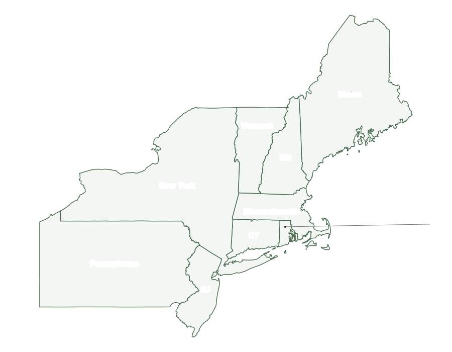
9 states; 58,042,054 residents. Divisions: New England, Middle Atlantic.
Midwest
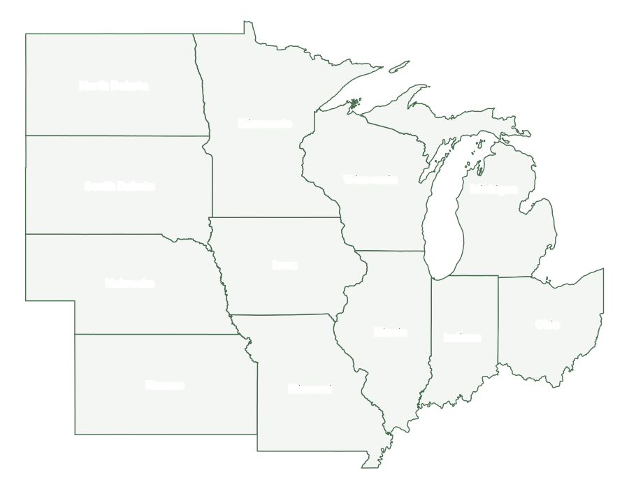
12 states; 69,762,666 residents. Divisions: East North Central, West North Central.
South
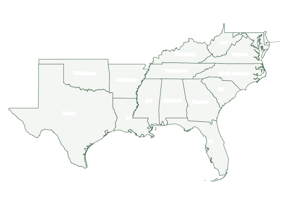
16 states and D.C.; 133,833,983 residents. Divisions: South Atlantic, East South Central, West South Central.
West
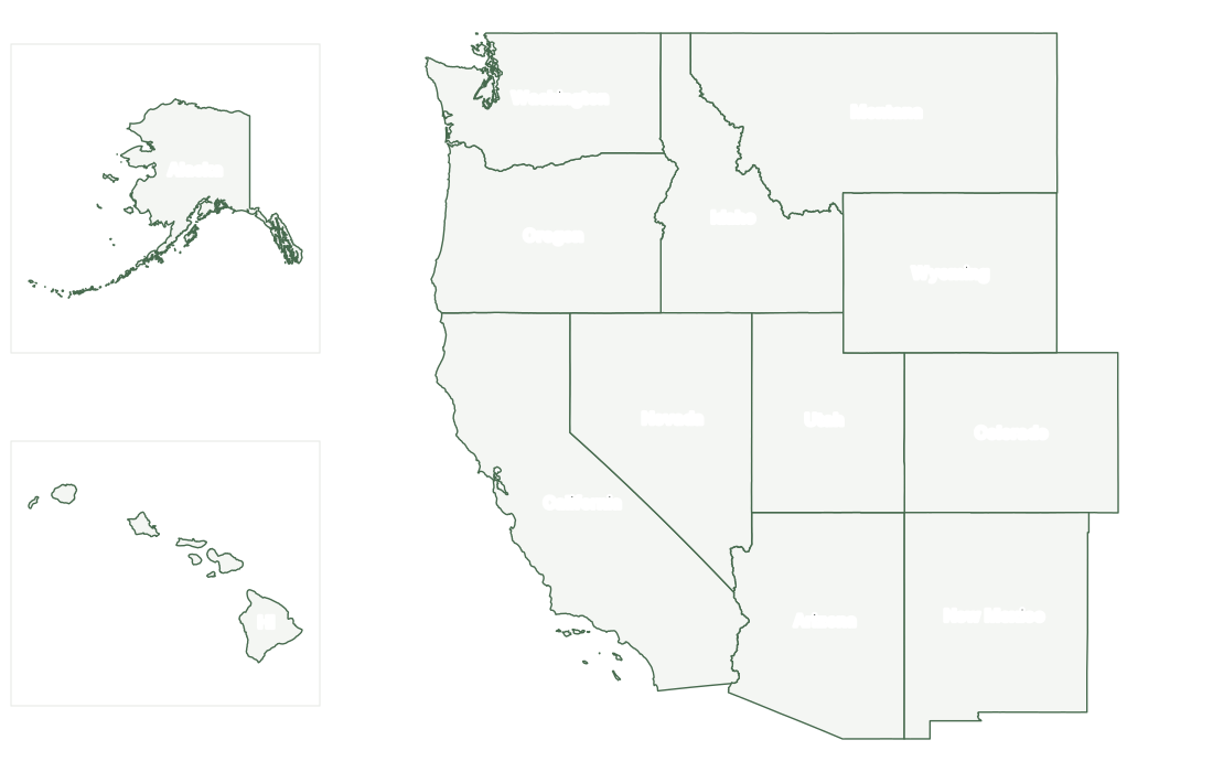
13 states; 80,146,154 residents. Divisions: Mountain, Pacific.
Regions compared
The South is the most populous region, with 39% of U.S. residents as of July 1, 2025; the Northeast is the least populous. The West covers the most land and the Northeast the least. The South grew fastest after April 2020 (+6.0%) and the Northeast slowest (+0.7%). Washington, D.C., is counted in the South Atlantic division.
| Region | States | Population 2025 | Share of U.S. | Change since 2020 | Land sq mi |
|---|---|---|---|---|---|
| Northeast | 9 | 58,042,054 | 17.0% | +0.7% | 161,915 |
| Midwest | 12 | 69,762,666 | 20.4% | +1.1% | 750,587 |
| South | 16 | 133,833,983 | 39.2% | +6.0% | 868,658 |
| West | 13 | 80,146,154 | 23.4% | +1.9% | 1,752,472 |
Other ways to divide the United States
Many school geography lessons use five regions: the Northeast, Southeast, Midwest, Southwest, and West. This scheme is informal, with no official list of states, and textbooks differ, especially for states on the edges. In a common version the Southwest is Arizona, New Mexico, Oklahoma, and Texas, the Northeast adds Delaware and Maryland to the Census Northeast, and the Southeast takes the rest of the Census South.
Federal agencies also use other groupings. The Bureau of Economic Analysis reports data for eight regions: New England, Mideast, Great Lakes, Plains, Southeast, Southwest, Rocky Mountain, and Far West; its New England, Great Lakes, and Plains regions have the same states as the New England, East North Central, and West North Central divisions. In the 1970s the Office of Management and Budget set up ten Standard Federal Administrative Regions, which agencies such as the EPA and FEMA use for their regional offices; they match the Census divisions only in New England.
Some groupings are used often enough to have their own pages here, each with a map and the states it includes: New England, Mid-Atlantic, East Coast, West Coast, Gulf Coast, Great Lakes, Southeast, Southwest, Pacific Northwest.
History of the Census regions
The nine divisions as they stand today, apart from Alaska and Hawaii, first appeared in the reports of the 1910 census, grouped into three sections: North, South, and West. The 1950 census renamed the sections regions and split the North into the Northeast and North Central regions, creating the four regions still in use. Alaska and Hawaii joined the Pacific division for the 1960 census, and in June 1984 the North Central Region was renamed the Midwest. A Commerce Department review after the 1950 census proposed regrouping many border states, but the existing regions were kept so that long-running statistical series stayed comparable.
Frequently asked questions
What are the 4 regions of the United States?
The U.S. Census Bureau’s four regions are the Northeast (9 states), the Midwest (12 states), the South (16 states and D.C.), and the West (13 states). Together they cover all 50 states and Washington, D.C.
What are the 9 divisions of the United States?
The four regions are split into nine Census divisions: New England (Northeast), Middle Atlantic (Northeast), East North Central (Midwest), West North Central (Midwest), South Atlantic (South), East South Central (South), West South Central (South), Mountain (West), and Pacific (West).
Which U.S. region has the most states?
The South, with 16 states plus Washington, D.C., has the most. The Northeast has the fewest, 9.
What is the largest region of the United States?
By land area, the West, with 1,752,472 square miles. By population, the South, with 133,833,983 residents in 2025, 39% of the U.S. total.
Is there an official five-region map of the United States?
No. The five regions often taught in schools, the Northeast, Southeast, Midwest, Southwest, and West, are an informal scheme without an official list of states. The Census Bureau’s four regions and nine divisions are the standard federal statistical grouping.
How to use the regional maps
Unlike the individual state maps, which fit each state to its own frame, a regional map draws all of its states at one scale, so their sizes can be compared directly. Select a state on any regional map to open its county map. Each region page lists its states with capitals, its divisions, largest cities, and time zones, and has a sortable table of its states. The maps download as PDF, SVG, or PNG for printing.
Regions and divisions are statistical groupings, not units of government. They are defined in the Census Bureau’s regions and divisions reference, and their history is described in chapter 6 of its Geographic Areas Reference Manual. Population: Vintage 2025 estimates; shares are of the 50 states plus D.C.