
Map of Arizona
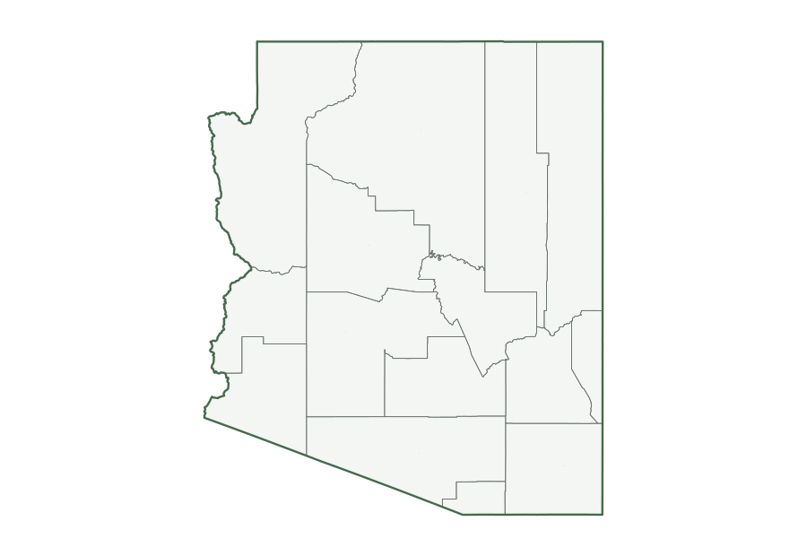
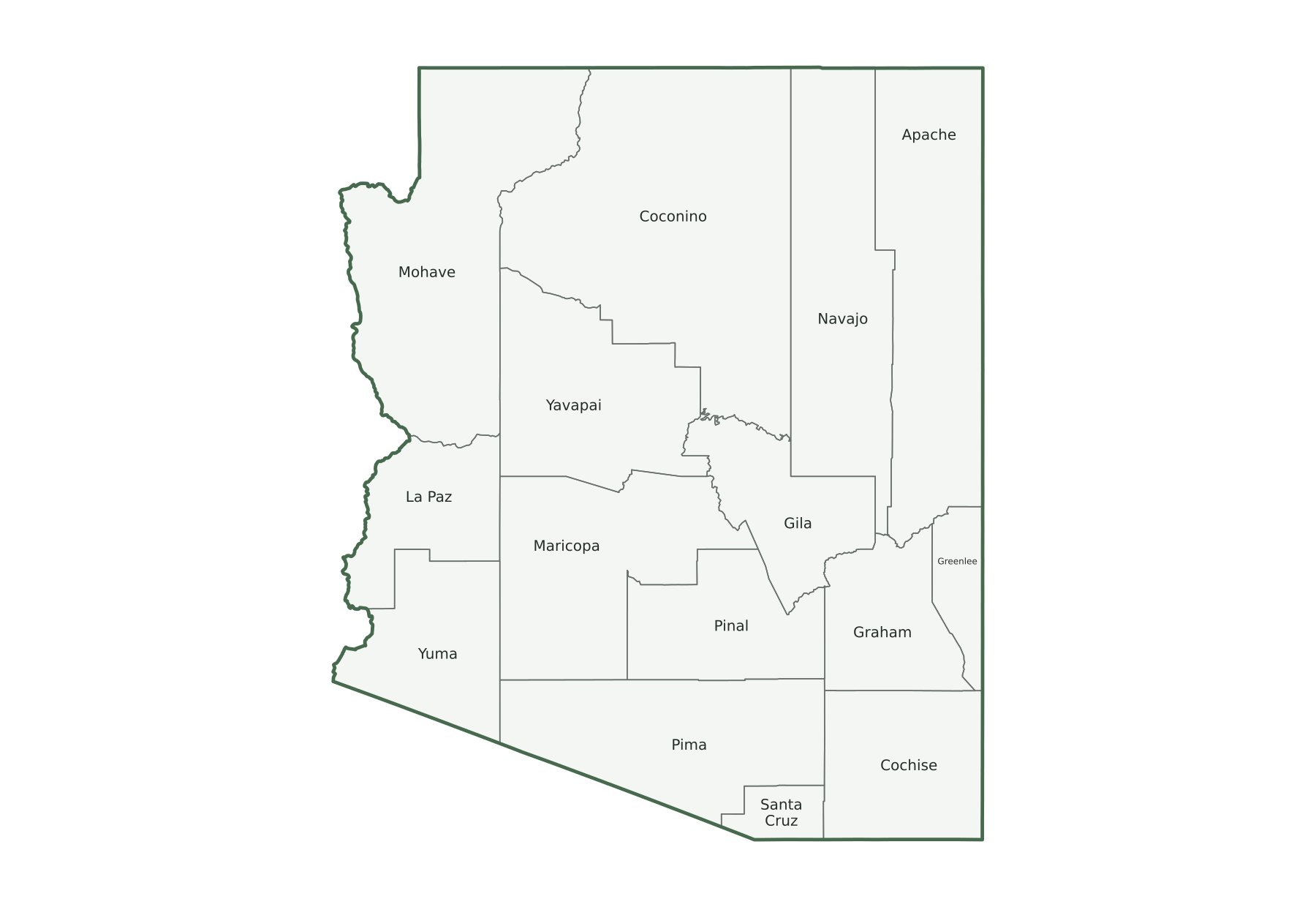
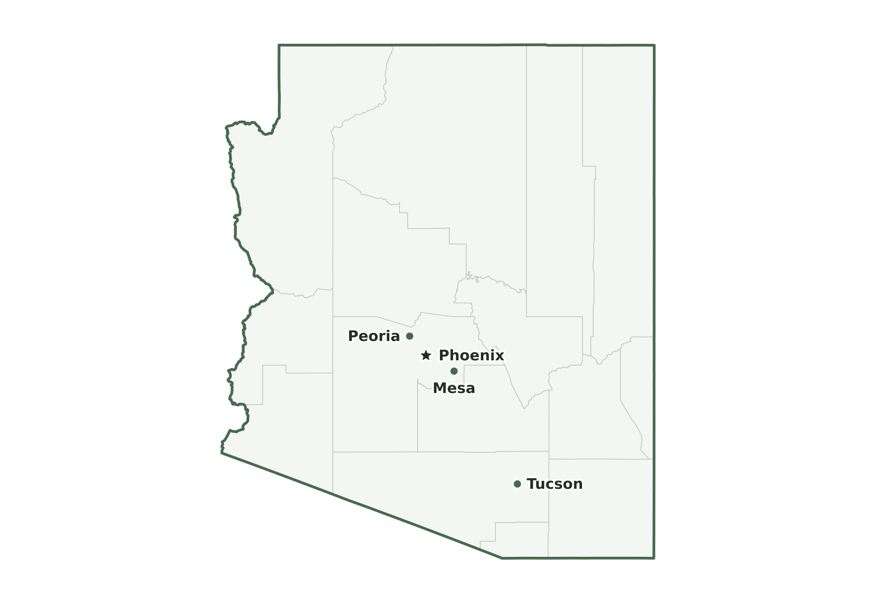
Arizona is a Mountain state in the Census Bureau’s West region, with 7,623,818 residents in the July 1, 2025 estimate (14th of 50) and 113,655 square miles of land (6th largest). Its capital, Phoenix, is also its most populous city. The map below shows its 15 counties.
| Map | PDF for printing | Image | Vector |
|---|---|---|---|
| County map with names | PNG | SVG | |
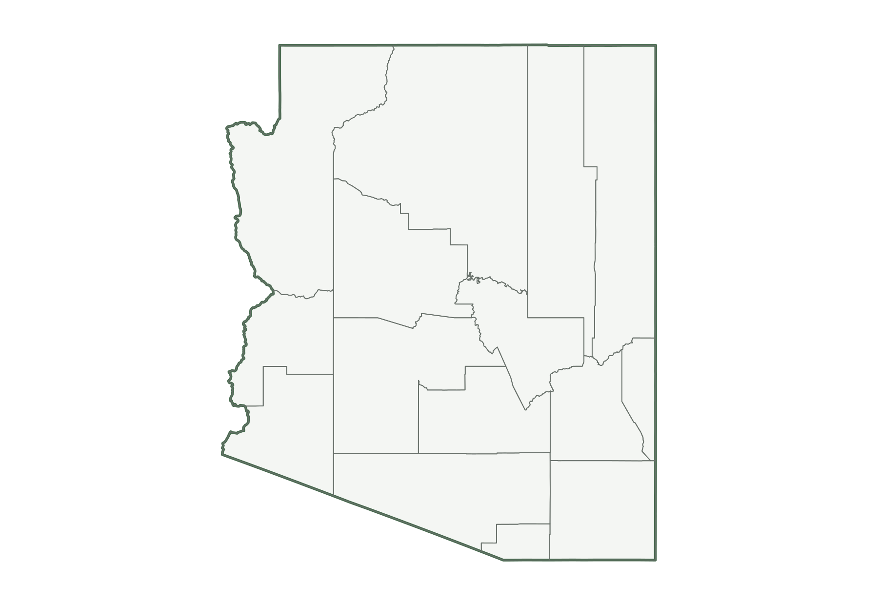
| County map, unlabeled | PNG | SVG | |
| Capital and largest cities | PNG | SVG | |
| Interstates and major highways | PNG | SVG | |
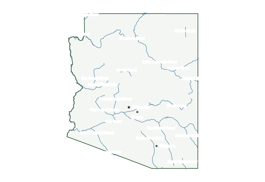
| Rivers and lakes | PNG | SVG | |
| With bordering states | PNG | SVG | |
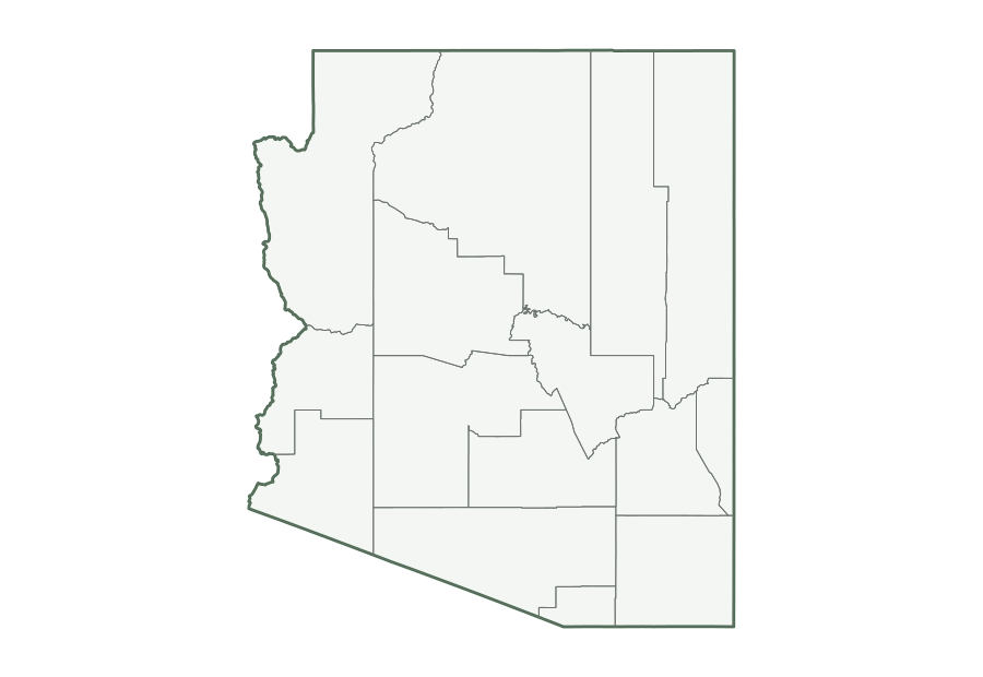
| Blank outline | PNG | SVG |
Arizona facts
| Capital | Phoenix |
|---|---|
| Most populous city | Phoenix (1,665,481) |
| Admitted to the Union | February 14, 1912 (48th state) |
| Population, July 1, 2025 | 7,623,818 (14th of 50) |
| Change since April 2020 | +6.5% (8th of 50 by growth) |
| Land area | 113,655 sq mi (6th largest) |
| Water area | 330 sq mi (0.3% of total area) |
| Population density | 67 people per sq mi of land (32nd densest) |
| Highest point | Humphreys Peak, 12,633 ft (12th highest state high point) |
| Lowest point | Colorado River, 70 ft |
| Mean elevation | About 4,100 ft |
| Time zone | Mountain (U.S. time zones) |
| Bordering states | California, Nevada, New Mexico, and Utah |
| Main interstates | I-8, I-10, I-15, I-17, I-19, and I-40 |
| County-level divisions | 15 counties |
| Census region and division | West, Mountain |
| Regional groupings | Southwest |
| Postal code and FIPS code | AZ · 04 |
Population figures are the Census Bureau’s Vintage 2025 estimates; the change is measured from the April 1, 2020 estimates base. Areas come from the 2025 boundary file and are converted from square meters. Elevations are from the U.S. Geological Survey. Ranks compare the 50 states and exclude Washington, D.C.
Geography of Arizona
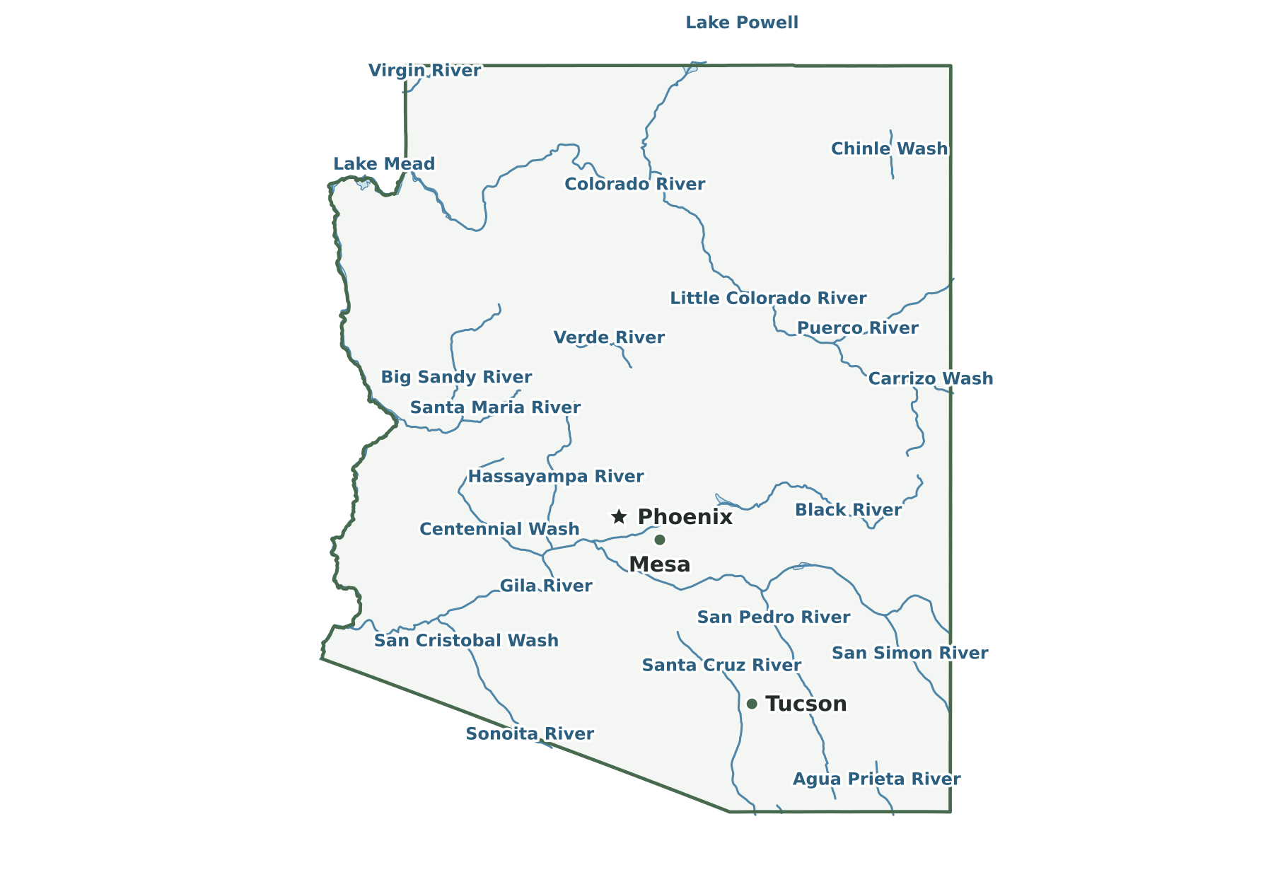
Northern Arizona belongs to the Colorado Plateau, which ends to the south at the Mogollon Rim, an escarpment running east toward New Mexico. The Colorado River crosses the plateau through the Grand Canyon, flows west into Lake Mead, then turns south and forms the western border. Between the canyon and Utah, the Arizona Strip is separated from the rest of the state by the river. Desert basins and ranges fill the south and west, where the Gila River runs from New Mexico to the Colorado near Yuma.
Capital and largest cities
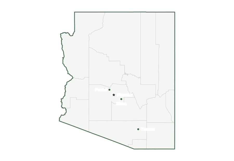
Phoenix is both the capital and the most populous city in Arizona, with 1,665,481 residents as of July 1, 2025. The ten largest places together hold 57% of the state’s population.
| Rank | Place | Population 2025 | Change since 2020 |
|---|---|---|---|
| 1 | Phoenix (capital) | 1,665,481 | +3.6% |
| 2 | Tucson | 548,371 | +1.1% |
| 3 | Mesa | 513,656 | +1.8% |
| 4 | Gilbert | 287,285 | +7.2% |
| 5 | Chandler | 278,748 | +1.0% |
| 6 | Glendale | 260,572 | +4.9% |
| 7 | Scottsdale | 243,006 | +0.7% |
| 8 | Peoria | 200,881 | +5.2% |
| 9 | Tempe | 190,571 | +3.5% |
| 10 | Surprise | 175,304 | +22.5% |
Interstates and major highways
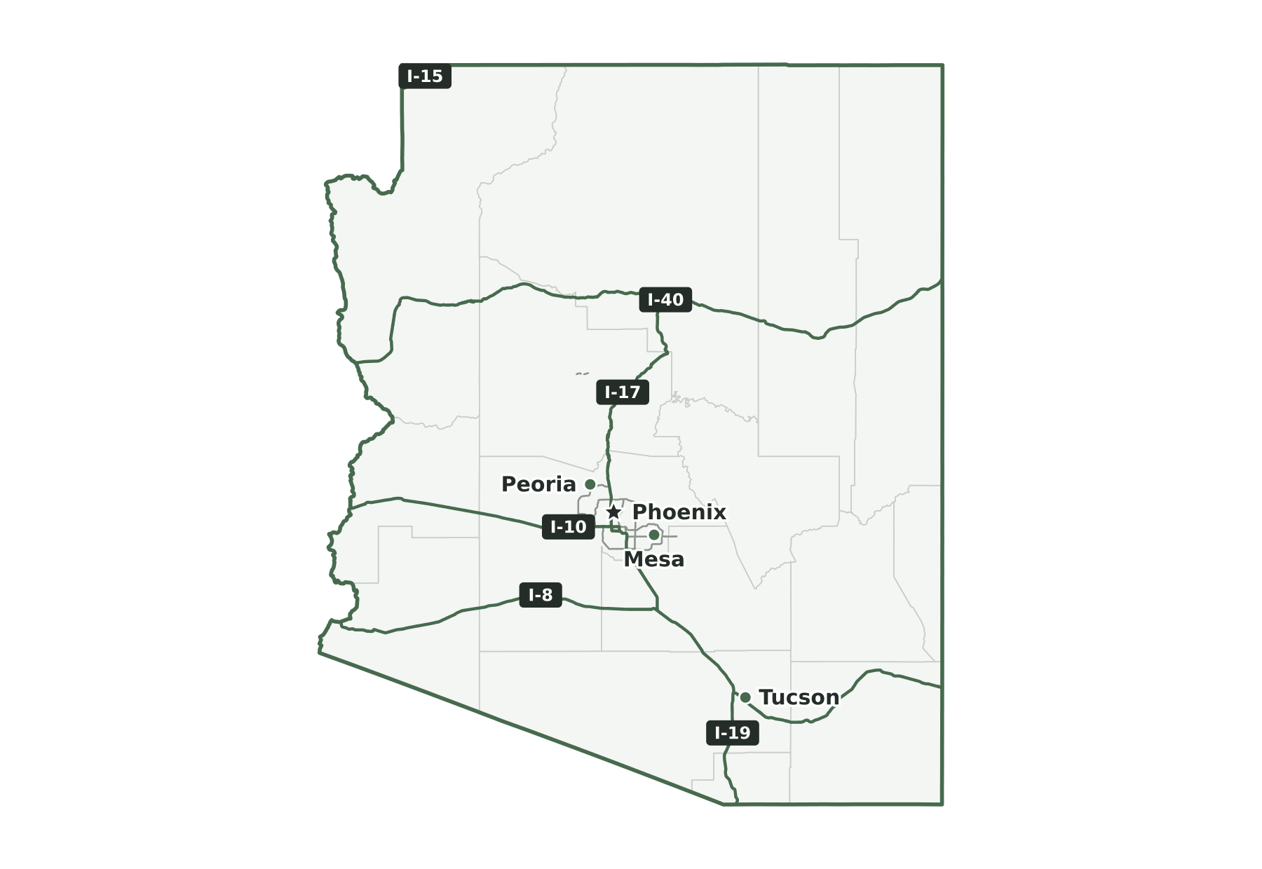
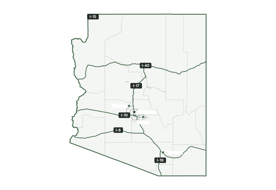
The interstates in Arizona are I-8, I-10, I-15, I-17, I-19, and I-40.
States that border Arizona
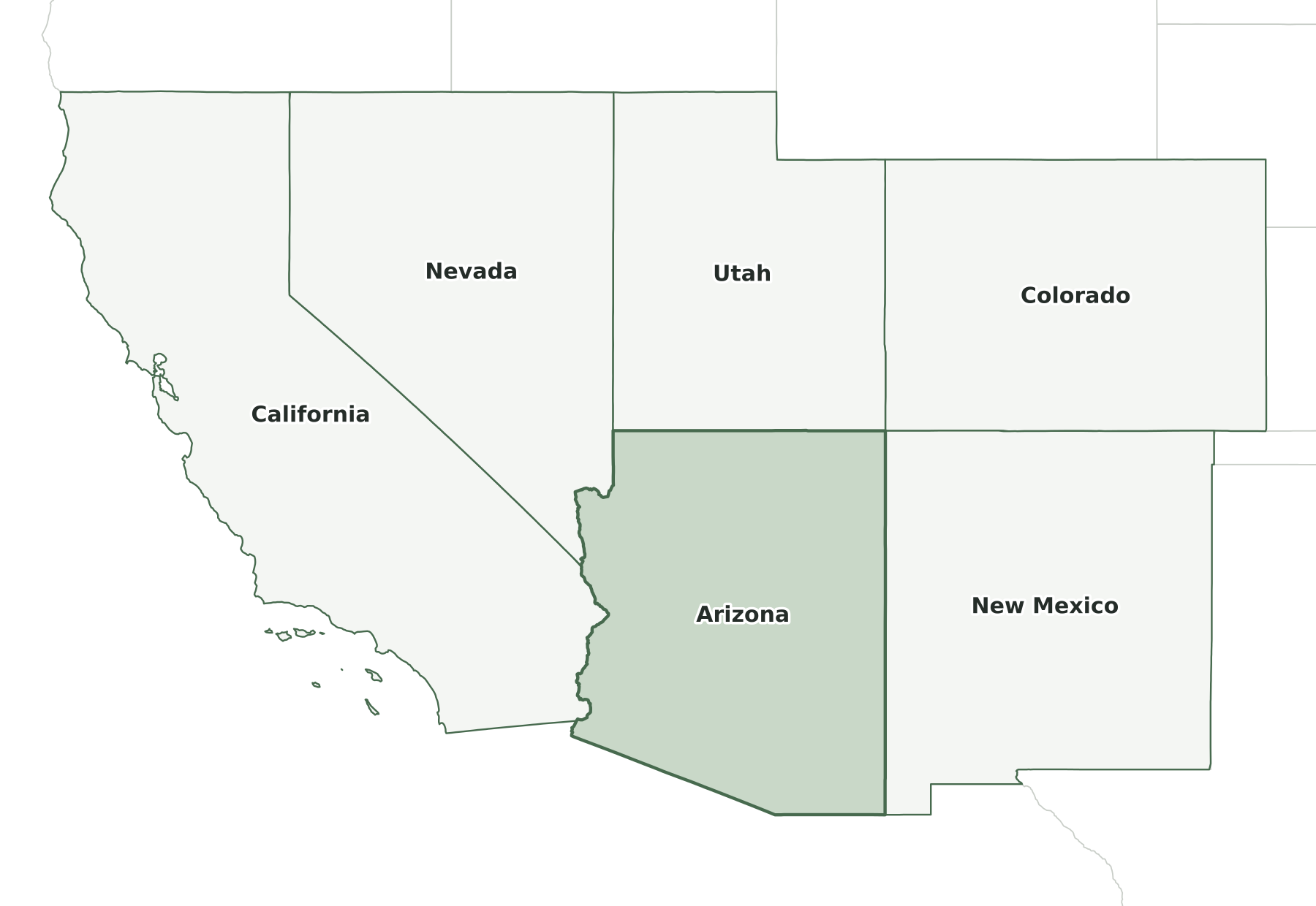
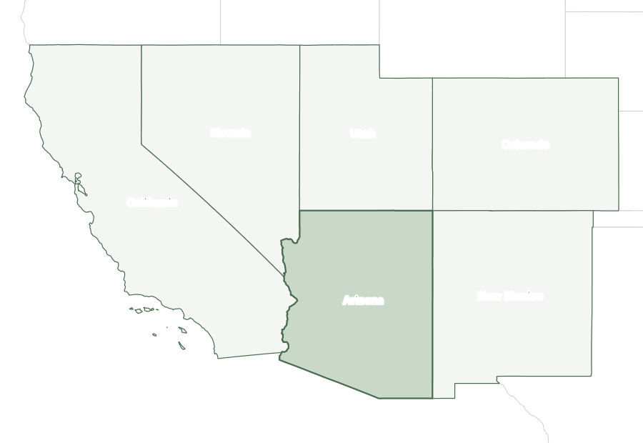
Four states border Arizona: California, Nevada, New Mexico, and Utah. It also meets Colorado at a single point, Four Corners, where Arizona, Colorado, New Mexico, and Utah touch. It shares an international boundary with Mexico.
Map of Arizona and surrounding states
| State | Direction | Shared land boundary |
|---|---|---|
| Utah | north | about 280 mi |
| New Mexico | east | about 390 mi |
| California | west | about 230 mi |
| Nevada | northwest | about 200 mi |
How each boundary is drawn
Utah. The 37th parallel, as surveyed in 1901, forms the entire line, running due east from the Nevada corner to the Four Corners monument.
New Mexico. The meridian 32 degrees west of Washington, about 109°03' W, runs straight south from the Four Corners monument to the international boundary with Mexico.
California. The Colorado River forms the whole line from the Nevada corner south to Mexico, fixed by a 1963 compact at surveyed points so later channel shifts do not move it.
Nevada. The meridian 37 degrees west of Washington, just west of 114° W, runs south from the 37th parallel to the Colorado River, which forms the line to California.
Directions and lengths in the table are our measurements: the direction is the side of Arizona along which each shared boundary runs, judged from the center of the state. Lengths are measured along the generalized 1:5,000,000 boundary lines, which smooth out river bends and small jogs, so they run shorter than surveyed lengths. The file is clipped to the shoreline of the oceans, the Great Lakes, and large bays, so boundaries through those waters are not counted.
Counties of Arizona
The 2025 county file divides Arizona into 15 counties. The largest by land area is Coconino County (18,616 sq mi) and the smallest is Santa Cruz County (1,236 sq mi). Maricopa County is the most populous, with 4,689,558 residents, or 62% of the state. Greenlee County has the fewest, with 9,312. Half of Arizona’s counties have fewer than 126,332 residents, and 12 of 15 grew between 2020 and 2025.
| Name | Seat | FIPS | Land sq mi | Population 2025 | Change since 2020 |
|---|---|---|---|---|---|
| Apache County | St. Johns | 04001 | 11,198 | 64,445 | −2.4% |
| Cochise County | Bisbee | 04003 | 6,210 | 126,332 | +0.7% |
| Coconino County | Flagstaff | 04005 | 18,616 | 144,368 | −0.5% |
| Gila County | Globe | 04007 | 4,758 | 53,801 | +1.0% |
| Graham County | Safford | 04009 | 4,622 | 40,157 | +4.2% |
| Greenlee County | Clifton | 04011 | 1,843 | 9,312 | −2.6% |
| La Paz County | Parker | 04012 | 4,497 | 16,711 | +0.9% |
| Maricopa County | Phoenix | 04013 | 9,202 | 4,689,558 | +6.0% |
| Mohave County | Kingman | 04015 | 13,332 | 228,102 | +7.0% |
| Navajo County | Holbrook | 04017 | 9,949 | 109,946 | +3.0% |
| Pima County | Tucson | 04019 | 9,189 | 1,074,685 | +3.0% |
| Pinal County | Florence | 04021 | 5,367 | 539,380 | +26.6% |
| Santa Cruz County | Nogales | 04023 | 1,236 | 50,020 | +4.9% |
| Yavapai County | Prescott | 04025 | 8,123 | 252,552 | +6.9% |
| Yuma County | Yuma | 04027 | 5,514 | 224,449 | +9.5% |
Geographic extent
In the generalized boundary file, Arizona reaches from 31.33° N to 37.00° N and from 114.81° W to 109.05° W. That is about 392 miles north to south and 330 miles east to west at its central latitude. The center of its mapped area falls at 34.29° N, 111.66° W, nearest to Strawberry among Census-listed places. We calculated this center from the outline; it is not an official geographic-center marker.
Frequently asked questions
How many states border Arizona?
Four: California, Nevada, New Mexico, and Utah. See the map of Arizona and surrounding states.
How many counties does Arizona have?
Arizona has 15 counties. Maricopa County has the most residents and Coconino County the most land; the county table lists them all.
What is the capital of Arizona, and what is its largest city?
Phoenix is both the capital and the largest city. The cities section lists the ten most populous places.
How big is Arizona?
In the Census Bureau’s 2025 boundary file, Arizona covers 113,985 square miles: 113,655 of land and 330 of water. That makes it the 6th largest state by both total area and land area.
What time zone is Arizona in?
All of Arizona is in the Mountain Time Zone. Arizona does not observe daylight saving time, except in the Navajo Nation; the Hopi Reservation, which the Navajo Nation surrounds, does not observe it either.
What is the highest point in Arizona?
The highest point is Humphreys Peak, at 12,633 feet, the 12th highest of the 50 state high points. The lowest point is the Colorado River, at 70 feet.
Sources and use
Boundaries: U.S. Census Bureau, 2025 Cartographic Boundary Files, 1:5,000,000 scale, generalized for display. Population: Census Bureau Vintage 2025 estimates. City positions: the 2025 Census Gazetteer. Roads: 2025 TIGER/Line primary roads. Rivers and lakes: Natural Earth. County seats: Wikidata, checked against Wikipedia’s county lists. The maps are for reference, teaching, and ordinary printing, not for property lines, precincts, or navigation. When you share a map, keep the source line with it. The printing guide covers paper size and attribution.