
Map of Colorado
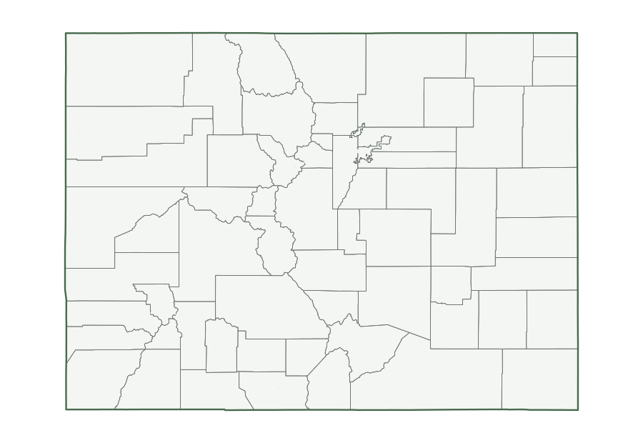
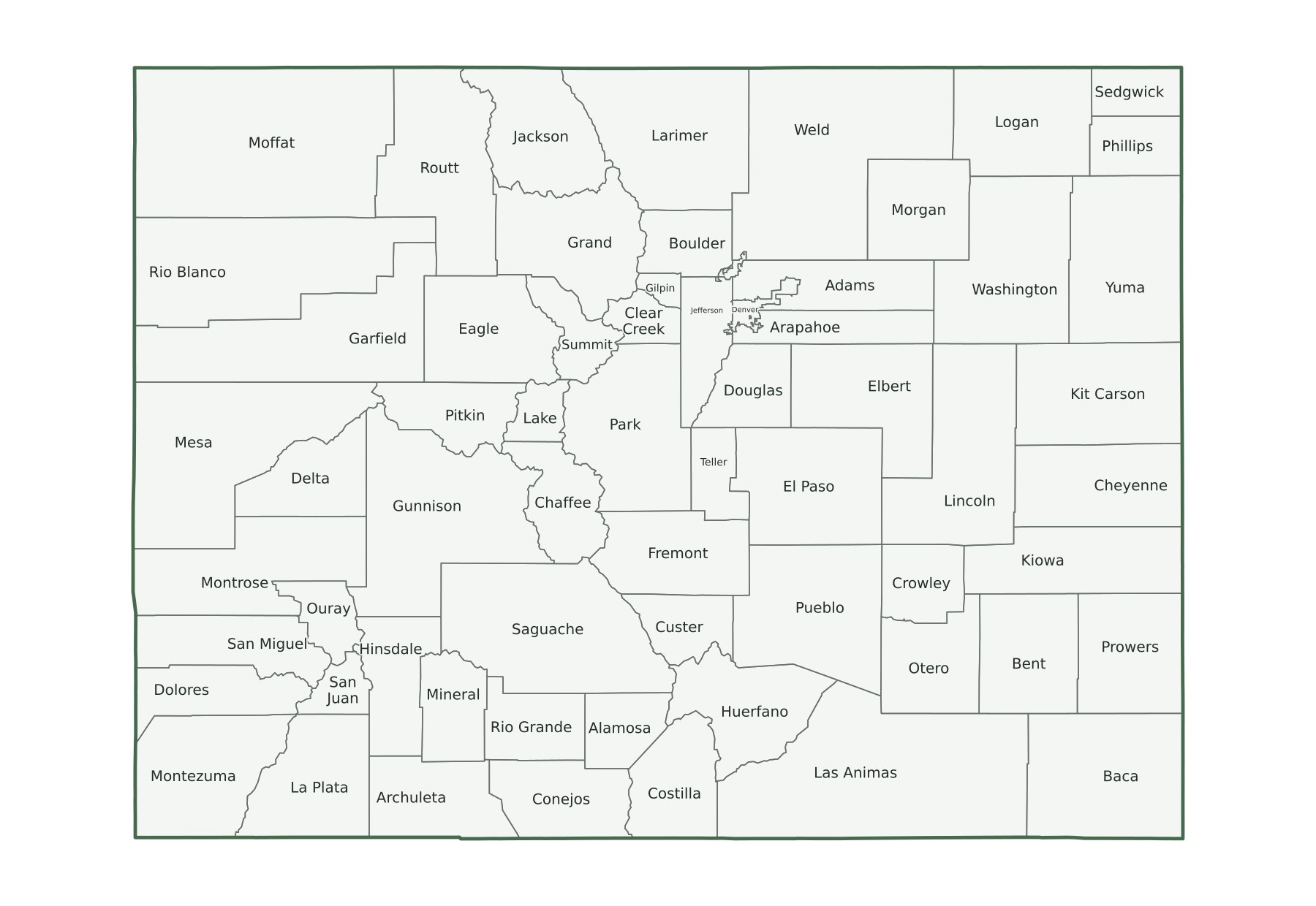
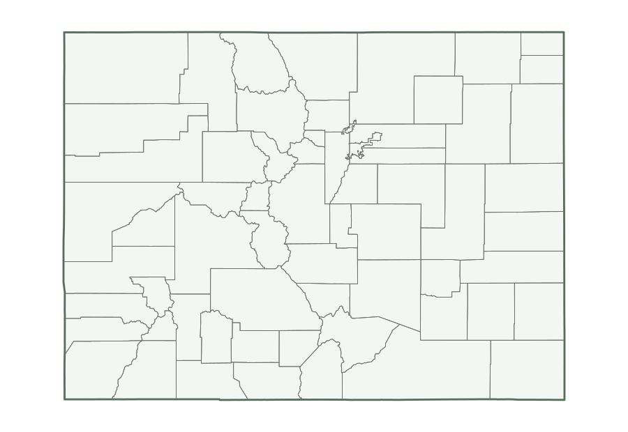
Colorado is a Mountain state in the Census Bureau’s West region, with 6,012,561 residents in the July 1, 2025 estimate (20th of 50) and 103,637 square miles of land (8th largest). Its capital, Denver, is also its most populous city. The map below shows its 64 counties.
| Map | PDF for printing | Image | Vector |
|---|---|---|---|
| County map with names | PNG | SVG | |
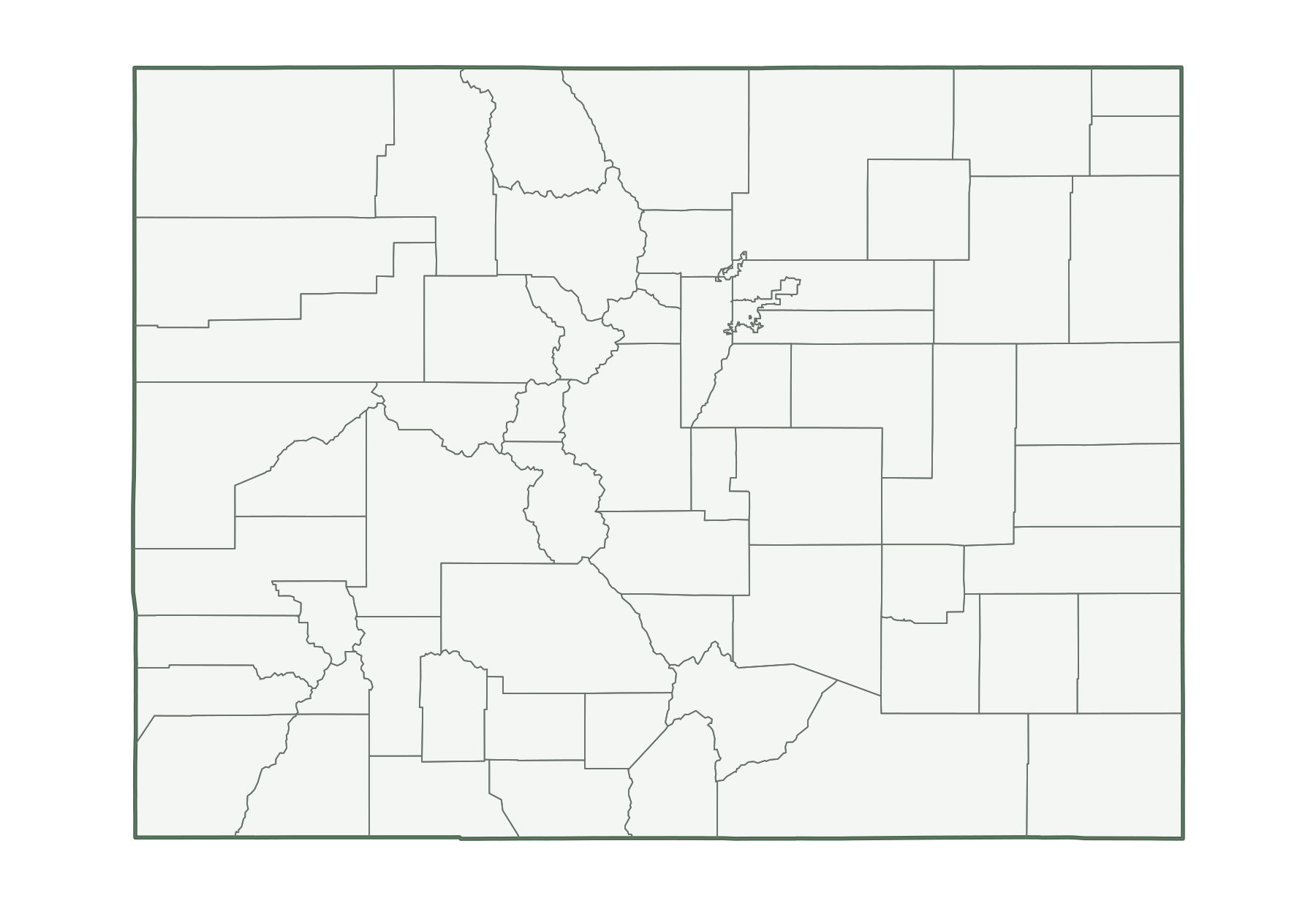
| County map, unlabeled | PNG | SVG | |
| Capital and largest cities | PNG | SVG | |
| Interstates and major highways | PNG | SVG | |
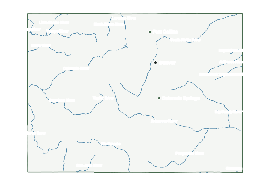
| Rivers and lakes | PNG | SVG | |
| With bordering states | PNG | SVG | |
| Blank outline | PNG | SVG |
Colorado facts
| Capital | Denver |
|---|---|
| Most populous city | Denver (740,613) |
| Admitted to the Union | August 1, 1876 (38th state) |
| Population, July 1, 2025 | 6,012,561 (20th of 50) |
| Change since April 2020 | +4.1% (15th of 50 by growth) |
| Land area | 103,637 sq mi (8th largest) |
| Water area | 458 sq mi (0.4% of total area) |
| Population density | 58 people per sq mi of land (36th densest) |
| Highest point | Mount Elbert, 14,433 ft (3rd highest state high point) |
| Lowest point | Arikaree River, 3,315 ft |
| Mean elevation | About 6,800 ft |
| Time zone | Mountain (U.S. time zones) |
| Bordering states | Kansas, Nebraska, New Mexico, Oklahoma, Utah, and Wyoming |
| Main interstates | I-25, I-70, and I-76 |
| County-level divisions | 64 counties |
| Census region and division | West, Mountain |
| Regional groupings | Southwest (sometimes) |
| Postal code and FIPS code | CO · 08 |
Population figures are the Census Bureau’s Vintage 2025 estimates; the change is measured from the April 1, 2020 estimates base. Areas come from the 2025 boundary file and are converted from square meters. Elevations are from the U.S. Geological Survey. Ranks compare the 50 states and exclude Washington, D.C.
Geography of Colorado
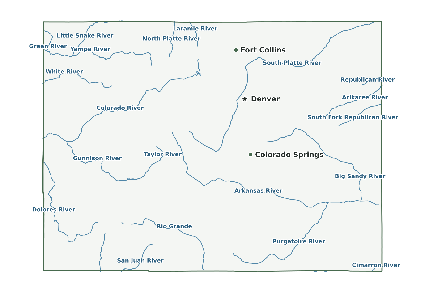
High Plains in the east give way at the Front Range to the Rocky Mountains, whose crest carries the Continental Divide through the state. The South Platte and Arkansas rivers leave the mountains and cross the plains eastward. West of the Divide, the Colorado River begins in Rocky Mountain National Park and runs southwest into Utah, reaching the edge of the Colorado Plateau along the western border. Farther south, the Rio Grande rises in the San Juan Mountains and crosses the San Luis Valley into New Mexico. Four states meet at the southwest corner.
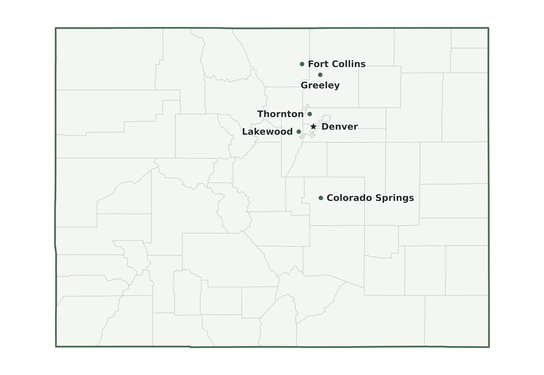
Capital and largest cities
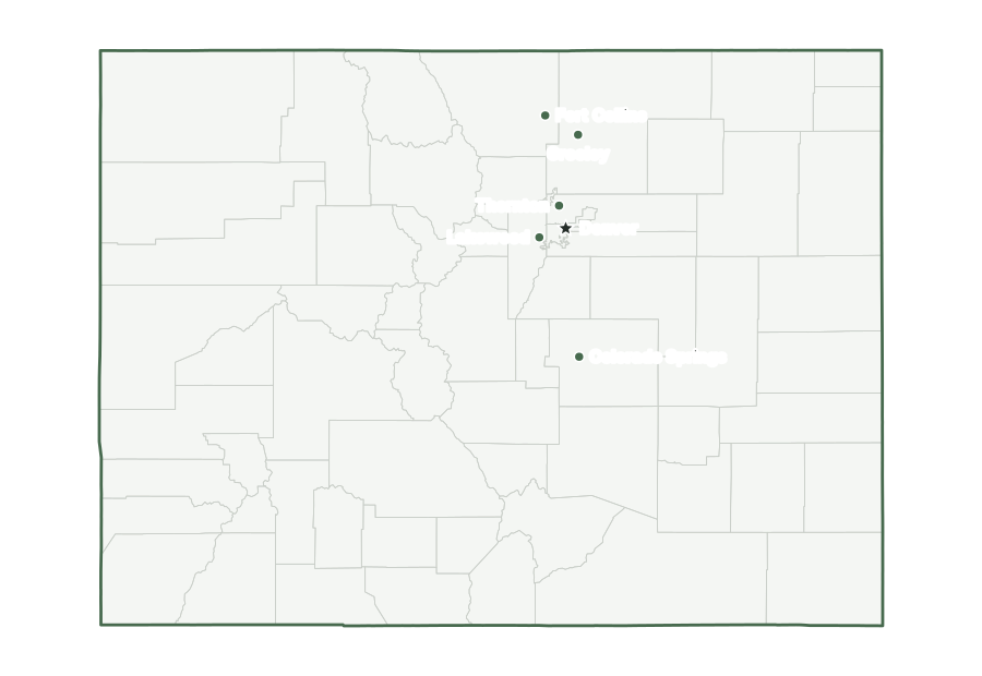
Denver is both the capital and the most populous city in Colorado, with 740,613 residents as of July 1, 2025. The ten largest places together hold 43% of the state’s population.
| Rank | Place | Population 2025 | Change since 2020 |
|---|---|---|---|
| 1 | Denver (capital) | 740,613 | +3.5% |
| 2 | Colorado Springs | 494,743 | +3.1% |
| 3 | Aurora | 410,053 | +6.2% |
| 4 | Fort Collins | 171,500 | +1.0% |
| 5 | Lakewood | 156,927 | +0.6% |
| 6 | Thornton | 147,766 | +4.2% |
| 7 | Arvada | 122,901 | −1.2% |
| 8 | Westminster | 116,182 | −0.4% |
| 9 | Greeley | 115,073 | +5.8% |
| 10 | Pueblo | 110,404 | −1.3% |
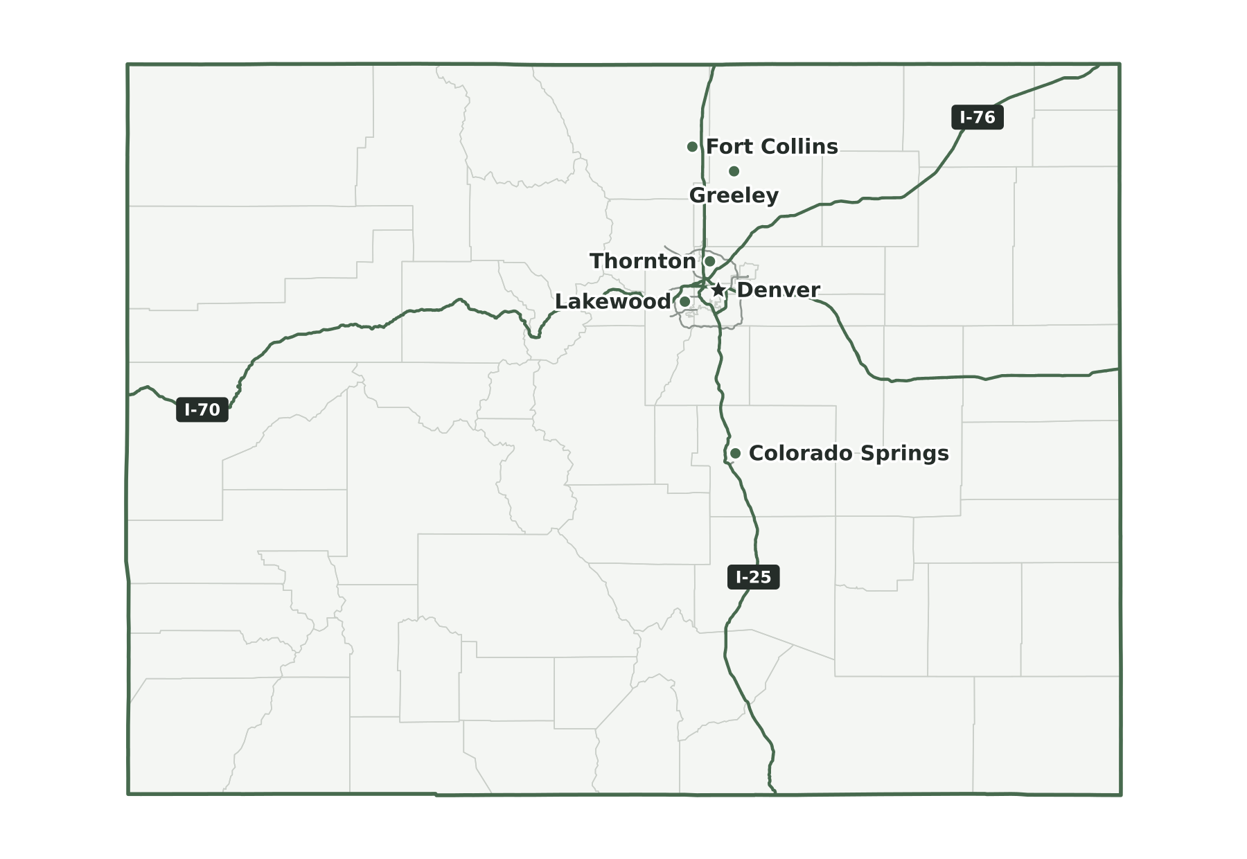
Interstates and major highways
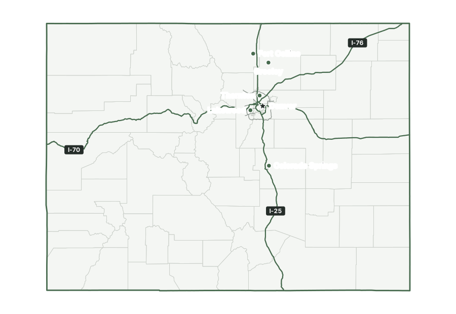
The main interstates in Colorado are I-25, I-70, and I-76. Shorter spurs and loops include I-225 and I-270.
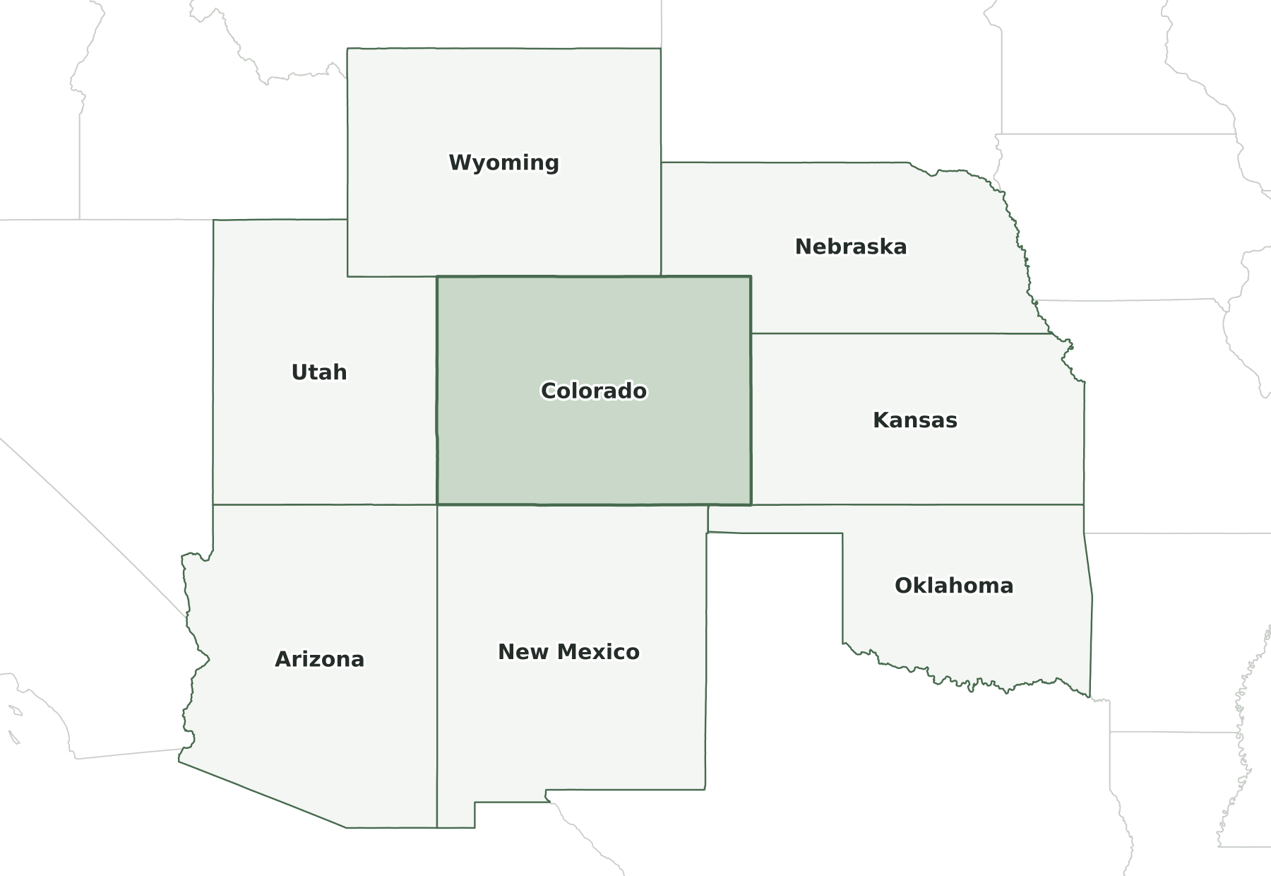
States that border Colorado
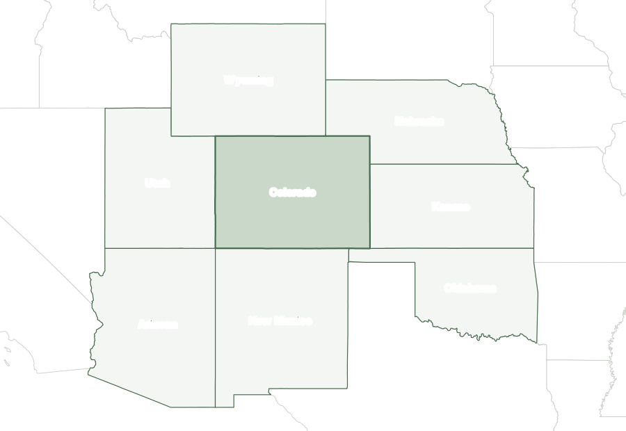
Six states border Colorado: Kansas, Nebraska, New Mexico, Oklahoma, Utah, and Wyoming. It also meets Arizona at a single point, Four Corners, where Arizona, Colorado, New Mexico, and Utah touch.
Map of Colorado and surrounding states
| State | Direction | Shared land boundary |
|---|---|---|
| Wyoming | north | about 260 mi |
| Nebraska | northeast | about 170 mi |
| Kansas | east | about 210 mi |
| Oklahoma | southeast | about 50 mi |
| New Mexico | south | about 330 mi |
| Utah | west | about 280 mi |
How each boundary is drawn
Wyoming. The 41st parallel forms the entire line, running from the Nebraska corner west to the Utah corner.
Nebraska. The 41st parallel runs east from the Wyoming corner to the meridian 25 degrees west of Washington, about 102°03' W, which then forms the line south to the 40th parallel.
Kansas. The meridian 25 degrees west of Washington, about 102°03' W, forms the entire line, from the Nebraska corner on the 40th parallel south to the Oklahoma corner on the 37th.
Oklahoma. The 37th parallel, as surveyed, forms the entire line, from the New Mexico corner east to the Kansas corner on the meridian 25 degrees west of Washington.
New Mexico. The statutory line is the 37th parallel, but the U.S. Supreme Court upheld Darling's 1868 survey, errors included, so the marked line departs from the parallel in places.
Utah. The meridian 32 degrees west of Washington, as surveyed in 1879, runs north from the Four Corners to the Wyoming corner, lying slightly west of its statutory position in places.
Directions and lengths in the table are our measurements: the direction is the side of Colorado along which each shared boundary runs, judged from the center of the state. Lengths are measured along the generalized 1:5,000,000 boundary lines, which smooth out river bends and small jogs, so they run shorter than surveyed lengths. The file is clipped to the shoreline of the oceans, the Great Lakes, and large bays, so boundaries through those waters are not counted.
Counties of Colorado
The 2025 county file divides Colorado into 64 counties. The largest by land area is Las Animas County (4,773 sq mi) and the smallest is Broomfield County (33 sq mi). El Paso County is the most populous, with 757,040 residents, or 13% of the state. Hinsdale County has the fewest, with 753. Half of Colorado’s counties have fewer than 15,444 residents, and 40 of 64 grew between 2020 and 2025.
| Name | Seat | FIPS | Land sq mi | Population 2025 | Change since 2020 |
|---|---|---|---|---|---|
| Adams County | Brighton | 08001 | 1,167 | 554,668 | +6.8% |
| Alamosa County | Alamosa | 08003 | 723 | 16,688 | +1.9% |
| Arapahoe County | Littleton | 08005 | 798 | 673,820 | +2.9% |
| Archuleta County | Pagosa Springs | 08007 | 1,350 | 14,306 | +7.1% |
| Baca County | Springfield | 08009 | 2,555 | 3,347 | −4.5% |
| Bent County | Las Animas | 08011 | 1,513 | 5,716 | +1.3% |
| Boulder County | Boulder | 08013 | 726 | 328,560 | −0.7% |
| Broomfield County | Broomfield | 08014 | 33 | 79,174 | +6.8% |
| Chaffee County | Salida | 08015 | 1,013 | 20,831 | +7.0% |
| Cheyenne County | Cheyenne Wells | 08017 | 1,778 | 1,713 | −2.1% |
| Clear Creek County | Georgetown | 08019 | 395 | 8,994 | −4.0% |
| Conejos County | Conejos | 08021 | 1,287 | 7,529 | +0.9% |
| Costilla County | San Luis | 08023 | 1,228 | 3,679 | +5.3% |
| Crowley County | Ordway | 08025 | 787 | 5,677 | −4.2% |
| Custer County | Westcliffe | 08027 | 739 | 5,590 | +18.8% |
| Delta County | Delta | 08029 | 1,142 | 32,178 | +3.1% |
| Denver County | Denver | 08031 | 153 | 740,613 | +3.5% |
| Dolores County | Dove Creek | 08033 | 1,067 | 2,466 | +6.1% |
| Douglas County | Castle Rock | 08035 | 841 | 399,396 | +11.6% |
| Eagle County | Eagle | 08037 | 1,684 | 54,291 | −2.6% |
| El Paso County | Colorado Springs | 08041 | 2,126 | 757,040 | +3.5% |
| Elbert County | Kiowa | 08039 | 1,850 | 30,534 | +17.2% |
| Fremont County | Cañon City | 08043 | 1,534 | 50,039 | +2.3% |
| Garfield County | Glenwood Springs | 08045 | 2,947 | 63,474 | +2.9% |
| Gilpin County | Central City | 08047 | 150 | 6,073 | +4.7% |
| Grand County | Hot Sulphur Springs | 08049 | 1,847 | 16,496 | +5.0% |
| Gunnison County | Gunnison | 08051 | 3,239 | 17,439 | +3.1% |
| Hinsdale County | Lake City | 08053 | 1,117 | 753 | −4.0% |
| Huerfano County | Walsenburg | 08055 | 1,591 | 7,011 | +2.9% |
| Jackson County | Walden | 08057 | 1,614 | 1,211 | −12.2% |
| Jefferson County | Golden | 08059 | 764 | 580,451 | −0.4% |
| Kiowa County | Eads | 08061 | 1,768 | 1,412 | −2.4% |
| Kit Carson County | Burlington | 08063 | 2,161 | 7,069 | −0.2% |
| La Plata County | Durango | 08067 | 1,690 | 56,898 | +2.3% |
| Lake County | Leadville | 08065 | 377 | 7,552 | +1.6% |
| Larimer County | Fort Collins | 08069 | 2,596 | 377,292 | +5.1% |
| Las Animas County | Trinidad | 08071 | 4,773 | 14,391 | −1.1% |
| Lincoln County | Hugo | 08073 | 2,578 | 5,645 | −0.6% |
| Logan County | Sterling | 08075 | 1,839 | 20,654 | −4.1% |
| Mesa County | Grand Junction | 08077 | 3,329 | 162,845 | +4.6% |
| Mineral County | Creede | 08079 | 876 | 910 | +5.2% |
| Moffat County | Craig | 08081 | 4,743 | 13,122 | −1.3% |
| Montezuma County | Cortez | 08083 | 2,029 | 26,678 | +3.2% |
| Montrose County | Montrose | 08085 | 2,241 | 44,591 | +4.5% |
| Morgan County | Fort Morgan | 08087 | 1,280 | 30,306 | +4.1% |
| Otero County | La Junta | 08089 | 1,262 | 17,683 | −5.4% |
| Ouray County | Ouray | 08091 | 541 | 5,265 | +7.9% |
| Park County | Fairplay | 08093 | 2,194 | 18,314 | +5.3% |
| Phillips County | Holyoke | 08095 | 688 | 4,420 | −2.5% |
| Pitkin County | Aspen | 08097 | 971 | 16,625 | −4.2% |
| Prowers County | Lamar | 08099 | 1,638 | 11,884 | −0.9% |
| Pueblo County | Pueblo | 08101 | 2,387 | 169,277 | +0.7% |
| Rio Blanco County | Meeker | 08103 | 3,221 | 6,683 | +2.4% |
| Rio Grande County | Del Norte | 08105 | 912 | 11,087 | −3.9% |
| Routt County | Steamboat Springs | 08107 | 2,362 | 25,329 | +2.0% |
| Saguache County | Saguache | 08109 | 3,169 | 6,732 | +5.6% |
| San Juan County | Silverton | 08111 | 388 | 813 | +15.5% |
| San Miguel County | Telluride | 08113 | 1,287 | 7,753 | −3.9% |
| Sedgwick County | Julesburg | 08115 | 548 | 2,247 | −6.5% |
| Summit County | Breckenridge | 08117 | 608 | 31,517 | +0.7% |
| Teller County | Cripple Creek | 08119 | 557 | 24,756 | +0.2% |
| Washington County | Akron | 08121 | 2,518 | 4,732 | −1.7% |
| Weld County | Greeley | 08123 | 3,985 | 378,426 | +15.0% |
| Yuma County | Wray | 08125 | 2,364 | 9,896 | −0.9% |
Geographic extent
In the generalized boundary file, Colorado reaches from 36.99° N to 41.00° N and from 109.06° W to 102.04° W. That is about 277 miles north to south and 377 miles east to west at its central latitude. The center of its mapped area falls at 39.00° N, 105.55° W, nearest to Hartsel among Census-listed places. We calculated this center from the outline; it is not an official geographic-center marker.
Frequently asked questions
How many states border Colorado?
Six: Kansas, Nebraska, New Mexico, Oklahoma, Utah, and Wyoming. See the map of Colorado and surrounding states.
How many counties does Colorado have?
Colorado has 64 counties. El Paso County has the most residents and Las Animas County the most land; the county table lists them all.
What is the capital of Colorado, and what is its largest city?
Denver is both the capital and the largest city. The cities section lists the ten most populous places.
How big is Colorado?
In the Census Bureau’s 2025 boundary file, Colorado covers 104,095 square miles: 103,637 of land and 458 of water. That makes it the 8th largest state by both total area and land area.
What time zone is Colorado in?
All of Colorado is in the Mountain Time Zone and observes daylight saving time.
What is the highest point in Colorado?
The highest point is Mount Elbert, at 14,433 feet, the 3rd highest of the 50 state high points. The lowest point is the Arikaree River, at 3,315 feet.
Sources and use
Boundaries: U.S. Census Bureau, 2025 Cartographic Boundary Files, 1:5,000,000 scale, generalized for display. Population: Census Bureau Vintage 2025 estimates. City positions: the 2025 Census Gazetteer. Roads: 2025 TIGER/Line primary roads. Rivers and lakes: Natural Earth. County seats: Wikidata, checked against Wikipedia’s county lists. The maps are for reference, teaching, and ordinary printing, not for property lines, precincts, or navigation. When you share a map, keep the source line with it. The printing guide covers paper size and attribution.