
Map of Oklahoma
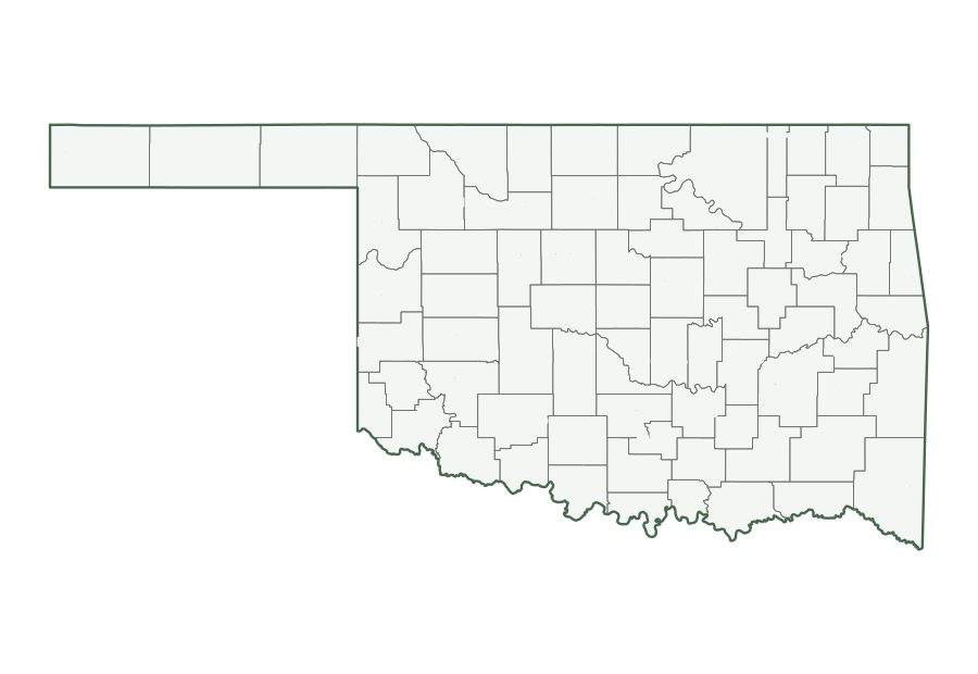
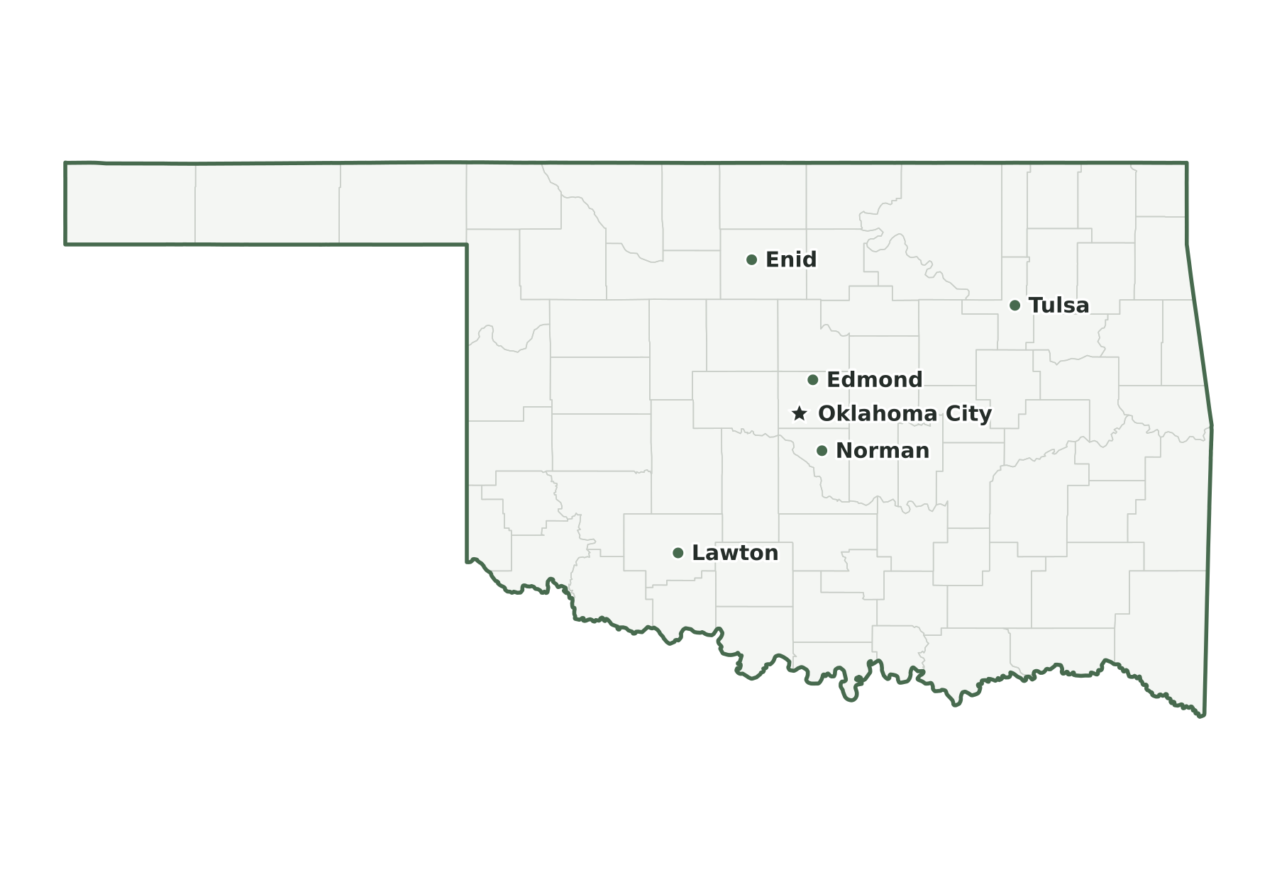
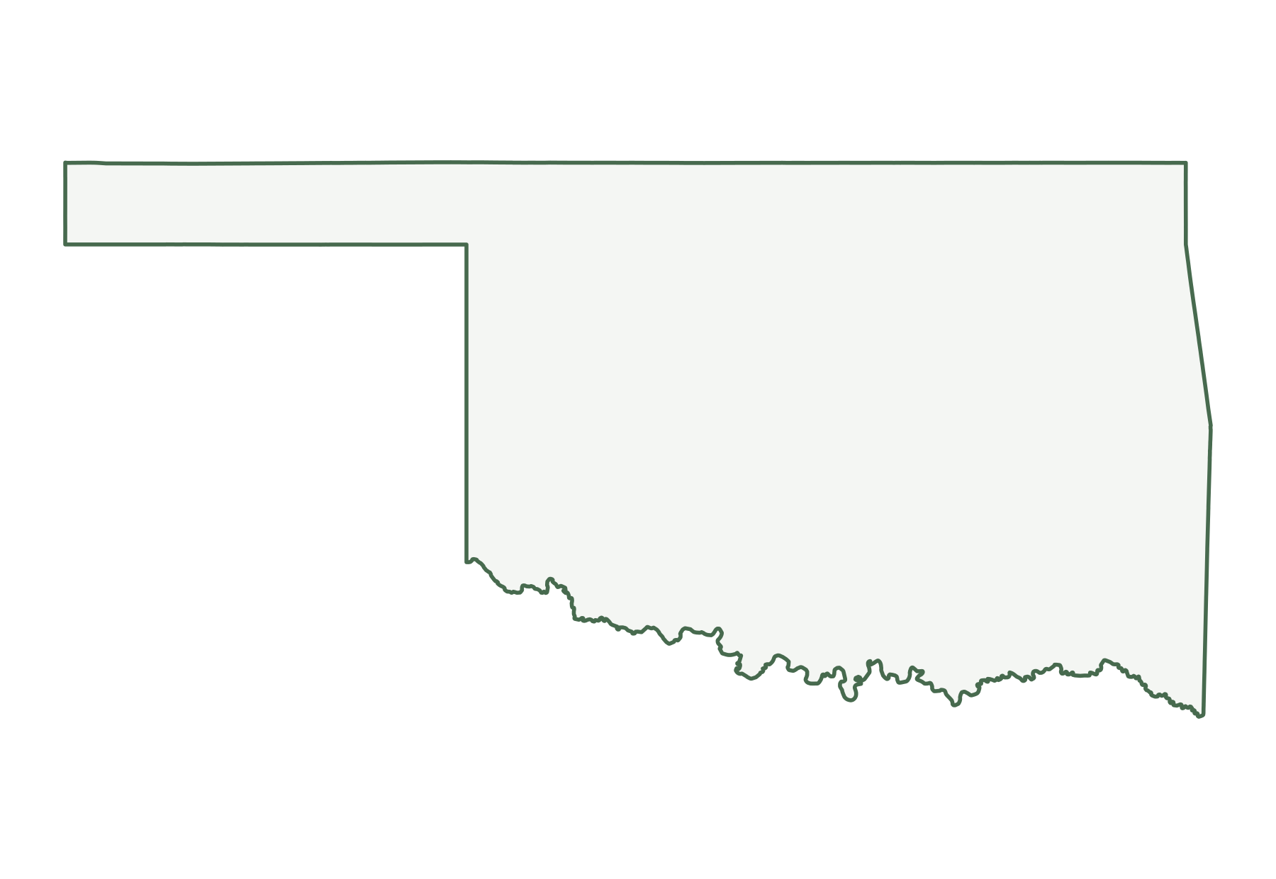
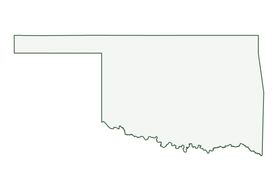
Oklahoma is a West South Central state in the Census Bureau’s South region, with 4,123,288 residents in the July 1, 2025 estimate (28th of 50) and 68,597 square miles of land (19th largest). Its capital, Oklahoma City, is also its most populous city. The map below shows its 77 counties.
| Map | PDF for printing | Image | Vector |
|---|---|---|---|
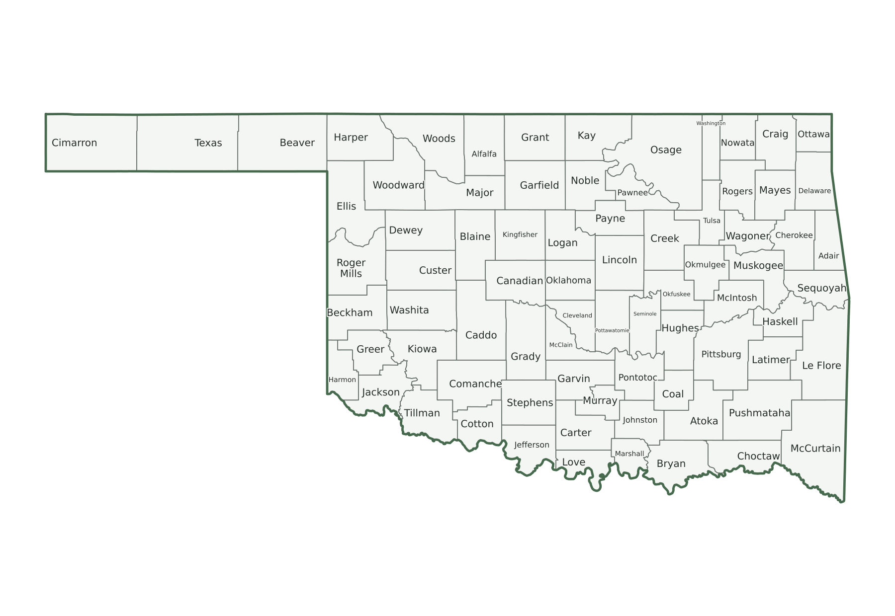
| County map with names | PNG | SVG | |
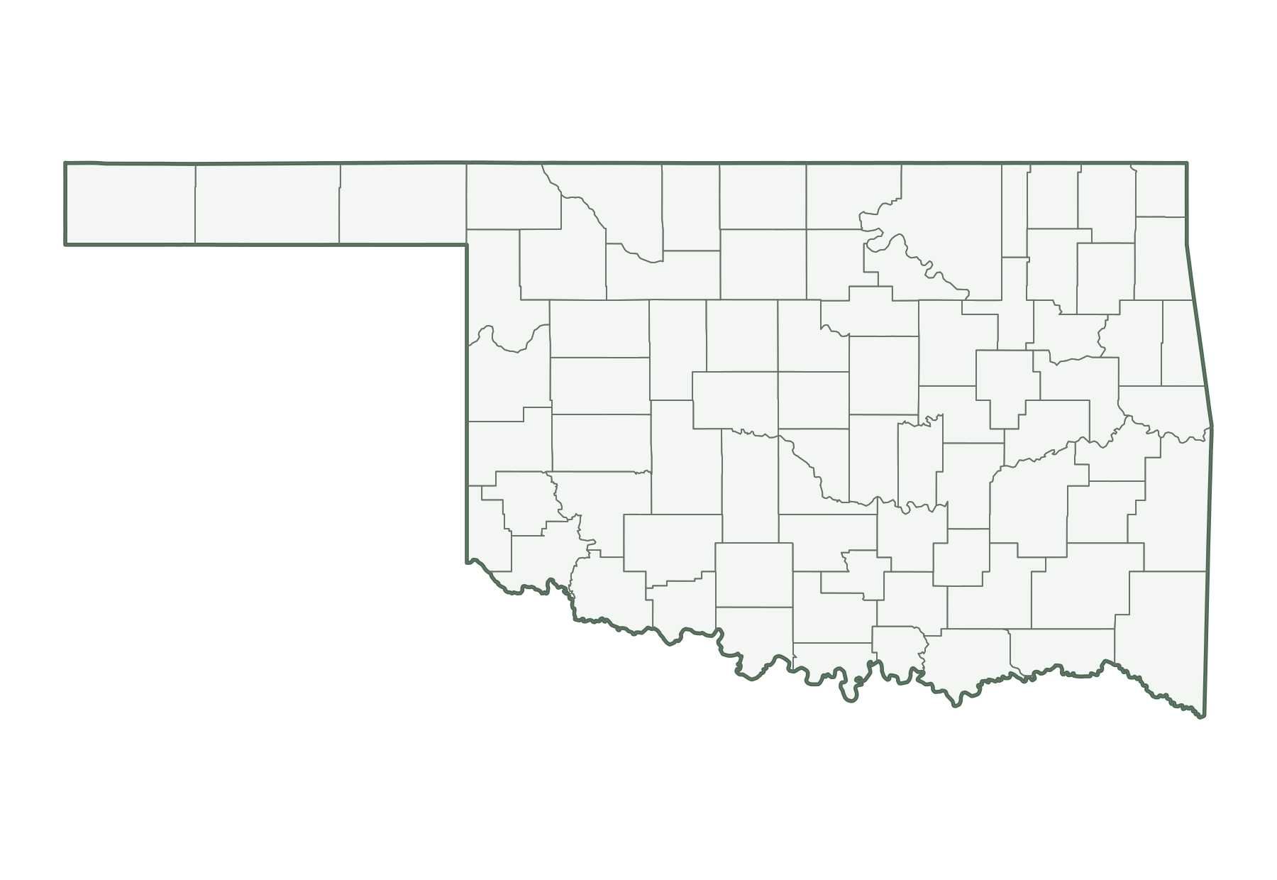
| County map, unlabeled | PNG | SVG | |
| Capital and largest cities | PNG | SVG | |
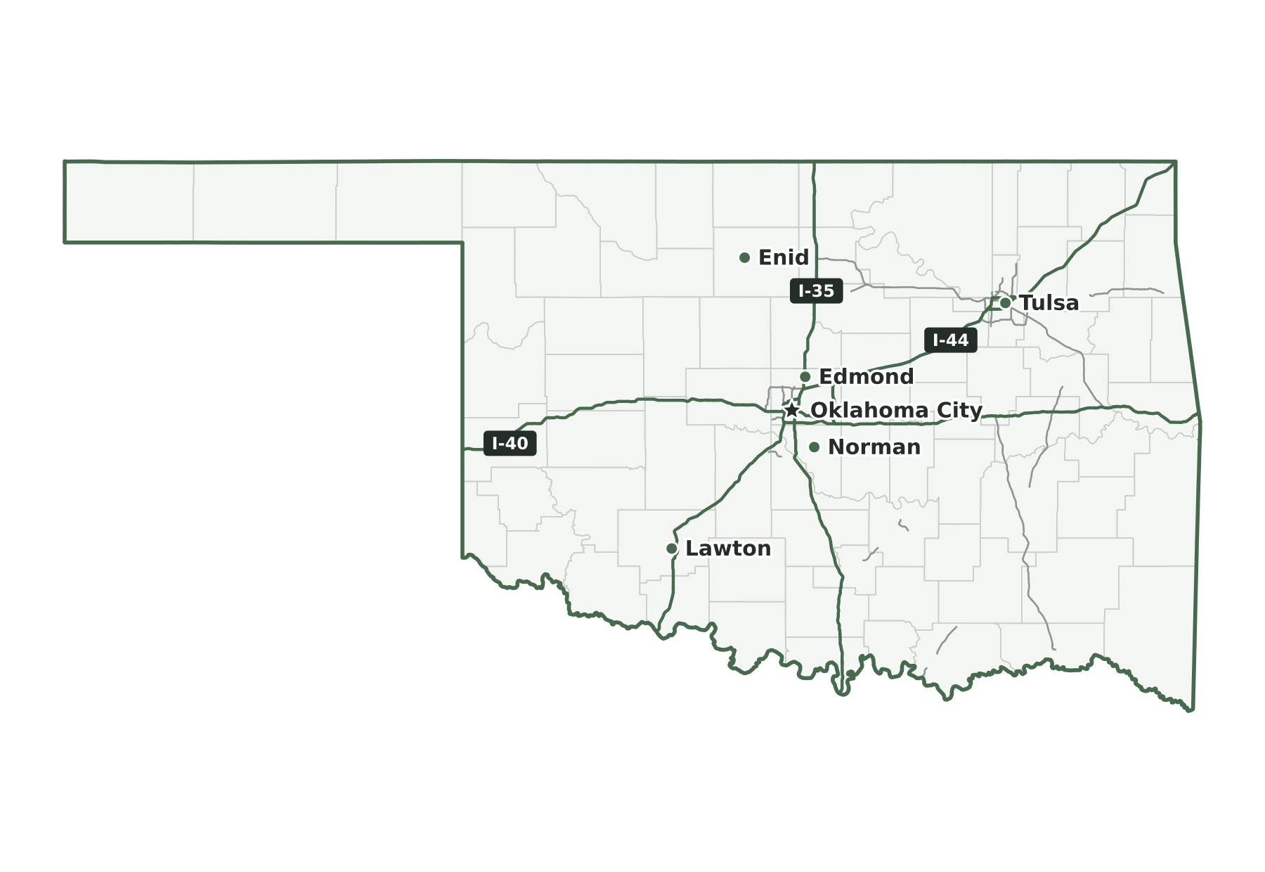
| Interstates and major highways | PNG | SVG | |
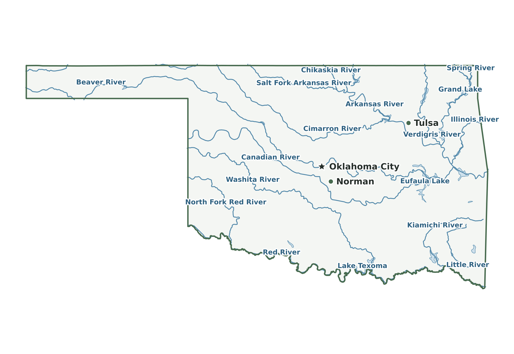
| Rivers and lakes | PNG | SVG | |
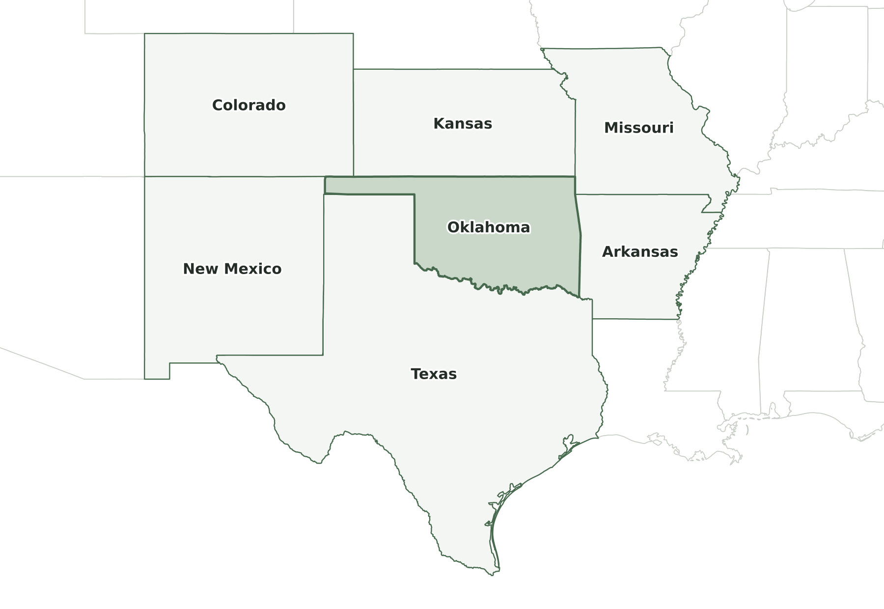
| With bordering states | PNG | SVG | |
| Blank outline | PNG | SVG |
Oklahoma facts
| Capital | Oklahoma City |
|---|---|
| Most populous city | Oklahoma City (719,849) |
| Admitted to the Union | November 16, 1907 (46th state) |
| Population, July 1, 2025 | 4,123,288 (28th of 50) |
| Change since April 2020 | +4.1% (14th of 50 by growth) |
| Land area | 68,597 sq mi (19th largest) |
| Water area | 1,302 sq mi (1.9% of total area) |
| Population density | 60 people per sq mi of land (34th densest) |
| Highest point | Black Mesa, 4,973 ft (23rd highest state high point) |
| Lowest point | Little River, 289 ft |
| Mean elevation | About 1,300 ft |
| Time zone | Central (U.S. time zones) |
| Bordering states | Arkansas, Colorado, Kansas, Missouri, New Mexico, and Texas |
| Main interstates | I-35, I-40, and I-44 |
| County-level divisions | 77 counties |
| Census region and division | South, West South Central |
| Regional groupings | Southwest (sometimes) |
| Postal code and FIPS code | OK · 40 |
Population figures are the Census Bureau’s Vintage 2025 estimates; the change is measured from the April 1, 2020 estimates base. Areas come from the 2025 boundary file and are converted from square meters. Elevations are from the U.S. Geological Survey. Ranks compare the 50 states and exclude Washington, D.C.
Geography of Oklahoma
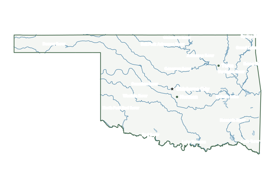
A long, narrow Panhandle projects west between Kansas and Texas, ending near Black Mesa at the far corner, and the land slopes gradually down from there to the eastern border. Four mountain areas interrupt the plains: the Ozarks in the northeast, the Ouachitas in the southeast, the Arbuckles in the south-center, and the Wichitas in the southwest. The Red River marks the southern edge and holds Lake Texoma, at the confluence with the Washita. The Arkansas River flows southeast from the Kansas line, joined by the Cimarron and by the Canadian, whose Lake Eufaula is the state's largest by surface area.
Capital and largest cities
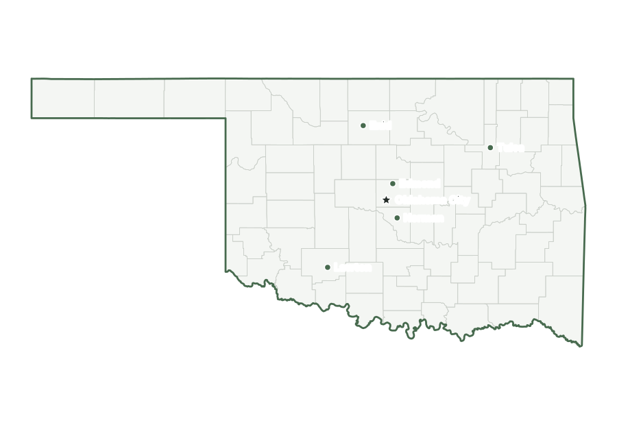
Oklahoma City is both the capital and the most populous city in Oklahoma, with 719,849 residents as of July 1, 2025. The ten largest places together hold 44% of the state’s population.
| Rank | Place | Population 2025 | Change since 2020 |
|---|---|---|---|
| 1 | Oklahoma City (capital) | 719,849 | +5.7% |
| 2 | Tulsa | 416,209 | +0.8% |
| 3 | Norman | 130,943 | +2.3% |
| 4 | Broken Arrow | 124,991 | +10.1% |
| 5 | Edmond | 100,479 | +6.4% |
| 6 | Lawton | 90,503 | +0.1% |
| 7 | Moore | 63,609 | +1.3% |
| 8 | Midwest City | 58,799 | +0.7% |
| 9 | Enid | 50,297 | −1.9% |
| 10 | Stillwater | 50,046 | +3.5% |
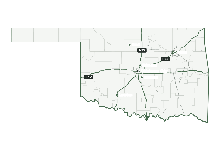
Interstates and major highways
The main interstates in Oklahoma are I-35, I-40, and I-44. Shorter spurs and loops include I-235, I-240, I-244, and I-335.
States that border Oklahoma
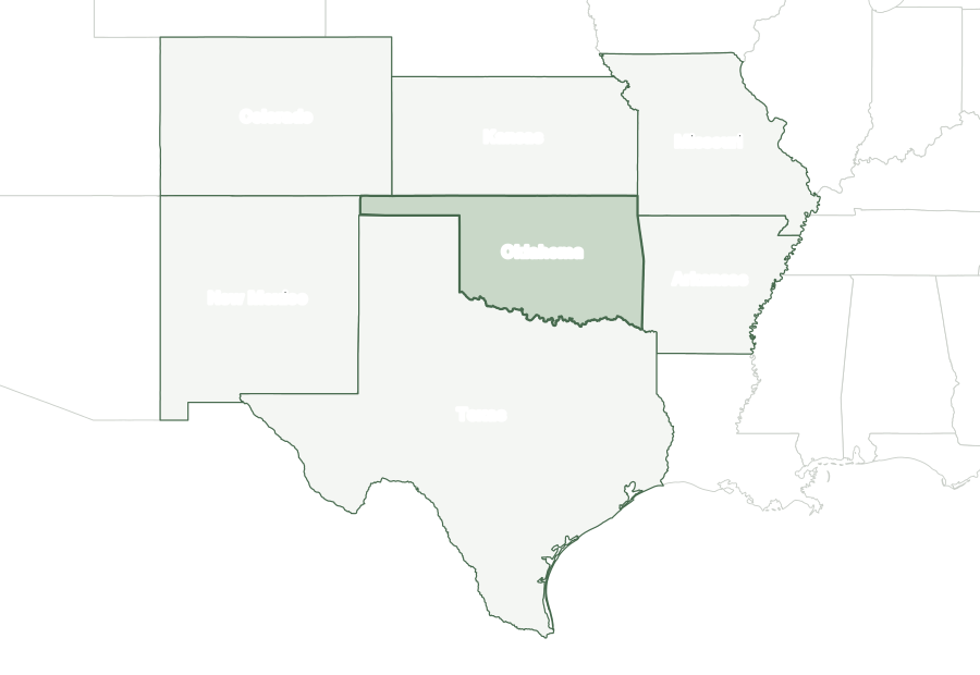
Six states border Oklahoma: Arkansas, Colorado, Kansas, Missouri, New Mexico, and Texas.
Map of Oklahoma and surrounding states
| State | Direction | Shared land boundary |
|---|---|---|
| Kansas | north | about 410 mi |
| Arkansas | east | about 200 mi |
| Missouri | east | about 30 mi |
| Texas | southwest | about 840 mi |
| New Mexico | west | about 30 mi |
| Colorado | northwest | about 50 mi |
How each boundary is drawn
Kansas. The 37th parallel forms the entire line, running west from the Missouri corner near 94°37′ W to the Colorado line.
Arkansas. Two surveyed straight lines meet at Fort Smith on the Arkansas River: one runs south to the Red River and the other runs north, slightly west, to the Missouri corner.
Missouri. A meridian through the mouth of the Kansas River, near 94°37′ W, forms the entire line between the 37th parallel and 36°30′ N.
Texas. The vegetation line on the Red River's south bank, with a separate line through Lake Texoma, reaches the 100th meridian, which runs north to the Panhandle's 36°30' N line.
New Mexico. The Cimarron meridian, established by the General Land Office in 1881 at about 103° W, runs south from the Colorado corner to the Texas line at about 36°30' N.
Colorado. The 37th parallel, as surveyed, forms the entire line, from the New Mexico corner east to the Kansas corner on the meridian 25 degrees west of Washington.
Directions and lengths in the table are our measurements: the direction is the side of Oklahoma along which each shared boundary runs, judged from the center of the state. Lengths are measured along the generalized 1:5,000,000 boundary lines, which smooth out river bends and small jogs, so they run shorter than surveyed lengths. The file is clipped to the shoreline of the oceans, the Great Lakes, and large bays, so boundaries through those waters are not counted.
Counties of Oklahoma
The 2025 county file divides Oklahoma into 77 counties. The largest by land area is Osage County (2,247 sq mi) and the smallest is Marshall County (371 sq mi). Oklahoma County is the most populous, with 822,125 residents, or 20% of the state. Cimarron County has the fewest, with 2,059. Half of Oklahoma’s counties have fewer than 20,322 residents, and 45 of 77 grew between 2020 and 2025.
| Name | Seat | FIPS | Land sq mi | Population 2025 | Change since 2020 |
|---|---|---|---|---|---|
| Adair County | Stilwell | 40001 | 574 | 19,828 | +1.7% |
| Alfalfa County | Cherokee | 40003 | 867 | 5,649 | −1.0% |
| Atoka County | Atoka | 40005 | 975 | 14,609 | +3.3% |
| Beaver County | Beaver | 40007 | 1,815 | 4,882 | −3.3% |
| Beckham County | Sayre | 40009 | 902 | 22,159 | −1.1% |
| Blaine County | Watonga | 40011 | 928 | 8,515 | −2.5% |
| Bryan County | Durant | 40013 | 904 | 51,367 | +11.5% |
| Caddo County | Anadarko | 40015 | 1,278 | 26,130 | −3.0% |
| Canadian County | El Reno | 40017 | 897 | 187,189 | +21.4% |
| Carter County | Ardmore | 40019 | 822 | 48,910 | +1.9% |
| Cherokee County | Tahlequah | 40021 | 749 | 49,196 | +4.5% |
| Choctaw County | Hugo | 40023 | 770 | 14,059 | −1.0% |
| Cimarron County | Boise City | 40025 | 1,835 | 2,059 | −10.1% |
| Cleveland County | Norman | 40027 | 539 | 303,973 | +2.9% |
| Coal County | Coalgate | 40029 | 517 | 5,436 | +3.3% |
| Comanche County | Lawton | 40031 | 1,069 | 122,158 | +0.9% |
| Cotton County | Walters | 40033 | 633 | 5,432 | −1.7% |
| Craig County | Vinita | 40035 | 761 | 14,518 | +2.9% |
| Creek County | Sapulpa | 40037 | 950 | 74,967 | +4.5% |
| Custer County | Arapaho | 40039 | 989 | 28,175 | −1.2% |
| Delaware County | Jay | 40041 | 738 | 41,910 | +3.8% |
| Dewey County | Taloga | 40043 | 1,000 | 4,207 | −6.2% |
| Ellis County | Arnett | 40045 | 1,231 | 3,613 | −3.7% |
| Garfield County | Enid | 40047 | 1,059 | 61,779 | −1.7% |
| Garvin County | Pauls Valley | 40049 | 802 | 26,377 | +2.8% |
| Grady County | Chickasha | 40051 | 1,101 | 59,128 | +7.9% |
| Grant County | Medford | 40053 | 1,001 | 4,067 | −2.6% |
| Greer County | Mangum | 40055 | 639 | 5,373 | −2.2% |
| Harmon County | Hollis | 40057 | 537 | 2,327 | −6.5% |
| Harper County | Buffalo | 40059 | 1,039 | 3,172 | −2.8% |
| Haskell County | Stigler | 40061 | 577 | 11,787 | +1.9% |
| Hughes County | Holdenville | 40063 | 804 | 13,455 | +0.7% |
| Jackson County | Altus | 40065 | 803 | 24,764 | −0.1% |
| Jefferson County | Waurika | 40067 | 759 | 5,431 | +1.9% |
| Johnston County | Tishomingo | 40069 | 643 | 10,448 | +1.7% |
| Kay County | Newkirk | 40071 | 920 | 43,490 | −0.5% |
| Kingfisher County | Kingfisher | 40073 | 898 | 15,795 | +4.0% |
| Kiowa County | Hobart | 40075 | 1,015 | 8,181 | −3.8% |
| Latimer County | Wilburton | 40077 | 722 | 9,645 | +2.2% |
| Le Flore County | Poteau | 40079 | 1,589 | 50,196 | +4.3% |
| Lincoln County | Chandler | 40081 | 952 | 35,278 | +5.4% |
| Logan County | Guthrie | 40083 | 744 | 55,473 | +11.9% |
| Love County | Marietta | 40085 | 514 | 10,780 | +6.3% |
| Major County | Fairview | 40093 | 955 | 7,536 | −3.1% |
| Marshall County | Madill | 40095 | 371 | 16,255 | +6.2% |
| Mayes County | Pryor Creek | 40097 | 655 | 40,416 | +3.5% |
| McClain County | Purcell | 40087 | 571 | 49,647 | +19.1% |
| McCurtain County | Idabel | 40089 | 1,851 | 30,744 | −0.2% |
| McIntosh County | Eufaula | 40091 | 618 | 19,758 | +4.3% |
| Murray County | Sulphur | 40099 | 416 | 13,805 | −0.7% |
| Muskogee County | Muskogee | 40101 | 811 | 66,708 | +0.6% |
| Noble County | Perry | 40103 | 732 | 10,899 | −0.2% |
| Nowata County | Nowata | 40105 | 566 | 9,522 | +2.1% |
| Okfuskee County | Okemah | 40107 | 618 | 11,451 | +1.2% |
| Oklahoma County | Oklahoma City | 40109 | 709 | 822,125 | +3.2% |
| Okmulgee County | Okmulgee | 40111 | 697 | 37,241 | +1.5% |
| Osage County | Pawhuska | 40113 | 2,247 | 46,794 | +2.1% |
| Ottawa County | Miami | 40115 | 471 | 30,438 | +0.5% |
| Pawnee County | Pawnee | 40117 | 568 | 16,029 | +3.1% |
| Payne County | Stillwater | 40119 | 685 | 83,889 | +2.7% |
| Pittsburg County | McAlester | 40121 | 1,306 | 43,320 | −1.0% |
| Pontotoc County | Ada | 40123 | 720 | 38,528 | +1.2% |
| Pottawatomie County | Shawnee | 40125 | 788 | 75,102 | +3.7% |
| Pushmataha County | Antlers | 40127 | 1,396 | 10,807 | −0.0% |
| Roger Mills County | Cheyenne | 40129 | 1,141 | 3,259 | −5.3% |
| Rogers County | Claremore | 40131 | 676 | 102,197 | +7.3% |
| Seminole County | Wewoka | 40133 | 633 | 23,441 | −0.5% |
| Sequoyah County | Sallisaw | 40135 | 674 | 40,842 | +4.0% |
| Stephens County | Duncan | 40137 | 870 | 44,310 | +3.4% |
| Texas County | Guymon | 40139 | 2,041 | 20,322 | −5.0% |
| Tillman County | Frederick | 40141 | 871 | 6,780 | −2.7% |
| Tulsa County | Tulsa | 40143 | 570 | 698,782 | +4.4% |
| Wagoner County | Wagoner | 40145 | 562 | 93,263 | +15.2% |
| Washington County | Bartlesville | 40147 | 416 | 54,037 | +3.0% |
| Washita County | New Cordell | 40149 | 1,003 | 10,884 | −0.3% |
| Woods County | Alva | 40151 | 1,286 | 8,443 | −2.1% |
| Woodward County | Woodward | 40153 | 1,243 | 19,827 | −3.1% |
Geographic extent
In the generalized boundary file, Oklahoma reaches from 33.62° N to 37.00° N and from 103.00° W to 94.43° W. That is about 234 miles north to south and 482 miles east to west at its central latitude. The center of its mapped area falls at 35.58° N, 97.51° W, nearest to The Village among Census-listed places. We calculated this center from the outline; it is not an official geographic-center marker.
Frequently asked questions
How many states border Oklahoma?
Six: Arkansas, Colorado, Kansas, Missouri, New Mexico, and Texas. See the map of Oklahoma and surrounding states.
How many counties does Oklahoma have?
Oklahoma has 77 counties. Oklahoma County has the most residents and Osage County the most land; the county table lists them all.
What is the capital of Oklahoma, and what is its largest city?
Oklahoma City is both the capital and the largest city. The cities section lists the ten most populous places.
How big is Oklahoma?
In the Census Bureau’s 2025 boundary file, Oklahoma covers 69,899 square miles: 68,597 of land and 1,302 of water. That makes it the 21st largest state by total area and the 19th largest by land area.
What time zone is Oklahoma in?
All of Oklahoma is legally in Central Time, but Kenton, in the far northwest corner of the Panhandle, informally keeps Mountain Time.
What is the highest point in Oklahoma?
The highest point is Black Mesa, at 4,973 feet, the 23rd highest of the 50 state high points. The lowest point is the Little River, at 289 feet.
Sources and use
Boundaries: U.S. Census Bureau, 2025 Cartographic Boundary Files, 1:5,000,000 scale, generalized for display. Population: Census Bureau Vintage 2025 estimates. City positions: the 2025 Census Gazetteer. Roads: 2025 TIGER/Line primary roads. Rivers and lakes: Natural Earth. County seats: Wikidata, checked against Wikipedia’s county lists. The maps are for reference, teaching, and ordinary printing, not for property lines, precincts, or navigation. When you share a map, keep the source line with it. The printing guide covers paper size and attribution.