
Map of South Dakota
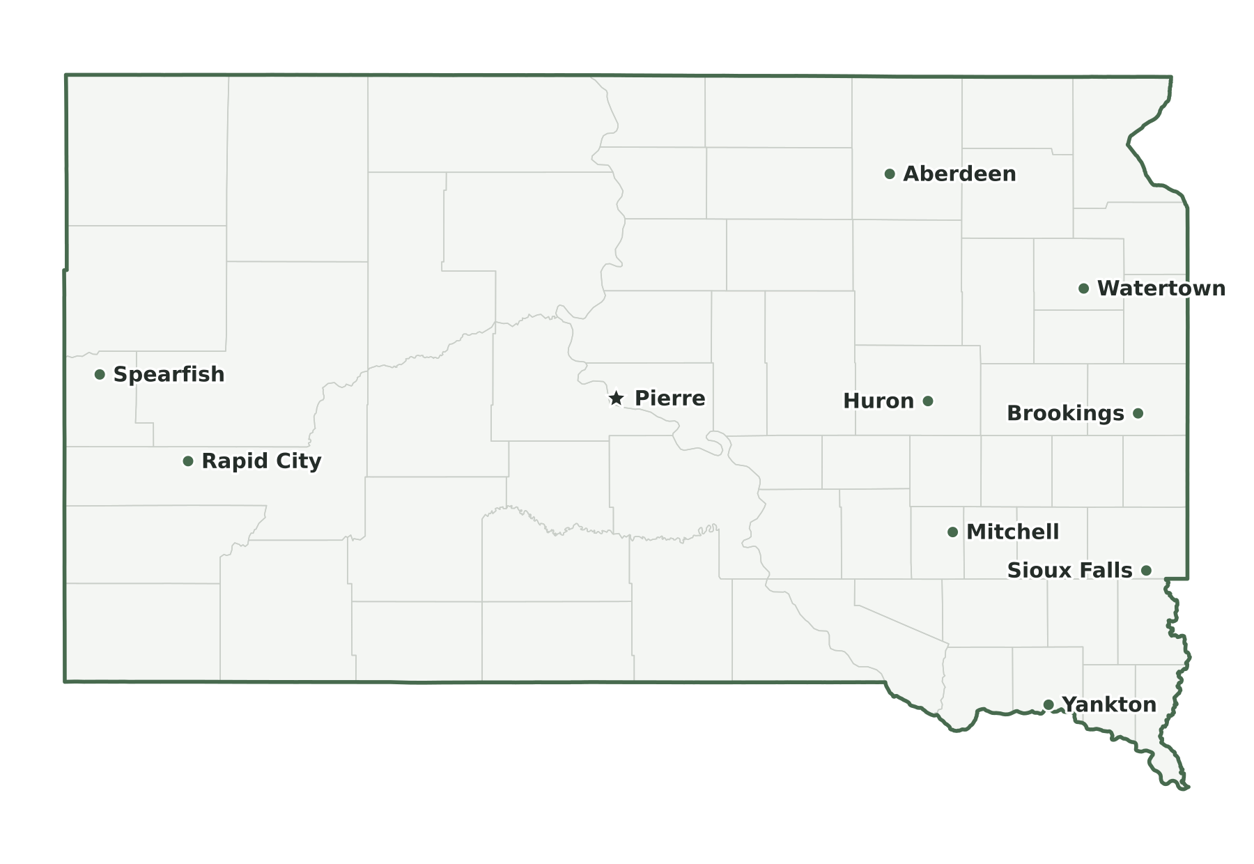
South Dakota is a West North Central state in the Census Bureau’s Midwest region, with 935,094 residents in the July 1, 2025 estimate (46th of 50) and 75,808 square miles of land (16th largest). Its capital is Pierre; its most populous city is Sioux Falls. The map below shows its 66 counties.
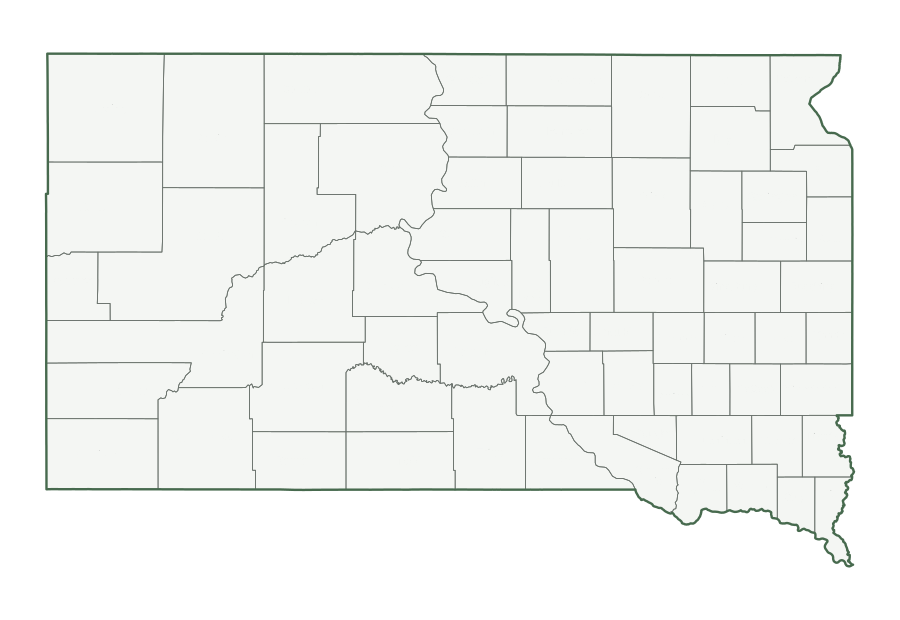
| Map | PDF for printing | Image | Vector |
|---|---|---|---|
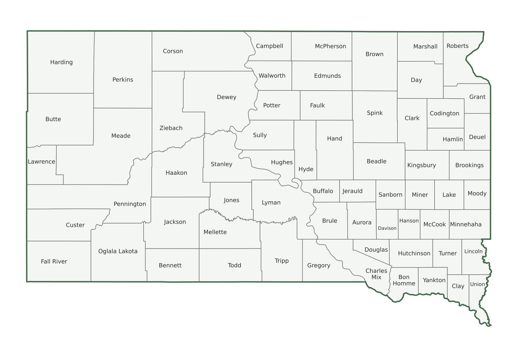
| County map with names | PNG | SVG | |
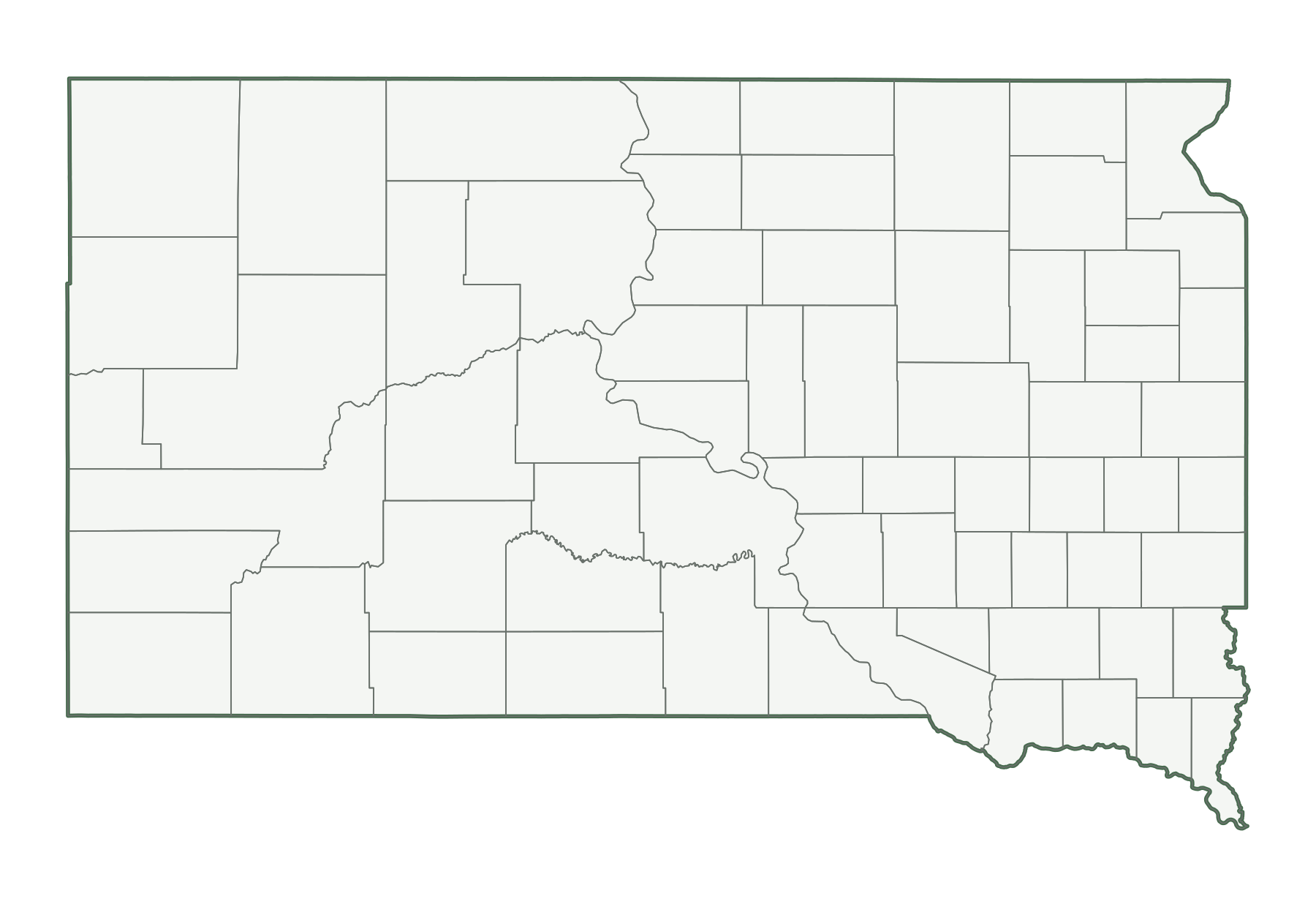
| County map, unlabeled | PNG | SVG | |
| Capital and largest cities | PNG | SVG | |
| Interstates and major highways | PNG | SVG | |
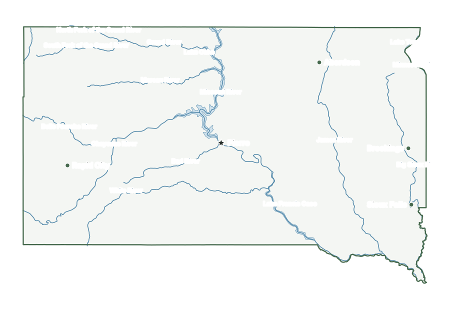
| Rivers and lakes | PNG | SVG | |
| With bordering states | PNG | SVG | |
| Blank outline | PNG | SVG |
South Dakota facts
| Capital | Pierre |
|---|---|
| Most populous city | Sioux Falls (213,748) |
| Admitted to the Union | November 2, 1889 (40th state) |
| Population, July 1, 2025 | 935,094 (46th of 50) |
| Change since April 2020 | +5.5% (13th of 50 by growth) |
| Land area | 75,808 sq mi (16th largest) |
| Water area | 1,308 sq mi (1.7% of total area) |
| Population density | 12 people per sq mi of land (46th densest) |
| Highest point | Black Elk Peak, 7,242 ft (15th highest state high point) |
| Lowest point | Big Stone Lake, 966 ft |
| Mean elevation | About 2,200 ft |
| Time zones | Central and Mountain (U.S. time zones) |
| Bordering states | Iowa, Minnesota, Montana, Nebraska, North Dakota, and Wyoming |
| Main interstates | I-29 and I-90 |
| County-level divisions | 66 counties |
| Census region and division | Midwest, West North Central |
| Postal code and FIPS code | SD · 46 |
Population figures are the Census Bureau’s Vintage 2025 estimates; the change is measured from the April 1, 2020 estimates base. Areas come from the 2025 boundary file and are converted from square meters. Elevations are from the U.S. Geological Survey. Ranks compare the 50 states and exclude Washington, D.C.
Geography of South Dakota
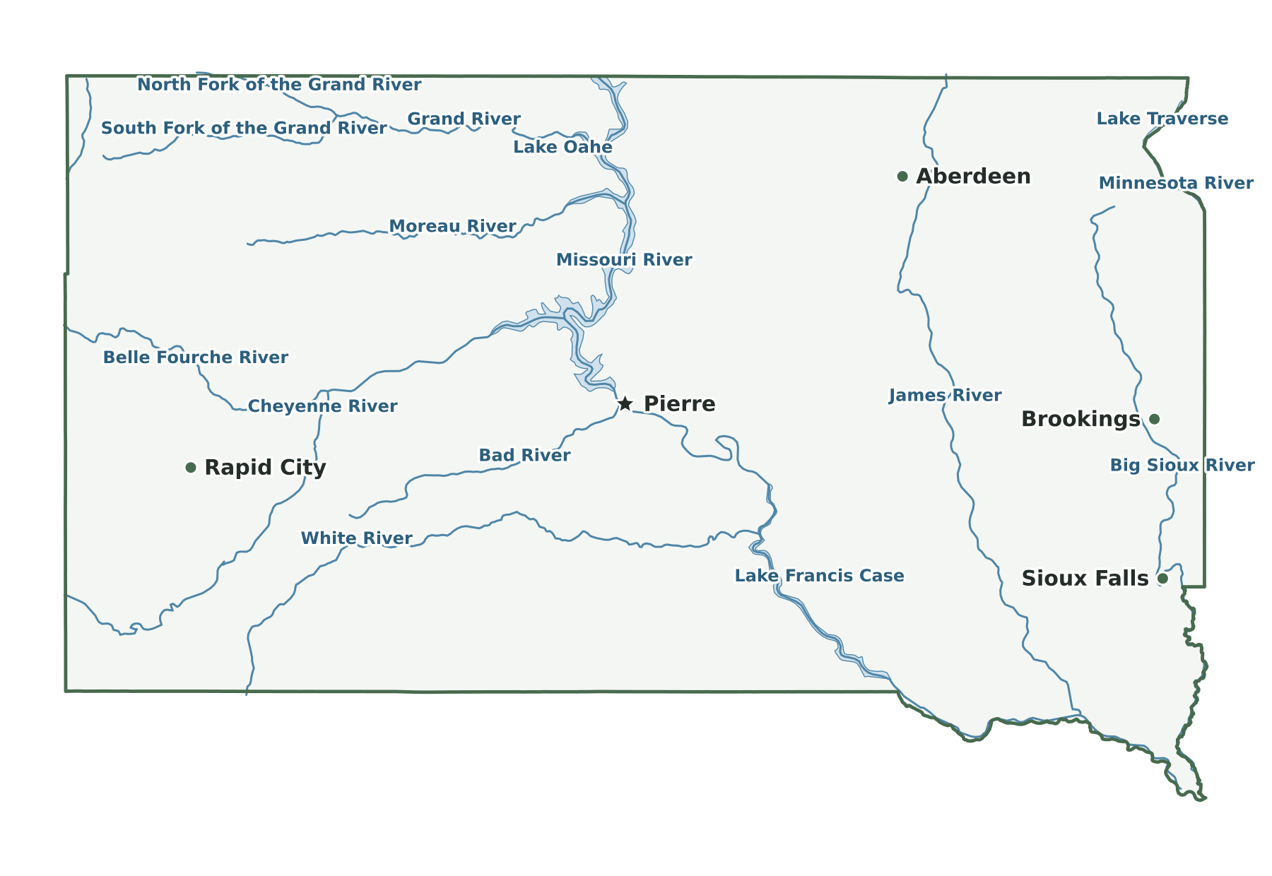
The Missouri River divides South Dakota into two regions, known locally as East River and West River. East River is lower and wetter, with the Coteau des Prairies along the Minnesota line, drained largely by the Big Sioux River, and the James River Basin to the west of it. West River is higher and drier, with the Badlands in the southwest and the Black Hills, including Black Elk Peak, in the southwestern corner. Dams on the Missouri create Lake Oahe, Lake Sharpe, Lake Francis Case and Lewis and Clark Lake. Big Stone Lake and Lake Traverse mark the northeastern border.
Capital and largest cities
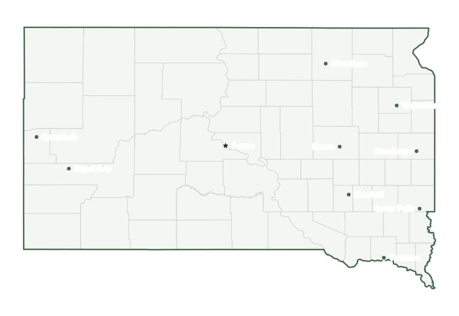
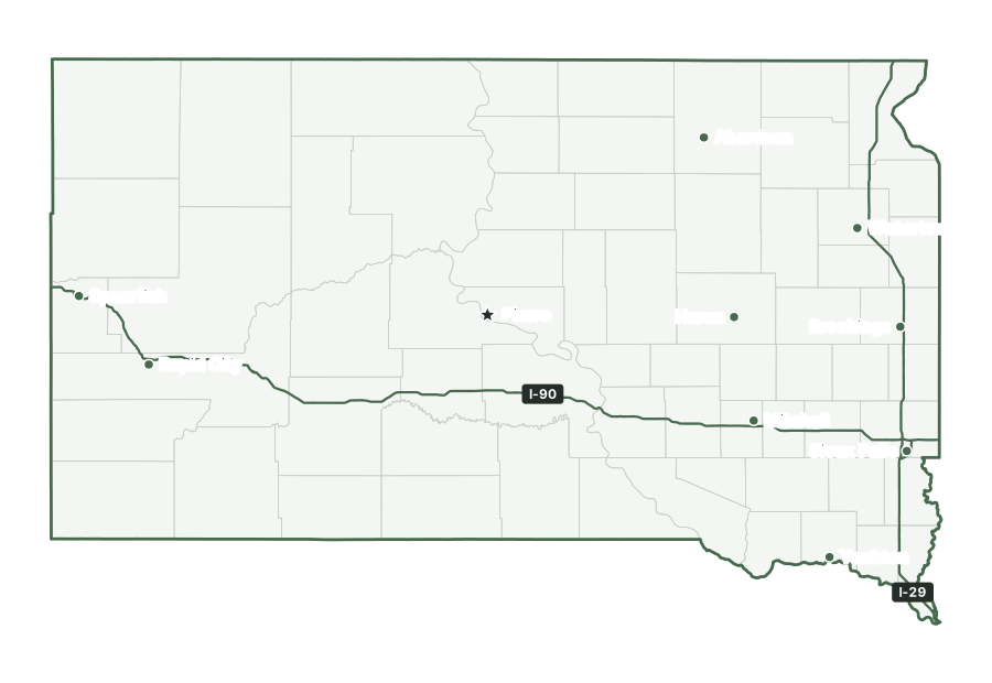
Pierre, the capital, is not among the ten most populous places in South Dakota; it had 13,848 residents as of July 1, 2025. Sioux Falls is the largest, with 213,748 residents. The ten largest places together hold 48% of the state’s population.
| Rank | Place | Population 2025 | Change since 2020 |
|---|---|---|---|
| 1 | Sioux Falls | 213,748 | +10.9% |
| 2 | Rapid City | 80,589 | +7.8% |
| 3 | Aberdeen | 27,961 | −1.8% |
| 4 | Brookings | 25,355 | +8.5% |
| 5 | Watertown | 23,736 | +4.8% |
| 6 | Yankton | 15,816 | +2.4% |
| 7 | Mitchell | 15,756 | +0.5% |
| 8 | Huron | 14,607 | +2.5% |
| 9 | Spearfish | 14,154 | +15.9% |
| 10 | Box Elder | 13,936 | +17.6% |
Interstates and major highways
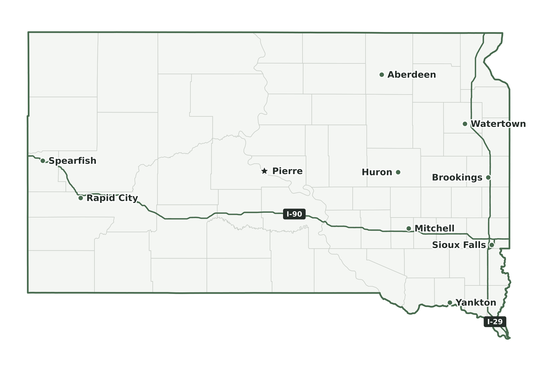
The main interstates in South Dakota are I-29 and I-90. Shorter spurs and loops include I-229.
States that border South Dakota
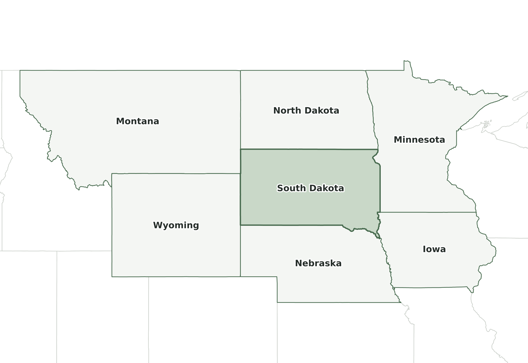
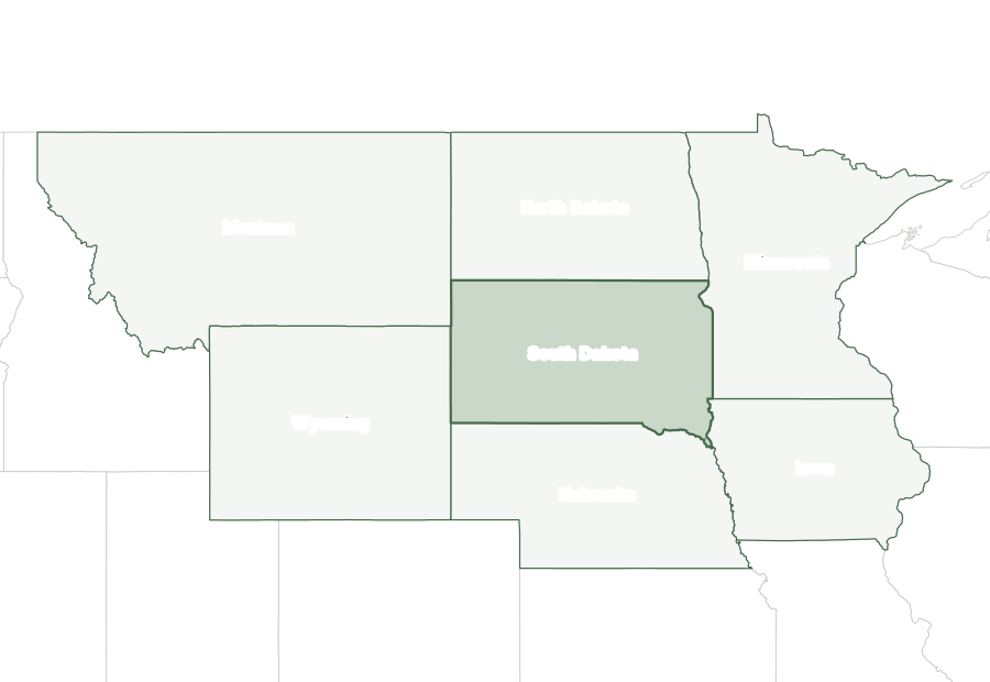
Six states border South Dakota: Iowa, Minnesota, Montana, Nebraska, North Dakota, and Wyoming.
Map of South Dakota and surrounding states
| State | Direction | Shared land boundary |
|---|---|---|
| North Dakota | north | about 360 mi |
| Iowa | east | about 110 mi |
| Minnesota | east | about 180 mi |
| Nebraska | south | about 420 mi |
| Montana | west | about 70 mi |
| Wyoming | west | about 140 mi |
How each boundary is drawn
North Dakota. The seventh standard parallel of the public-land survey, near 45°56′ N, forms the line from the Bois de Sioux River west to Montana.
Iowa. The Big Sioux River forms the line north from the Missouri River to the parallel of 43°30′ N, which continues it east to the Minnesota corner.
Minnesota. From the Bois de Sioux River the line passes through Lake Traverse and Big Stone Lake, then runs due south from the Big Stone outlet to the Iowa line.
Nebraska. The 43rd parallel runs east from Wyoming to the Missouri River, and the main channel of the Missouri continues the line downstream to the Iowa corner.
Montana. A single meridian, 27 degrees west of Washington and about 104°03' W, forms the line, from the North Dakota corner south to the Wyoming corner on the 45th parallel.
Wyoming. The 27th meridian west of Washington, near 104°03′ W, forms the line between the 43rd and 45th parallels.
Directions and lengths in the table are our measurements: the direction is the side of South Dakota along which each shared boundary runs, judged from the center of the state. Lengths are measured along the generalized 1:5,000,000 boundary lines, which smooth out river bends and small jogs, so they run shorter than surveyed lengths. The file is clipped to the shoreline of the oceans, the Great Lakes, and large bays, so boundaries through those waters are not counted.
Counties of South Dakota
The 2025 county file divides South Dakota into 66 counties. The largest by land area is Meade County (3,471 sq mi) and the smallest is Clay County (412 sq mi). Minnehaha County is the most populous, with 212,691 residents, or 23% of the state. Jones County has the fewest, with 913. Half of South Dakota’s counties have fewer than 5,352 residents, and 40 of 66 grew between 2020 and 2025.
| Name | Seat | FIPS | Land sq mi | Population 2025 | Change since 2020 |
|---|---|---|---|---|---|
| Aurora County | Plankinton | 46003 | 708 | 2,801 | +2.1% |
| Beadle County | Huron | 46005 | 1,259 | 19,624 | +2.5% |
| Bennett County | Martin | 46007 | 1,185 | 3,307 | −2.2% |
| Bon Homme County | Tyndall | 46009 | 564 | 7,244 | +3.5% |
| Brookings County | Brookings | 46011 | 792 | 37,635 | +9.5% |
| Brown County | Aberdeen | 46013 | 1,713 | 37,561 | −1.9% |
| Brule County | Chamberlain | 46015 | 817 | 5,278 | +0.5% |
| Buffalo County | Gann Valley | 46017 | 471 | 1,802 | −7.3% |
| Butte County | Belle Fourche | 46019 | 2,250 | 10,856 | +6.0% |
| Campbell County | Mound City | 46021 | 734 | 1,377 | +0.1% |
| Charles Mix County | Lake Andes | 46023 | 1,097 | 9,303 | −0.8% |
| Clark County | Clark | 46025 | 958 | 4,031 | +5.1% |
| Clay County | Vermillion | 46027 | 412 | 15,031 | +0.4% |
| Codington County | Watertown | 46029 | 688 | 29,562 | +4.4% |
| Corson County | McIntosh | 46031 | 2,470 | 3,781 | −3.0% |
| Custer County | Custer | 46033 | 1,557 | 9,431 | +13.4% |
| Davison County | Mitchell | 46035 | 436 | 20,069 | +0.6% |
| Day County | Webster | 46037 | 1,028 | 5,484 | +0.6% |
| Deuel County | Clear Lake | 46039 | 623 | 4,408 | +2.6% |
| Dewey County | Timber Lake | 46041 | 2,302 | 5,419 | +3.3% |
| Douglas County | Armour | 46043 | 432 | 2,888 | +1.9% |
| Edmunds County | Ipswich | 46045 | 1,126 | 4,022 | +1.0% |
| Fall River County | Hot Springs | 46047 | 1,740 | 7,467 | +7.2% |
| Faulk County | Faulkton | 46049 | 982 | 2,178 | +2.4% |
| Grant County | Milbank | 46051 | 681 | 7,534 | −0.4% |
| Gregory County | Burke | 46053 | 1,015 | 4,037 | +1.3% |
| Haakon County | Philip | 46055 | 1,811 | 1,802 | −3.9% |
| Hamlin County | Hayti | 46057 | 507 | 6,900 | +11.8% |
| Hand County | Miller | 46059 | 1,437 | 3,121 | −0.8% |
| Hanson County | Alexandria | 46061 | 435 | 3,456 | −0.2% |
| Harding County | Buffalo | 46063 | 2,672 | 1,331 | +2.0% |
| Hughes County | Pierre | 46065 | 742 | 17,570 | −1.1% |
| Hutchinson County | Olivet | 46067 | 813 | 7,413 | −0.2% |
| Hyde County | Highmore | 46069 | 861 | 1,191 | −5.4% |
| Jackson County | Kadoka | 46071 | 1,864 | 2,666 | −4.9% |
| Jerauld County | Wessington Springs | 46073 | 526 | 1,654 | −0.4% |
| Jones County | Murdo | 46075 | 970 | 913 | −0.8% |
| Kingsbury County | De Smet | 46077 | 832 | 5,284 | +2.0% |
| Lake County | Madison | 46079 | 563 | 10,993 | −0.6% |
| Lawrence County | Deadwood | 46081 | 800 | 29,459 | +14.3% |
| Lincoln County | Canton | 46083 | 577 | 77,145 | +18.4% |
| Lyman County | Kennebec | 46085 | 1,642 | 3,694 | −0.5% |
| Marshall County | Britton | 46091 | 838 | 4,426 | +2.8% |
| McCook County | Salem | 46087 | 574 | 5,964 | +5.0% |
| McPherson County | Leola | 46089 | 1,137 | 2,347 | −2.5% |
| Meade County | Sturgis | 46093 | 3,471 | 30,711 | +2.9% |
| Mellette County | White River | 46095 | 1,307 | 2,137 | +11.4% |
| Miner County | Howard | 46097 | 570 | 2,281 | −0.7% |
| Minnehaha County | Sioux Falls | 46099 | 807 | 212,691 | +7.9% |
| Moody County | Flandreau | 46101 | 519 | 6,632 | +4.6% |
| Oglala Lakota County | — | 46102 | 2,094 | 13,338 | −2.5% |
| Pennington County | Rapid City | 46103 | 2,777 | 116,792 | +6.9% |
| Perkins County | Bison | 46105 | 2,870 | 2,853 | +0.8% |
| Potter County | Gettysburg | 46107 | 861 | 2,377 | −3.9% |
| Roberts County | Sisseton | 46109 | 1,101 | 10,255 | −0.3% |
| Sanborn County | Woonsocket | 46111 | 569 | 2,388 | +2.3% |
| Spink County | Redfield | 46115 | 1,503 | 6,155 | −3.2% |
| Stanley County | Fort Pierre | 46117 | 1,444 | 3,018 | +1.3% |
| Sully County | Onida | 46119 | 1,007 | 1,479 | +2.2% |
| Todd County | — | 46121 | 1,389 | 8,863 | −4.9% |
| Tripp County | Winner | 46123 | 1,612 | 5,708 | +1.4% |
| Turner County | Parker | 46125 | 617 | 9,314 | +7.4% |
| Union County | Elk Point | 46127 | 461 | 17,402 | +3.5% |
| Walworth County | Selby | 46129 | 707 | 5,217 | −1.9% |
| Yankton County | Yankton | 46135 | 521 | 23,635 | +1.4% |
| Ziebach County | Dupree | 46137 | 1,961 | 2,389 | −1.0% |
Geographic extent
In the generalized boundary file, South Dakota reaches from 42.48° N to 45.95° N and from 104.06° W to 96.44° W. That is about 239 miles north to south and 376 miles east to west at its central latitude. The center of its mapped area falls at 44.44° N, 100.23° W, nearest to Oahe Acres among Census-listed places. We calculated this center from the outline; it is not an official geographic-center marker.
Frequently asked questions
How many states border South Dakota?
Six: Iowa, Minnesota, Montana, Nebraska, North Dakota, and Wyoming. See the map of South Dakota and surrounding states.
How many counties does South Dakota have?
South Dakota has 66 counties. Minnehaha County has the most residents and Meade County the most land; the county table lists them all.
What is the capital of South Dakota, and what is its largest city?
The capital is Pierre; the largest city is Sioux Falls. The cities section lists the ten most populous places.
How big is South Dakota?
In the Census Bureau’s 2025 boundary file, South Dakota covers 77,116 square miles: 75,808 of land and 1,308 of water. That makes it the 17th largest state by total area and the 16th largest by land area.
What time zone is South Dakota in?
South Dakota is split between the Central and Mountain time zones. The area west of the Missouri River above Pierre and west of the western lines of Jones, Mellette and Todd counties farther south is in the Mountain zone; the rest of the state is in the Central zone.
What is the highest point in South Dakota?
The highest point is Black Elk Peak, at 7,242 feet, the 15th highest of the 50 state high points. The lowest point is Big Stone Lake, at 966 feet.
Sources and use
Boundaries: U.S. Census Bureau, 2025 Cartographic Boundary Files, 1:5,000,000 scale, generalized for display. Population: Census Bureau Vintage 2025 estimates. City positions: the 2025 Census Gazetteer. Roads: 2025 TIGER/Line primary roads. Rivers and lakes: Natural Earth. County seats: Wikidata, checked against Wikipedia’s county lists. The maps are for reference, teaching, and ordinary printing, not for property lines, precincts, or navigation. When you share a map, keep the source line with it. The printing guide covers paper size and attribution.