
Map of North Dakota
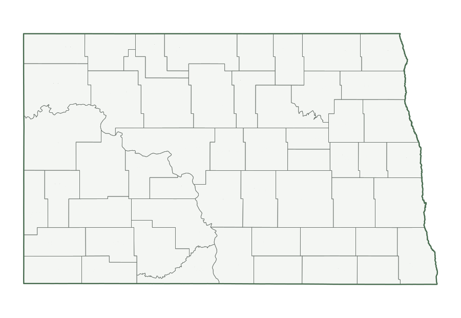
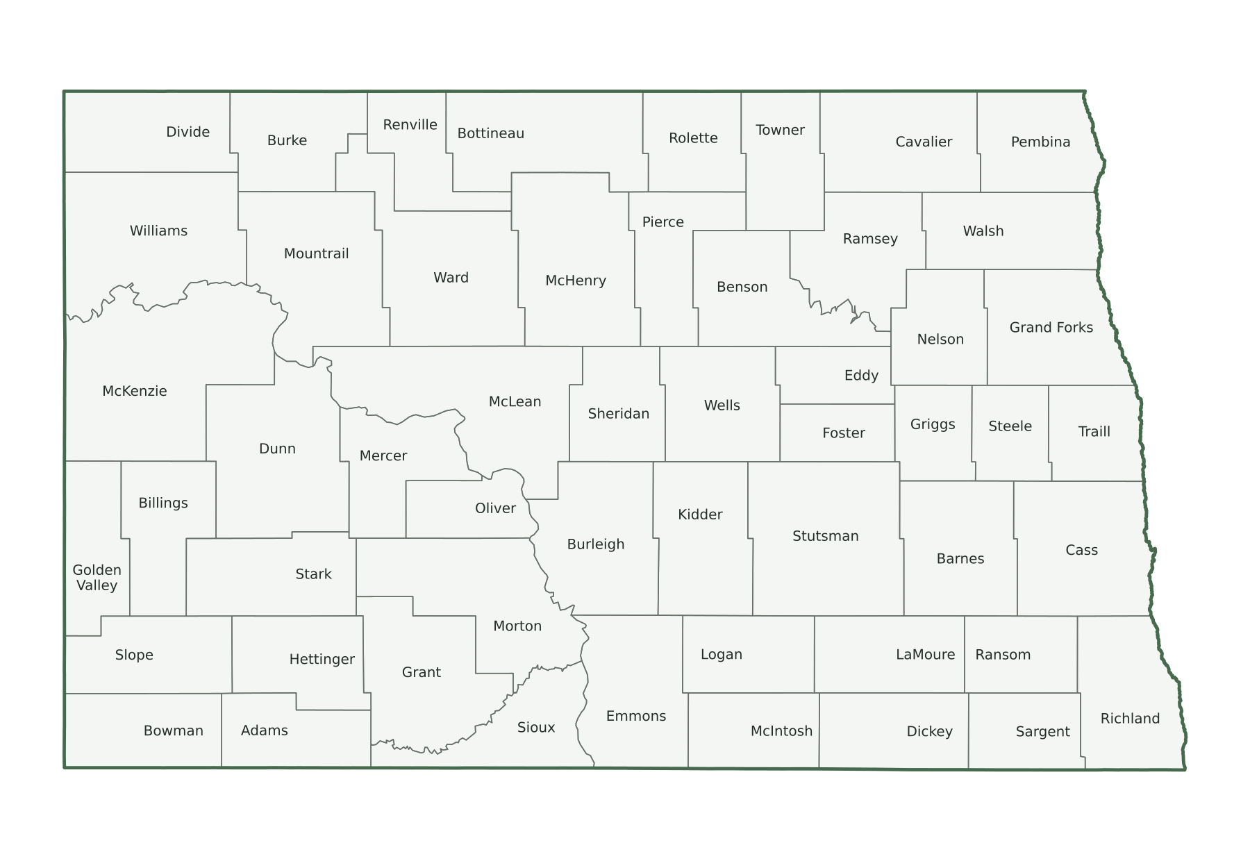
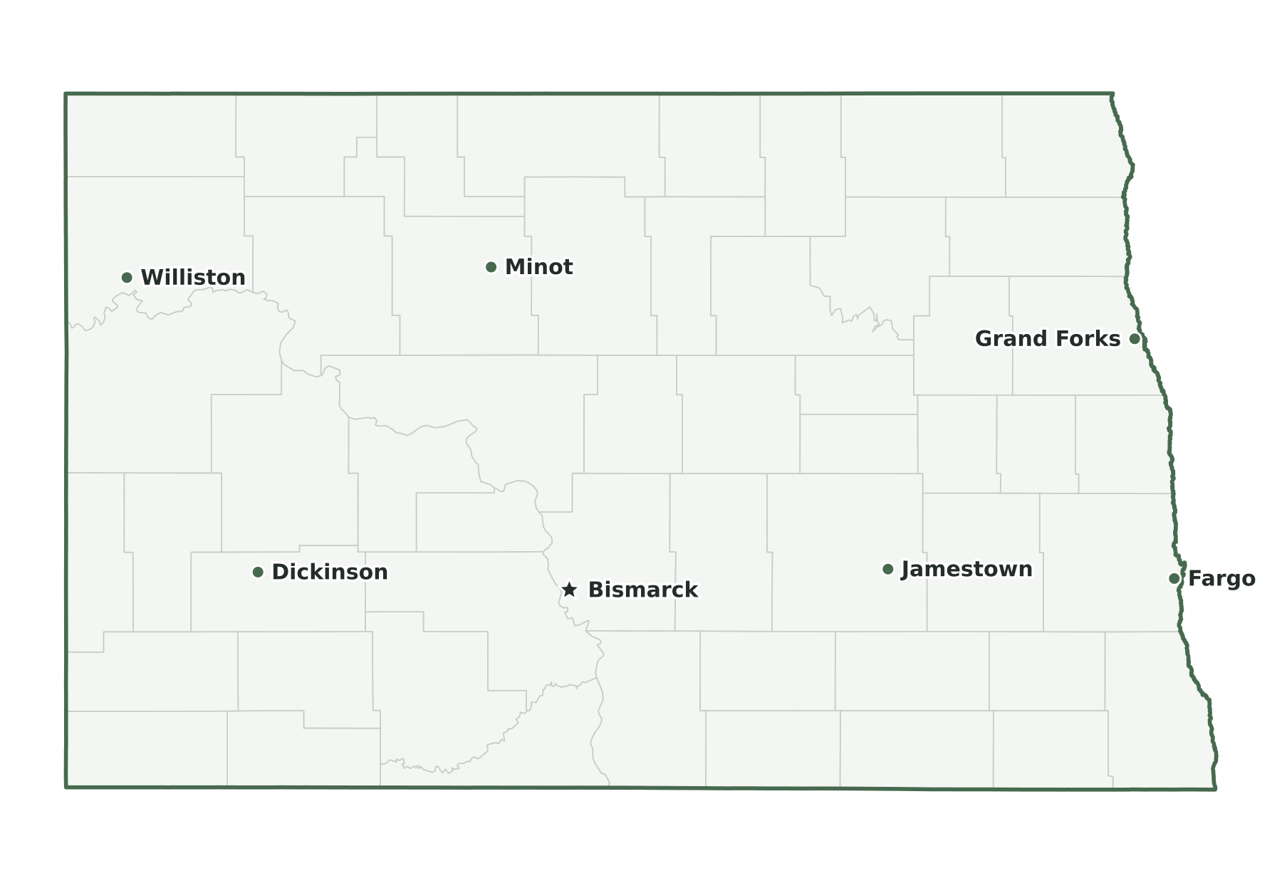
North Dakota is a West North Central state in the Census Bureau’s Midwest region, with 799,358 residents in the July 1, 2025 estimate (47th of 50) and 68,994 square miles of land (17th largest). Its capital is Bismarck; its most populous city is Fargo. The map below shows its 53 counties.
| Map | PDF for printing | Image | Vector |
|---|---|---|---|
| County map with names | PNG | SVG | |
| County map, unlabeled | PNG | SVG | |
| Capital and largest cities | PNG | SVG | |
| Interstates and major highways | PNG | SVG | |
| Rivers and lakes | PNG | SVG | |
| With bordering states | PNG | SVG | |
| Blank outline | PNG | SVG |
North Dakota facts
| Capital | Bismarck |
|---|---|
| Most populous city | Fargo (136,275) |
| Admitted to the Union | November 2, 1889 (39th state) |
| Population, July 1, 2025 | 799,358 (47th of 50) |
| Change since April 2020 | +2.6% (25th of 50 by growth) |
| Land area | 68,994 sq mi (17th largest) |
| Water area | 1,705 sq mi (2.4% of total area) |
| Population density | 12 people per sq mi of land (47th densest) |
| Highest point | White Butte, 3,506 ft (30th highest state high point) |
| Lowest point | Red River of the North, 750 ft |
| Mean elevation | About 1,900 ft |
| Time zones | Central and Mountain (U.S. time zones) |
| Bordering states | Minnesota, Montana, and South Dakota |
| Main interstates | I-29 and I-94 |
| County-level divisions | 53 counties |
| Census region and division | Midwest, West North Central |
| Postal code and FIPS code | ND · 38 |
Population figures are the Census Bureau’s Vintage 2025 estimates; the change is measured from the April 1, 2020 estimates base. Areas come from the 2025 boundary file and are converted from square meters. Elevations are from the U.S. Geological Survey. Ranks compare the 50 states and exclude Washington, D.C.
Geography of North Dakota
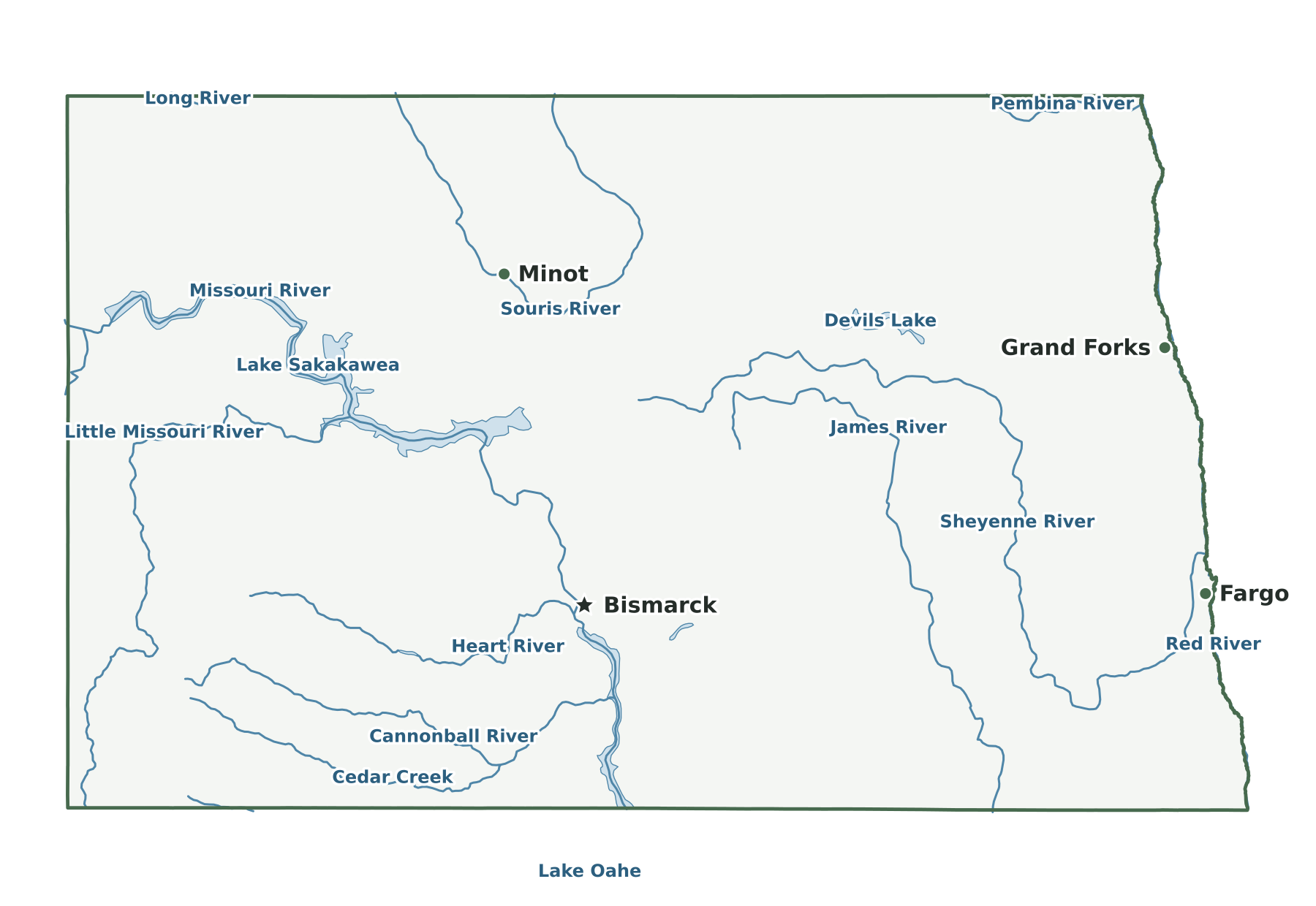
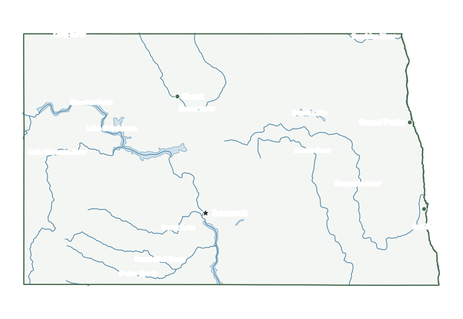
Flat lakebed of glacial Lake Agassiz forms the Red River Valley along the Minnesota line, where the Red River flows north to Manitoba. West of it the Drift Prairie rises, bounded on the north by the Turtle Mountains and holding Devils Lake, the largest natural lake, in the northeast. Beyond lies the Missouri Plateau, crossed by the Missouri River, whose Garrison Dam impounds Lake Sakakawea. In the southwest the Great Plains give way to the Badlands along the Little Missouri River, which flows north through Theodore Roosevelt National Park. White Butte, the high point, stands in Slope County.
Capital and largest cities
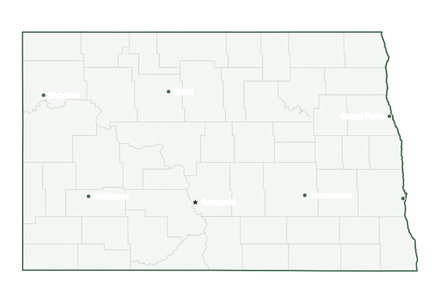
Bismarck, the capital, ranks 2nd among North Dakota’s incorporated places by population. Fargo is the largest, with 136,275 residents as of July 1, 2025. The ten largest places together hold 58% of the state’s population.
| Rank | Place | Population 2025 | Change since 2020 |
|---|---|---|---|
| 1 | Fargo | 136,275 | +8.2% |
| 2 | Bismarck (capital) | 77,963 | +5.9% |
| 3 | Grand Forks | 60,365 | +2.0% |
| 4 | Minot | 47,308 | −2.2% |
| 5 | West Fargo | 41,175 | +6.6% |
| 6 | Williston | 29,522 | +1.3% |
| 7 | Dickinson | 25,870 | +0.8% |
| 8 | Mandan | 25,061 | +3.6% |
| 9 | Jamestown | 15,688 | −1.0% |
| 10 | Wahpeton | 8,141 | +1.6% |
Interstates and major highways
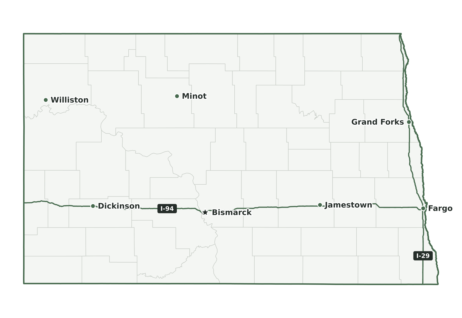
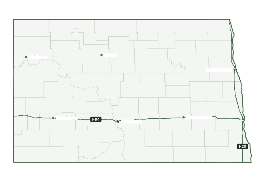
The interstates in North Dakota are I-29 and I-94.
States that border North Dakota
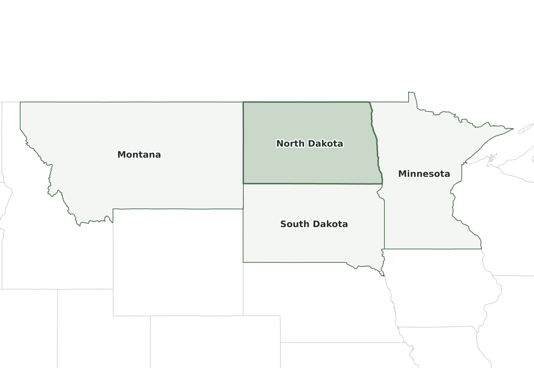
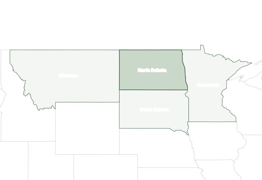
Three states border North Dakota: Minnesota, Montana, and South Dakota. It shares an international boundary with Canada.
Map of North Dakota and surrounding states
| State | Direction | Shared land boundary |
|---|---|---|
| Minnesota | east | about 260 mi |
| South Dakota | south | about 360 mi |
| Montana | west | about 210 mi |
How each boundary is drawn
Minnesota. The Red River of the North forms the line south from Canada to Wahpeton and Breckenridge, and the Bois de Sioux River continues it to the South Dakota line.
South Dakota. The seventh standard parallel of the public-land survey, near 45°56′ N, forms the line from the Bois de Sioux River west to Montana.
Montana. The meridian 27 degrees west of Washington, about 104°03' W, forms the entire line, running south from the Canadian border to the South Dakota corner.
Directions and lengths in the table are our measurements: the direction is the side of North Dakota along which each shared boundary runs, judged from the center of the state. Lengths are measured along the generalized 1:5,000,000 boundary lines, which smooth out river bends and small jogs, so they run shorter than surveyed lengths. The file is clipped to the shoreline of the oceans, the Great Lakes, and large bays, so boundaries through those waters are not counted.
Counties of North Dakota
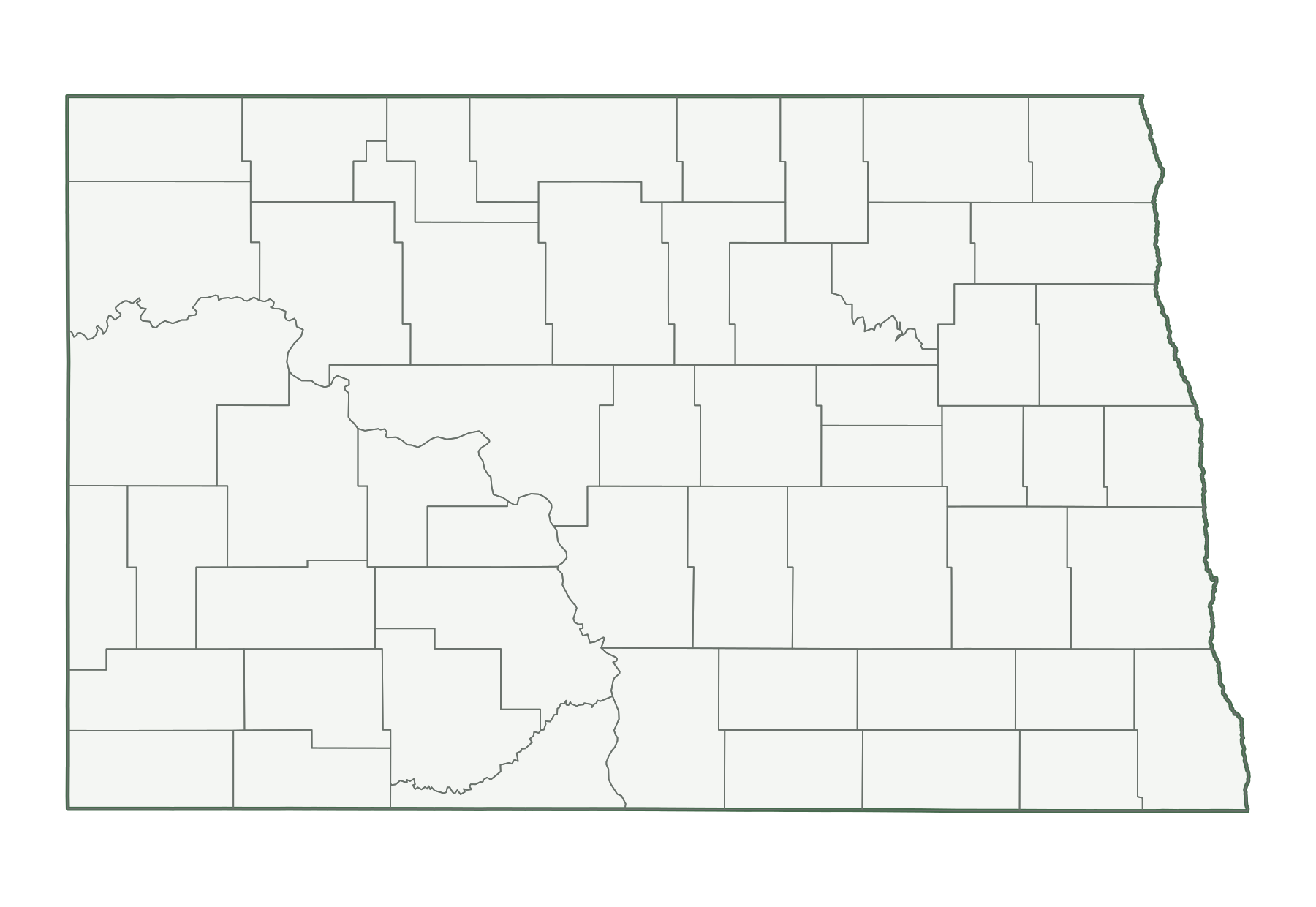
The 2025 county file divides North Dakota into 53 counties. The largest by land area is McKenzie County (2,760 sq mi) and the smallest is Eddy County (630 sq mi). Cass County is the most populous, with 201,794 residents, or 25% of the state. Slope County has the fewest, with 628. Half of North Dakota’s counties have fewer than 3,838 residents, and 17 of 53 grew between 2020 and 2025.
| Name | Seat | FIPS | Land sq mi | Population 2025 | Change since 2020 |
|---|---|---|---|---|---|
| Adams County | Hettinger | 38001 | 988 | 2,275 | +3.1% |
| Barnes County | Valley City | 38003 | 1,492 | 10,573 | −2.7% |
| Benson County | Minnewaukan | 38005 | 1,389 | 5,759 | −3.4% |
| Billings County | Medora | 38007 | 1,148 | 1,071 | +13.6% |
| Bottineau County | Bottineau | 38009 | 1,669 | 6,284 | −1.5% |
| Bowman County | Bowman | 38011 | 1,162 | 2,762 | −7.5% |
| Burke County | Bowbells | 38013 | 1,104 | 2,132 | −2.8% |
| Burleigh County | Bismarck | 38015 | 1,633 | 103,251 | +4.9% |
| Cass County | Fargo | 38017 | 1,765 | 201,794 | +9.4% |
| Cavalier County | Langdon | 38019 | 1,489 | 3,497 | −5.6% |
| Dickey County | Ellendale | 38021 | 1,131 | 4,895 | −2.1% |
| Divide County | Crosby | 38023 | 1,261 | 2,110 | −3.7% |
| Dunn County | Manning | 38025 | 2,008 | 4,058 | −1.0% |
| Eddy County | New Rockford | 38027 | 630 | 2,329 | −0.6% |
| Emmons County | Linton | 38029 | 1,508 | 3,215 | −2.8% |
| Foster County | Carrington | 38031 | 634 | 3,212 | −5.3% |
| Golden Valley County | Beach | 38033 | 1,001 | 1,808 | +4.2% |
| Grand Forks County | Grand Forks | 38035 | 1,436 | 74,501 | +1.8% |
| Grant County | Carson | 38037 | 1,659 | 2,206 | −4.0% |
| Griggs County | Cooperstown | 38039 | 709 | 2,239 | −2.9% |
| Hettinger County | Mott | 38041 | 1,132 | 2,492 | −0.2% |
| Kidder County | Steele | 38043 | 1,351 | 2,393 | +0.2% |
| LaMoure County | LaMoure | 38045 | 1,146 | 4,135 | +1.2% |
| Logan County | Napoleon | 38047 | 993 | 1,859 | −0.7% |
| McHenry County | Towner | 38049 | 1,874 | 5,130 | −4.2% |
| McIntosh County | Ashley | 38051 | 975 | 2,451 | −3.2% |
| McKenzie County | Watford City | 38053 | 2,760 | 15,192 | +3.3% |
| McLean County | Washburn | 38055 | 2,110 | 9,740 | −0.4% |
| Mercer County | Stanton | 38057 | 1,043 | 8,441 | +1.0% |
| Morton County | Mandan | 38059 | 1,926 | 34,601 | +3.9% |
| Mountrail County | Stanley | 38061 | 1,825 | 9,395 | −4.3% |
| Nelson County | Lakota | 38063 | 982 | 2,963 | −1.7% |
| Oliver County | Center | 38065 | 722 | 1,898 | +1.4% |
| Pembina County | Cavalier | 38067 | 1,119 | 6,568 | −3.9% |
| Pierce County | Rugby | 38069 | 1,018 | 3,838 | −4.0% |
| Ramsey County | Devils Lake | 38071 | 1,185 | 11,530 | −0.7% |
| Ransom County | Lisbon | 38073 | 862 | 5,617 | −1.6% |
| Renville County | Mohall | 38075 | 877 | 2,331 | +2.5% |
| Richland County | Wahpeton | 38077 | 1,436 | 16,731 | +1.1% |
| Rolette County | Rolla | 38079 | 903 | 11,688 | −4.1% |
| Sargent County | Forman | 38081 | 858 | 3,711 | −4.0% |
| Sheridan County | McClusky | 38083 | 972 | 1,296 | +2.3% |
| Sioux County | Fort Yates | 38085 | 1,094 | 3,667 | −5.8% |
| Slope County | Amidon | 38087 | 1,215 | 628 | −10.4% |
| Stark County | Dickinson | 38089 | 1,335 | 34,013 | +1.1% |
| Steele County | Finley | 38091 | 712 | 1,797 | −0.1% |
| Stutsman County | Jamestown | 38093 | 2,222 | 21,414 | −0.8% |
| Towner County | Cando | 38095 | 1,025 | 2,040 | −5.7% |
| Traill County | Hillsboro | 38097 | 862 | 7,920 | −0.9% |
| Walsh County | Grafton | 38099 | 1,282 | 10,179 | −3.7% |
| Ward County | Minot | 38101 | 2,013 | 68,233 | −2.4% |
| Wells County | Fessenden | 38103 | 1,271 | 3,729 | −6.3% |
| Williams County | Williston | 38105 | 2,078 | 41,767 | +2.0% |
Geographic extent
In the generalized boundary file, North Dakota reaches from 45.94° N to 49.00° N and from 104.05° W to 96.55° W. That is about 212 miles north to south and 351 miles east to west at its central latitude. The center of its mapped area falls at 47.45° N, 100.47° W, nearest to McClusky among Census-listed places. We calculated this center from the outline; it is not an official geographic-center marker.
Frequently asked questions
How many states border North Dakota?
Three: Minnesota, Montana, and South Dakota. See the map of North Dakota and surrounding states.
How many counties does North Dakota have?
North Dakota has 53 counties. Cass County has the most residents and McKenzie County the most land; the county table lists them all.
What is the capital of North Dakota, and what is its largest city?
The capital is Bismarck; the largest city is Fargo. The cities section lists the ten most populous places.
How big is North Dakota?
In the Census Bureau’s 2025 boundary file, North Dakota covers 70,699 square miles: 68,994 of land and 1,705 of water. That makes it the 20th largest state by total area and the 17th largest by land area.
What time zone is North Dakota in?
North Dakota is split between the Central and Mountain time zones. Adams, Billings, Bowman, Golden Valley, Grant, Hettinger, Slope and Stark counties, parts of Dunn and McKenzie counties and Sioux County west of State Highway 31 are in the Mountain zone; the rest of the state is in the Central zone.
What is the highest point in North Dakota?
The highest point is White Butte, at 3,506 feet, the 30th highest of the 50 state high points. The lowest point is the Red River of the North, at 750 feet.
Sources and use
Boundaries: U.S. Census Bureau, 2025 Cartographic Boundary Files, 1:5,000,000 scale, generalized for display. Population: Census Bureau Vintage 2025 estimates. City positions: the 2025 Census Gazetteer. Roads: 2025 TIGER/Line primary roads. Rivers and lakes: Natural Earth. County seats: Wikidata, checked against Wikipedia’s county lists. The maps are for reference, teaching, and ordinary printing, not for property lines, precincts, or navigation. When you share a map, keep the source line with it. The printing guide covers paper size and attribution.