
Texas maps
The Texas map shows the state outline and 254 county-level divisions . Compare the two views below and download either as SVG or PNG.
Preview the blank outline of Texas
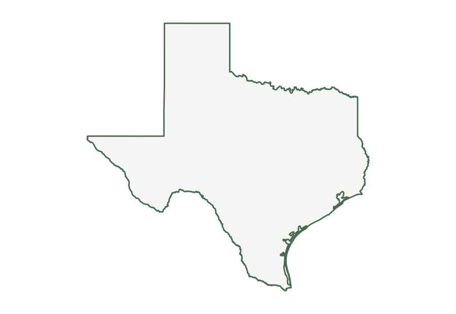
Texas in the source file
The Census Bureau identifies Texas with postal abbreviation TX and state FIPS code 48. Its 2025 county file has 254 county-level records. The fine lines in the first image trace those divisions within the state outline.
| Postal abbreviation | TX |
|---|---|
| State FIPS code | 48 |
| County-level records | 254 |
| Land area | 261,260 sq mi |
| Water area | 7,339 sq mi |
| Land area rank | 2 of 50 states |
The area figures are rounded conversions of the square-meter attributes in the state file. Water accounts for 2.7% of the file’s combined land and water area for Texas; that figure describes the source data, not a shaded portion of the SVG. The land rank compares the 50 states in this same file and excludes Washington, D.C.
What is on the map?
The blank version isolates the outer boundary. The county and equivalent map adds boundaries from the matching 2025 county file. Some states include county equivalents as well as counties; the alphabetical list below uses the Census names for each record. The maps omit roads, city names, terrain, and current travel information.
The files are based on the Census Bureau’s national 1:5,000,000 cartographic boundaries. The dataset is generalized for display, so small islands and fine bends along a coast or river may be simplified. The source scale describes the boundary detail; enlarging the SVG keeps its lines sharp but does not add geographic precision. For local analysis or a legal boundary question, use an appropriate larger-scale official dataset.
County-level names in this map
The alphabetical names below come from the same 2025 county file used to draw the internal lines. Hover over a division in the map above to see its name. The names appear as tooltips and are not printed on the map; the list below is useful on touch screens and when looking up a name alphabetically.
Show all 254 names
- Anderson County
- Andrews County
- Angelina County
- Aransas County
- Archer County
- Armstrong County
- Atascosa County
- Austin County
- Bailey County
- Bandera County
- Bastrop County
- Baylor County
- Bee County
- Bell County
- Bexar County
- Blanco County
- Borden County
- Bosque County
- Bowie County
- Brazoria County
- Brazos County
- Brewster County
- Briscoe County
- Brooks County
- Brown County
- Burleson County
- Burnet County
- Caldwell County
- Calhoun County
- Callahan County
- Cameron County
- Camp County
- Carson County
- Cass County
- Castro County
- Chambers County
- Cherokee County
- Childress County
- Clay County
- Cochran County
- Coke County
- Coleman County
- Collin County
- Collingsworth County
- Colorado County
- Comal County
- Comanche County
- Concho County
- Cooke County
- Coryell County
- Cottle County
- Crane County
- Crockett County
- Crosby County
- Culberson County
- Dallam County
- Dallas County
- Dawson County
- Deaf Smith County
- Delta County
- Denton County
- DeWitt County
- Dickens County
- Dimmit County
- Donley County
- Duval County
- Eastland County
- Ector County
- Edwards County
- El Paso County
- Ellis County
- Erath County
- Falls County
- Fannin County
- Fayette County
- Fisher County
- Floyd County
- Foard County
- Fort Bend County
- Franklin County
- Freestone County
- Frio County
- Gaines County
- Galveston County
- Garza County
- Gillespie County
- Glasscock County
- Goliad County
- Gonzales County
- Gray County
- Grayson County
- Gregg County
- Grimes County
- Guadalupe County
- Hale County
- Hall County
- Hamilton County
- Hansford County
- Hardeman County
- Hardin County
- Harris County
- Harrison County
- Hartley County
- Haskell County
- Hays County
- Hemphill County
- Henderson County
- Hidalgo County
- Hill County
- Hockley County
- Hood County
- Hopkins County
- Houston County
- Howard County
- Hudspeth County
- Hunt County
- Hutchinson County
- Irion County
- Jack County
- Jackson County
- Jasper County
- Jeff Davis County
- Jefferson County
- Jim Hogg County
- Jim Wells County
- Johnson County
- Jones County
- Karnes County
- Kaufman County
- Kendall County
- Kenedy County
- Kent County
- Kerr County
- Kimble County
- King County
- Kinney County
- Kleberg County
- Knox County
- La Salle County
- Lamar County
- Lamb County
- Lampasas County
- Lavaca County
- Lee County
- Leon County
- Liberty County
- Limestone County
- Lipscomb County
- Live Oak County
- Llano County
- Loving County
- Lubbock County
- Lynn County
- Madison County
- Marion County
- Martin County
- Mason County
- Matagorda County
- Maverick County
- McCulloch County
- McLennan County
- McMullen County
- Medina County
- Menard County
- Midland County
- Milam County
- Mills County
- Mitchell County
- Montague County
- Montgomery County
- Moore County
- Morris County
- Motley County
- Nacogdoches County
- Navarro County
- Newton County
- Nolan County
- Nueces County
- Ochiltree County
- Oldham County
- Orange County
- Palo Pinto County
- Panola County
- Parker County
- Parmer County
- Pecos County
- Polk County
- Potter County
- Presidio County
- Rains County
- Randall County
- Reagan County
- Real County
- Red River County
- Reeves County
- Refugio County
- Roberts County
- Robertson County
- Rockwall County
- Runnels County
- Rusk County
- Sabine County
- San Augustine County
- San Jacinto County
- San Patricio County
- San Saba County
- Schleicher County
- Scurry County
- Shackelford County
- Shelby County
- Sherman County
- Smith County
- Somervell County
- Starr County
- Stephens County
- Sterling County
- Stonewall County
- Sutton County
- Swisher County
- Tarrant County
- Taylor County
- Terrell County
- Terry County
- Throckmorton County
- Titus County
- Tom Green County
- Travis County
- Trinity County
- Tyler County
- Upshur County
- Upton County
- Uvalde County
- Val Verde County
- Van Zandt County
- Victoria County
- Walker County
- Waller County
- Ward County
- Washington County
- Webb County
- Wharton County
- Wheeler County
- Wichita County
- Wilbarger County
- Willacy County
- Williamson County
- Wilson County
- Winkler County
- Wise County
- Wood County
- Yoakum County
- Young County
- Zapata County
- Zavala County
Choosing and printing a file
Use the blank outline when you plan to add your own labels or use the shape in a worksheet. Use the county-level version when the internal divisions matter. SVG is a vector format that stays clear when resized in a browser or compatible editor. PNG is a fixed 1,800 × 1,240 pixel image for software that does not accept SVG. Both show the same source boundaries. The printing guide explains paper size, margins, and attribution.
For a road or topographic map, use a source that includes those layers. The USGS National Map provides downloadable topographic maps and other geographic data. Our map types guide compares the purpose of each kind of map.
Source and attribution
Source: U.S. Census Bureau, 2025 Cartographic Boundary Files , national state and county KML at 1:5,000,000 scale. USA State Maps transformed those coordinates into the files above. When sharing an image, include the Census Bureau as the boundary source and retain the year and scale so readers can understand its limits.