
Virginia maps
The Virginia map shows the state outline and 133 county-level divisions . Compare the two views below and download either as SVG or PNG.
Preview the blank outline of Virginia
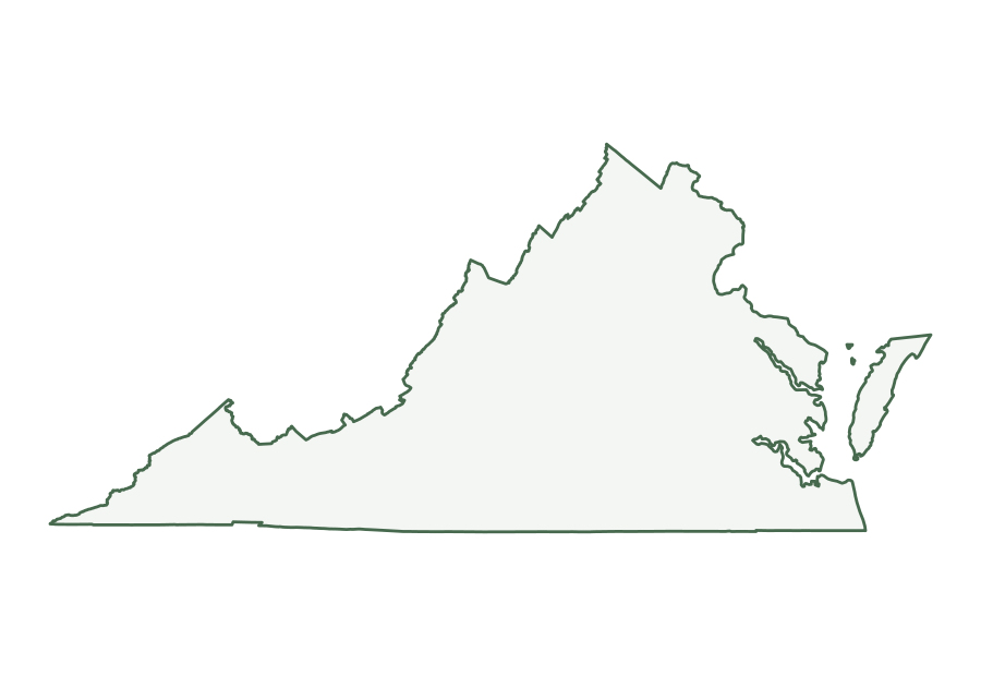
Virginia in the source file
The Census Bureau identifies Virginia with postal abbreviation VA and state FIPS code 51. Its 2025 county file has 133 county-level records. The fine lines in the first image trace those divisions within the state outline.
| Postal abbreviation | VA |
|---|---|
| State FIPS code | 51 |
| County-level records | 133 |
| Land area | 39,481 sq mi |
| Water area | 3,293 sq mi |
| Land area rank | 37 of 50 states |
The area figures are rounded conversions of the square-meter attributes in the state file. Water accounts for 7.7% of the file’s combined land and water area for Virginia; that figure describes the source data, not a shaded portion of the SVG. The land rank compares the 50 states in this same file and excludes Washington, D.C.
What is on the map?
The blank version isolates the outer boundary. The county and equivalent map adds boundaries from the matching 2025 county file. Some states include county equivalents as well as counties; the alphabetical list below uses the Census names for each record. The maps omit roads, city names, terrain, and current travel information.
The files are based on the Census Bureau’s national 1:5,000,000 cartographic boundaries. The dataset is generalized for display, so small islands and fine bends along a coast or river may be simplified. The source scale describes the boundary detail; enlarging the SVG keeps its lines sharp but does not add geographic precision. For local analysis or a legal boundary question, use an appropriate larger-scale official dataset.
County-level names in this map
The alphabetical names below come from the same 2025 county file used to draw the internal lines. Hover over a division in the map above to see its name. The names appear as tooltips and are not printed on the map; the list below is useful on touch screens and when looking up a name alphabetically.
Show all 133 names
- Accomack County
- Albemarle County
- Alexandria city
- Alleghany County
- Amelia County
- Amherst County
- Appomattox County
- Arlington County
- Augusta County
- Bath County
- Bedford County
- Bland County
- Botetourt County
- Bristol city
- Brunswick County
- Buchanan County
- Buckingham County
- Buena Vista city
- Campbell County
- Caroline County
- Carroll County
- Charles City County
- Charlotte County
- Charlottesville city
- Chesapeake city
- Chesterfield County
- Clarke County
- Colonial Heights city
- Covington city
- Craig County
- Culpeper County
- Cumberland County
- Danville city
- Dickenson County
- Dinwiddie County
- Emporia city
- Essex County
- Fairfax city
- Fairfax County
- Falls Church city
- Fauquier County
- Floyd County
- Fluvanna County
- Franklin city
- Franklin County
- Frederick County
- Fredericksburg city
- Galax city
- Giles County
- Gloucester County
- Goochland County
- Grayson County
- Greene County
- Greensville County
- Halifax County
- Hampton city
- Hanover County
- Harrisonburg city
- Henrico County
- Henry County
- Highland County
- Hopewell city
- Isle of Wight County
- James City County
- King and Queen County
- King George County
- King William County
- Lancaster County
- Lee County
- Lexington city
- Loudoun County
- Louisa County
- Lunenburg County
- Lynchburg city
- Madison County
- Manassas city
- Manassas Park city
- Martinsville city
- Mathews County
- Mecklenburg County
- Middlesex County
- Montgomery County
- Nelson County
- New Kent County
- Newport News city
- Norfolk city
- Northampton County
- Northumberland County
- Norton city
- Nottoway County
- Orange County
- Page County
- Patrick County
- Petersburg city
- Pittsylvania County
- Poquoson city
- Portsmouth city
- Powhatan County
- Prince Edward County
- Prince George County
- Prince William County
- Pulaski County
- Radford city
- Rappahannock County
- Richmond city
- Richmond County
- Roanoke city
- Roanoke County
- Rockbridge County
- Rockingham County
- Russell County
- Salem city
- Scott County
- Shenandoah County
- Smyth County
- Southampton County
- Spotsylvania County
- Stafford County
- Staunton city
- Suffolk city
- Surry County
- Sussex County
- Tazewell County
- Virginia Beach city
- Warren County
- Washington County
- Waynesboro city
- Westmoreland County
- Williamsburg city
- Winchester city
- Wise County
- Wythe County
- York County
Choosing and printing a file
Use the blank outline when you plan to add your own labels or use the shape in a worksheet. Use the county-level version when the internal divisions matter. SVG is a vector format that stays clear when resized in a browser or compatible editor. PNG is a fixed 1,800 × 1,240 pixel image for software that does not accept SVG. Both show the same source boundaries. The printing guide explains paper size, margins, and attribution.
For a road or topographic map, use a source that includes those layers. The USGS National Map provides downloadable topographic maps and other geographic data. Our map types guide compares the purpose of each kind of map.
Source and attribution
Source: U.S. Census Bureau, 2025 Cartographic Boundary Files , national state and county KML at 1:5,000,000 scale. USA State Maps transformed those coordinates into the files above. When sharing an image, include the Census Bureau as the boundary source and retain the year and scale so readers can understand its limits.