
Map of Pennsylvania
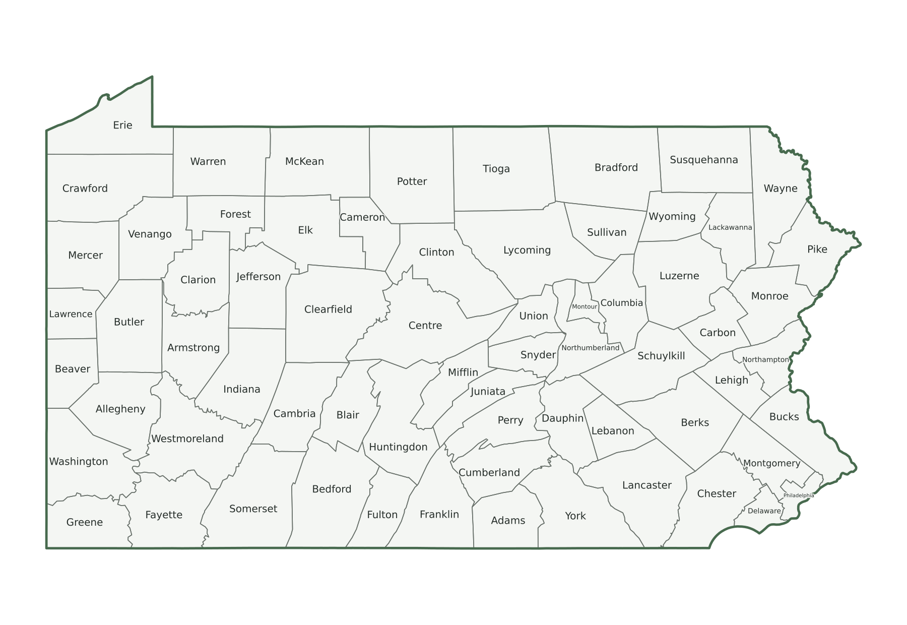
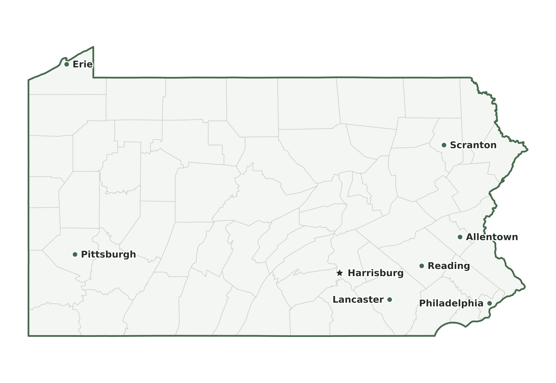
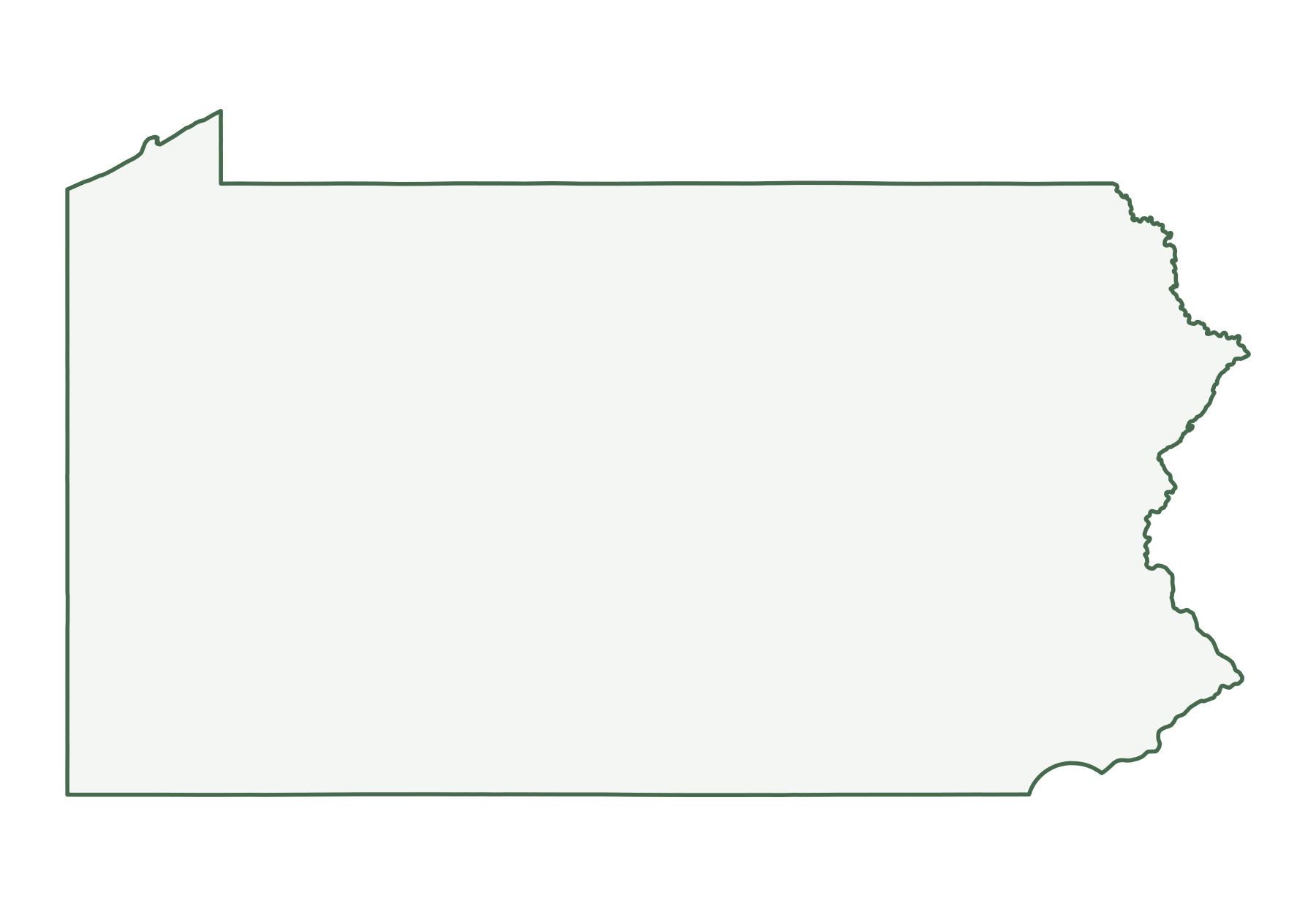
Pennsylvania is a Middle Atlantic state in the Census Bureau’s Northeast region, with 13,059,432 residents in the July 1, 2025 estimate (5th of 50) and 44,742 square miles of land (32nd largest). Its capital is Harrisburg; its most populous city is Philadelphia. The map below shows its 67 counties.
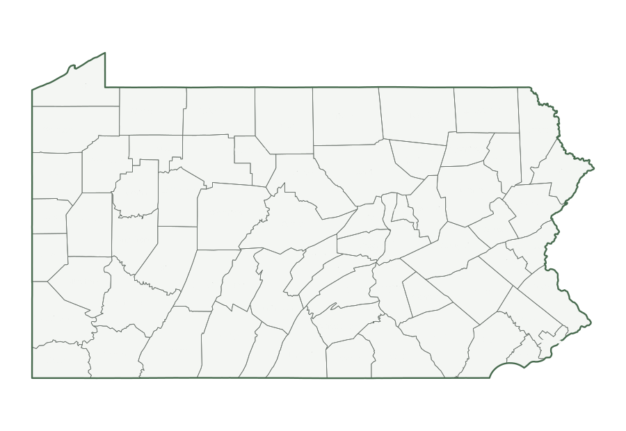
| Map | PDF for printing | Image | Vector |
|---|---|---|---|
| County map with names | PNG | SVG | |
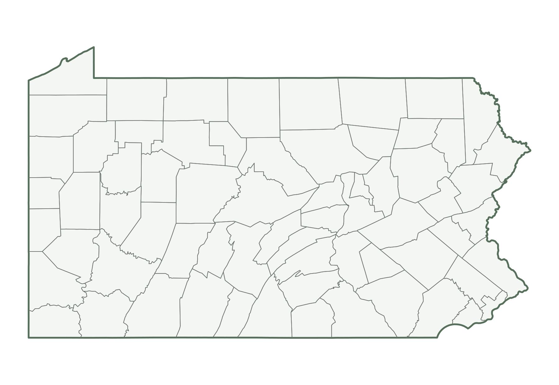
| County map, unlabeled | PNG | SVG | |
| Capital and largest cities | PNG | SVG | |
| Interstates and major highways | PNG | SVG | |
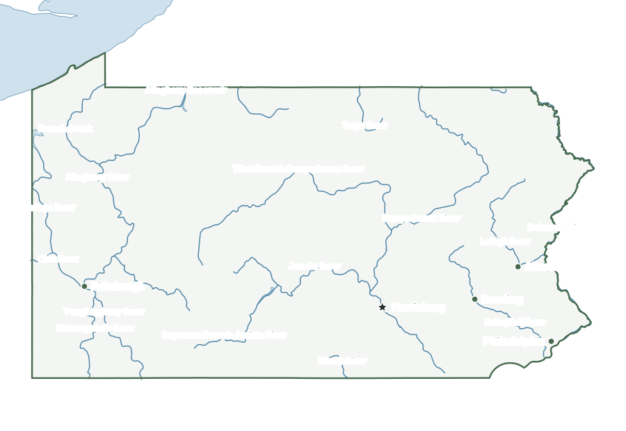
| Rivers and lakes | PNG | SVG | |
| With bordering states | PNG | SVG | |
| Blank outline | PNG | SVG |
Pennsylvania facts
| Capital | Harrisburg |
|---|---|
| Most populous city | Philadelphia (1,574,281) |
| Ratified the Constitution | December 12, 1787 (2nd state) |
| Population, July 1, 2025 | 13,059,432 (5th of 50) |
| Change since April 2020 | +0.4% (41st of 50 by growth) |
| Land area | 44,742 sq mi (32nd largest) |
| Water area | 1,312 sq mi (2.8% of total area) |
| Population density | 292 people per sq mi of land (9th densest) |
| Highest point | Mount Davis, 3,213 ft (33rd highest state high point) |
| Lowest point | Delaware River, sea level |
| Mean elevation | About 1,100 ft |
| Time zone | Eastern (U.S. time zones) |
| Bordering states | Delaware, Maryland, New Jersey, New York, Ohio, and West Virginia |
| Main interstates | I-70, I-76, I-78, I-79, I-80, I-81, I-83, I-84, I-86, I-90, I-95, and I-99 |
| County-level divisions | 67 counties |
| Census region and division | Northeast, Middle Atlantic |
| Regional groupings | Mid-Atlantic, Great Lakes |
| Postal code and FIPS code | PA · 42 |
Population figures are the Census Bureau’s Vintage 2025 estimates; the change is measured from the April 1, 2020 estimates base. Areas come from the 2025 boundary file and are converted from square meters. Elevations are from the U.S. Geological Survey. Ranks compare the 50 states and exclude Washington, D.C.
Geography of Pennsylvania
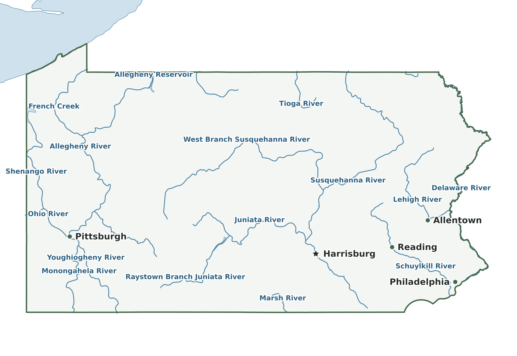
A diagonal S-curve of Appalachian ridges divides the state from southwest to northeast, with the Allegheny Front escarpment rising on the northwest side to the Allegheny Plateau. Southeast of the ridges lies the Piedmont; the tidal Delaware River passes Philadelphia along the eastern edge, and the Poconos occupy the northeast. The Susquehanna's North Branch enters from New York and meets the West Branch at Northumberland; the main river then runs southeast past Harrisburg into Maryland. In the west, the Allegheny and Monongahela join at Pittsburgh to form the Ohio. The Erie Triangle, in the far northwest, gives the state a narrow shore on Lake Erie.
Capital and largest cities
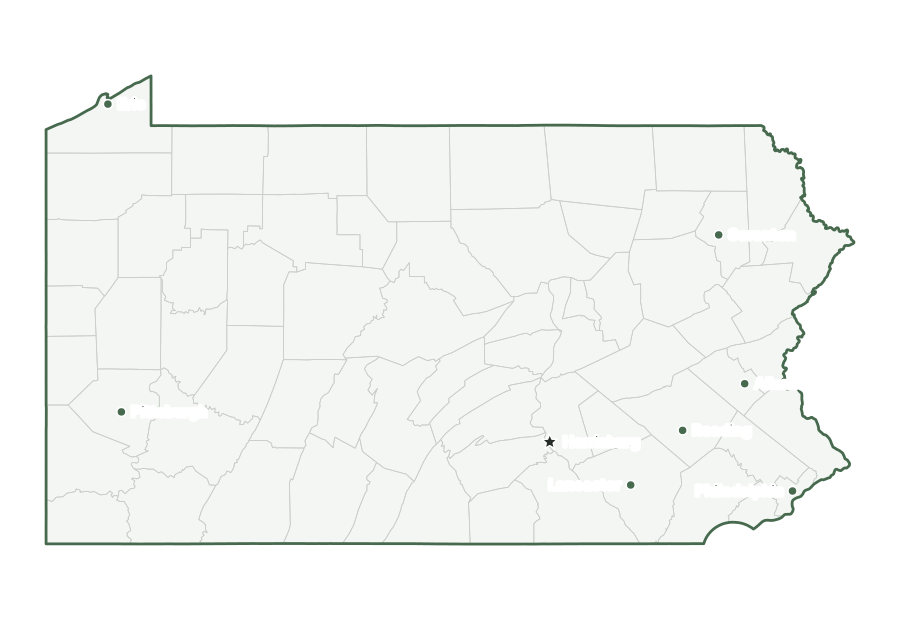
Harrisburg, the capital, ranks 9th among Pennsylvania’s incorporated places by population. Philadelphia is the largest, with 1,574,281 residents as of July 1, 2025. The ten largest places together hold 19% of the state’s population.
| Rank | Place | Population 2025 | Change since 2020 |
|---|---|---|---|
| 1 | Philadelphia | 1,574,281 | −1.8% |
| 2 | Pittsburgh | 307,632 | +1.5% |
| 3 | Allentown | 126,044 | +0.1% |
| 4 | Reading | 95,832 | +0.8% |
| 5 | Erie | 91,838 | −3.3% |
| 6 | Bethlehem | 79,644 | +5.1% |
| 7 | Scranton | 75,514 | −1.1% |
| 8 | Lancaster | 58,366 | +0.7% |
| 9 | Harrisburg (capital) | 50,522 | +0.9% |
| 10 | York | 45,342 | +1.2% |
Interstates and major highways
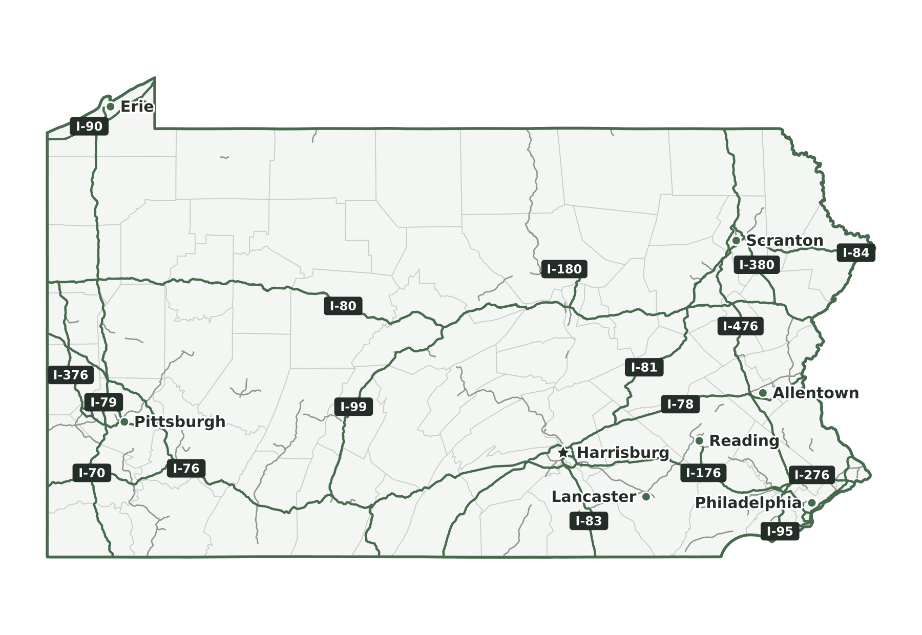
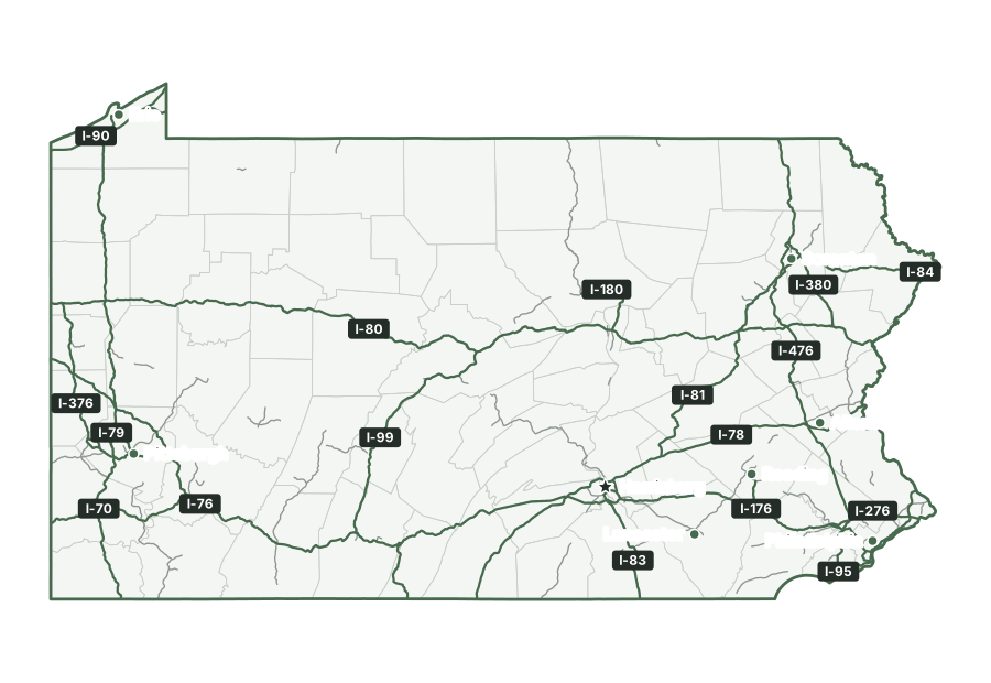
The main interstates in Pennsylvania are I-70, I-76, I-78, I-79, I-80, I-81, I-83, I-84, I-86, I-90, I-95, and I-99. Shorter spurs and loops include I-176, I-180, I-276, I-279, I-283, I-295, I-376, I-380, I-476, I-579, and I-676.
States that border Pennsylvania
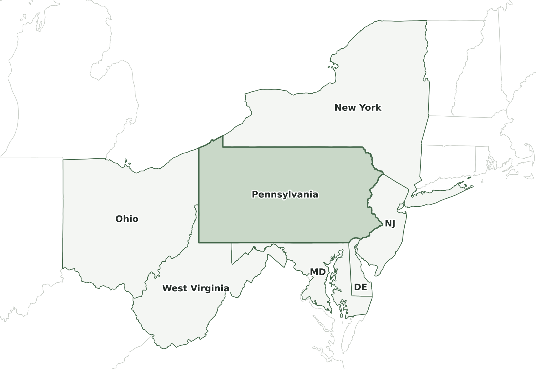
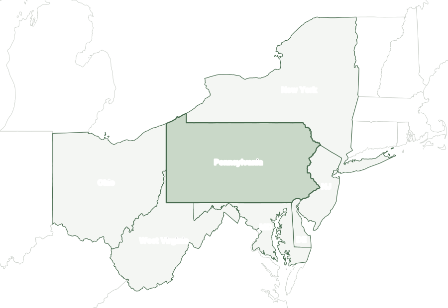
Six states border Pennsylvania: Delaware, Maryland, New Jersey, New York, Ohio, and West Virginia. It shares an international boundary with Canada, which runs through Lake Erie.
Map of Pennsylvania and surrounding states
| State | Direction | Shared land boundary |
|---|---|---|
| New York | north | about 330 mi |
| New Jersey | east | about 170 mi |
| Delaware | southeast | about 20 mi |
| Maryland | south | about 200 mi |
| West Virginia | southwest | about 120 mi |
| Ohio | west | about 90 mi |
How each boundary is drawn
New York. The Delaware River, including the West Branch above Hancock, runs up to the 42nd parallel, which the line follows west to a meridian running north to Lake Erie.
New Jersey. The Delaware River forms the entire line, from the New York corner at Port Jervis downstream to the Delaware line.
Delaware. An arc of the Twelve-Mile Circle centered on New Castle forms most of the line; at the west end, an eastward extension of the Mason-Dixon Line reaches Maryland.
Maryland. The Mason-Dixon Line, an east-west survey near 39°43' N, forms the entire boundary from the northeast corner of Maryland to the West Virginia corner.
West Virginia. The Mason-Dixon Line extension runs west from the Maryland corner to the southwest corner of Pennsylvania, then a meridian runs north along the West Virginia panhandle to the Ohio River.
Ohio. A north-south line near 80°31′ W runs from the Ohio River to Lake Erie and forms the entire boundary.
Directions and lengths in the table are our measurements: the direction is the side of Pennsylvania along which each shared boundary runs, judged from the center of the state. Lengths are measured along the generalized 1:5,000,000 boundary lines, which smooth out river bends and small jogs, so they run shorter than surveyed lengths. The file is clipped to the shoreline of the oceans, the Great Lakes, and large bays, so boundaries through those waters are not counted.
Counties of Pennsylvania
The 2025 county file divides Pennsylvania into 67 counties. The largest by land area is Lycoming County (1,229 sq mi) and the smallest is Montour County (130 sq mi). Philadelphia County is the most populous, with 1,574,281 residents, or 12% of the state. Cameron County has the fewest, with 4,211. Half of Pennsylvania’s counties have fewer than 82,878 residents, and 26 of 67 grew between 2020 and 2025.
| Name | Seat | FIPS | Land sq mi | Population 2025 | Change since 2020 |
|---|---|---|---|---|---|
| Adams County | Gettysburg | 42001 | 519 | 107,594 | +3.6% |
| Allegheny County | Pittsburgh | 42003 | 730 | 1,225,035 | −2.0% |
| Armstrong County | Kittanning | 42005 | 653 | 63,698 | −2.9% |
| Beaver County | Beaver | 42007 | 435 | 166,032 | −1.3% |
| Bedford County | Bedford | 42009 | 1,012 | 47,480 | −0.2% |
| Berks County | Reading | 42011 | 856 | 440,072 | +2.6% |
| Blair County | Hollidaysburg | 42013 | 525 | 119,541 | −2.7% |
| Bradford County | Towanda | 42015 | 1,147 | 59,600 | −0.6% |
| Bucks County | Doylestown | 42017 | 604 | 647,828 | +0.2% |
| Butler County | Butler | 42019 | 789 | 200,169 | +3.3% |
| Cambria County | Ebensburg | 42021 | 688 | 128,968 | −3.4% |
| Cameron County | Emporium | 42023 | 396 | 4,211 | −7.3% |
| Carbon County | Jim Thorpe | 42025 | 381 | 65,868 | +1.7% |
| Centre County | Bellefonte | 42027 | 1,107 | 157,393 | −0.5% |
| Chester County | West Chester | 42029 | 751 | 557,116 | +4.2% |
| Clarion County | Clarion | 42031 | 601 | 36,680 | −1.5% |
| Clearfield County | Clearfield | 42033 | 1,145 | 78,100 | −3.1% |
| Clinton County | Lock Haven | 42035 | 890 | 37,870 | +1.1% |
| Columbia County | Bloomsburg | 42037 | 483 | 66,193 | +2.3% |
| Crawford County | Meadville | 42039 | 1,012 | 81,792 | −2.6% |
| Cumberland County | Carlisle | 42041 | 545 | 277,270 | +6.9% |
| Dauphin County | Harrisburg | 42043 | 525 | 293,351 | +2.4% |
| Delaware County | Media | 42045 | 184 | 580,937 | +0.7% |
| Elk County | Ridgway | 42047 | 827 | 29,926 | −3.4% |
| Erie County | Erie | 42049 | 799 | 265,832 | −1.9% |
| Fayette County | Uniontown | 42051 | 791 | 123,021 | −4.5% |
| Forest County | Tionesta | 42053 | 427 | 6,614 | −5.3% |
| Franklin County | Chambersburg | 42055 | 772 | 160,652 | +3.0% |
| Fulton County | McConnellsburg | 42057 | 438 | 14,483 | −0.5% |
| Greene County | Waynesburg | 42059 | 576 | 33,885 | −5.7% |
| Huntingdon County | Huntingdon | 42061 | 875 | 43,001 | −2.4% |
| Indiana County | Indiana | 42063 | 827 | 82,878 | −0.4% |
| Jefferson County | Brookville | 42065 | 652 | 43,255 | −2.8% |
| Juniata County | Mifflintown | 42067 | 391 | 23,403 | −0.4% |
| Lackawanna County | Scranton | 42069 | 459 | 216,502 | +0.3% |
| Lancaster County | Lancaster | 42071 | 944 | 563,159 | +1.8% |
| Lawrence County | New Castle | 42073 | 357 | 83,911 | −2.5% |
| Lebanon County | Lebanon | 42075 | 362 | 146,380 | +2.2% |
| Lehigh County | Allentown | 42077 | 345 | 384,383 | +2.6% |
| Luzerne County | Wilkes-Barre | 42079 | 890 | 332,126 | +2.0% |
| Lycoming County | Williamsport | 42081 | 1,229 | 112,587 | −1.4% |
| McKean County | Smethport | 42083 | 980 | 38,984 | −3.6% |
| Mercer County | Mercer | 42085 | 673 | 107,860 | −2.5% |
| Mifflin County | Lewistown | 42087 | 411 | 46,127 | −0.0% |
| Monroe County | Stroudsburg | 42089 | 608 | 167,179 | −0.7% |
| Montgomery County | Norristown | 42091 | 483 | 877,643 | +2.5% |
| Montour County | Danville | 42093 | 130 | 17,868 | −1.5% |
| Northampton County | Easton | 42095 | 370 | 324,411 | +3.7% |
| Northumberland County | Sunbury | 42097 | 458 | 89,920 | −1.9% |
| Perry County | New Bloomfield | 42099 | 551 | 46,806 | +2.1% |
| Philadelphia County | Philadelphia | 42101 | 134 | 1,574,281 | −1.8% |
| Pike County | Milford | 42103 | 545 | 62,808 | +7.3% |
| Potter County | Coudersport | 42105 | 1,081 | 15,897 | −3.1% |
| Schuylkill County | Pottsville | 42107 | 779 | 145,085 | +1.4% |
| Snyder County | Middleburg | 42109 | 329 | 39,655 | −0.2% |
| Somerset County | Somerset | 42111 | 1,075 | 72,004 | −2.9% |
| Sullivan County | Laporte | 42113 | 450 | 5,856 | +0.4% |
| Susquehanna County | Montrose | 42115 | 823 | 38,237 | −0.5% |
| Tioga County | Wellsboro | 42117 | 1,134 | 40,502 | −1.3% |
| Union County | Lewisburg | 42119 | 316 | 42,313 | −0.9% |
| Venango County | Franklin | 42121 | 674 | 49,346 | −2.2% |
| Warren County | Warren | 42123 | 884 | 37,038 | −4.0% |
| Washington County | Washington | 42125 | 857 | 210,802 | +0.7% |
| Wayne County | Honesdale | 42127 | 726 | 51,703 | +1.1% |
| Westmoreland County | Greensburg | 42129 | 1,028 | 349,324 | −1.5% |
| Wyoming County | Tunkhannock | 42131 | 397 | 25,790 | −1.1% |
| York County | York | 42133 | 904 | 473,197 | +3.7% |
Geographic extent
In the generalized boundary file, Pennsylvania reaches from 39.72° N to 42.27° N and from 80.52° W to 74.69° W. That is about 176 miles north to south and 305 miles east to west at its central latitude. The center of its mapped area falls at 40.87° N, 77.80° W, nearest to Peru among Census-listed places. We calculated this center from the outline; it is not an official geographic-center marker.
Frequently asked questions
How many states border Pennsylvania?
Six: Delaware, Maryland, New Jersey, New York, Ohio, and West Virginia. See the map of Pennsylvania and surrounding states.
How many counties does Pennsylvania have?
Pennsylvania has 67 counties. Philadelphia County has the most residents and Lycoming County the most land; the county table lists them all.
What is the capital of Pennsylvania, and what is its largest city?
The capital is Harrisburg; the largest city is Philadelphia. The cities section lists the ten most populous places.
How big is Pennsylvania?
In the Census Bureau’s 2025 boundary file, Pennsylvania covers 46,054 square miles: 44,742 of land and 1,312 of water. That makes it the 33rd largest state by total area and the 32nd largest by land area.
What time zone is Pennsylvania in?
All of Pennsylvania is in the Eastern Time Zone and observes daylight saving time.
What is the highest point in Pennsylvania?
The highest point is Mount Davis, at 3,213 feet, the 33rd highest of the 50 state high points. The lowest point is the Delaware River, at sea level.
Sources and use
Boundaries: U.S. Census Bureau, 2025 Cartographic Boundary Files, 1:5,000,000 scale, generalized for display. Population: Census Bureau Vintage 2025 estimates. City positions: the 2025 Census Gazetteer. Roads: 2025 TIGER/Line primary roads. Rivers and lakes: Natural Earth. County seats: Wikidata, checked against Wikipedia’s county lists. The maps are for reference, teaching, and ordinary printing, not for property lines, precincts, or navigation. When you share a map, keep the source line with it. The printing guide covers paper size and attribution.